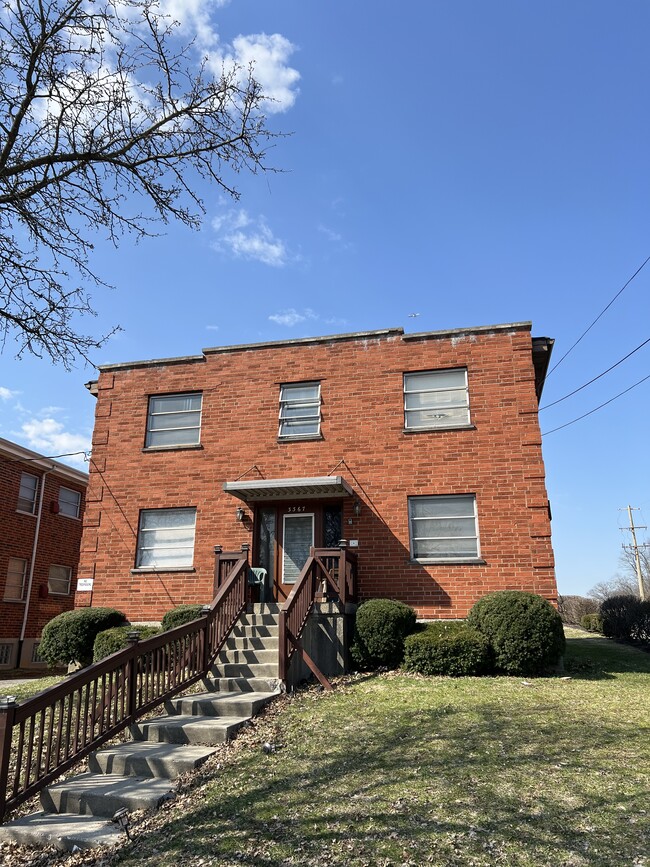
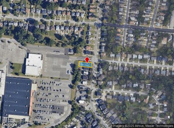
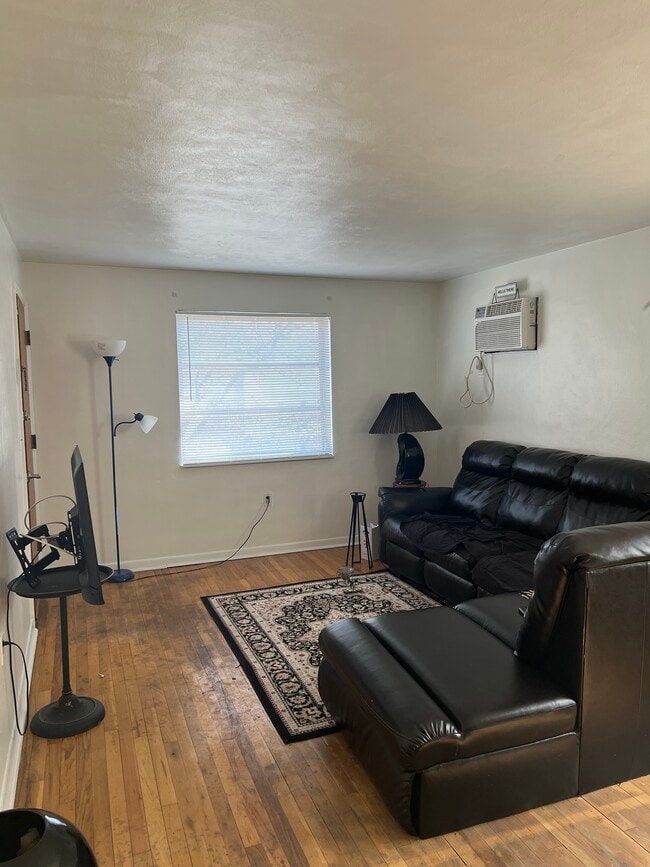
Property Record
3367 Parkcrest Ln, Cincinnati, OH 45211
NEARBY LISTINGS FOR SALE OR LEASE
Property Detail
3367 Parkcrest Ln
Cincinnati, OH-KY-IN
Western Woods Sub
212-0063-0079
PARKCREST LN 52 X 135 IRLOT 30 WESTERN WOODS SUB BLK B PARS 79 & 188 CONS
Apartment
Hamilton
X
Ohio
39061C0213E
30
2025
0.16 AC
2025
Westwood
020901
Cincinnati/Dayton
3,036 SF
DEMOGRAPHICS near 3367 Parkcrest Ln
1 Mile
3 Mile
5 Mile
2024 Total Population
17,456
95,519
217,687
2029 Population
16,840
94,091
215,773
Pop Growth 2024-2029
(3.53%)
(1.49%)
(0.88%)
Average Age
39
39
39
2024 Total Households
7,511
39,760
89,456
HH Growth 2024-2029
(3.75%)
(1.57%)
(1.00%)
Median Household Inc
$48,995
$55,997
$54,746
Avg Household Size
2.30
2.30
2.30
2024 Avg HH Vehicles
2.00
2.00
2.00
Median Home Value
$143,950
$163,582
$167,911
Median Year Built
1953
1961
1962
Nearby Places
Map Layers
Map Styles
 Street
 Aerial
- Restaurants
- Banks
- Shops
- Fitness
- Groceries
PUBLIC TRANSPORTATION
COMMUTER RAIL
DRIVE
WALK
Distance
16 min
7.4 mi
AIRPORT
Cincinnati/Northern Kentucky International
DRIVE
WALK
Distance
Cincinnati/Northern Kentucky International
37 min
19.6 mi
SALE & LEASE HISTORY
LISTING DATE
SALE/LEASE

Apr 03, 2025
For Sale
Nearby Properties
Address
Land Use
TOTAL SIZE
Lot Size
Zoning
Address
Land Use
TOTAL SIZE
Lot Size
Zoning
Address
Land Use
TOTAL SIZE
Lot Size
Zoning
9.52 AC
B
Address
Land Use
TOTAL SIZE
Lot Size
Zoning
17,857 SF
26.60 AC
CGA
Address
Land Use
TOTAL SIZE
Lot Size
Zoning
8.18 AC
SF4
Address
Land Use
TOTAL SIZE
Lot Size
Zoning
Address
Land Use
TOTAL SIZE
Lot Size
Zoning
2,678 SF
8.76 AC
Address
Land Use
TOTAL SIZE
Lot Size
Zoning
6,620 SF
16.91 AC
Address
Land Use
TOTAL SIZE
Lot Size
Zoning
14.43 AC
Address
Land Use
TOTAL SIZE
Lot Size
Zoning
Address
Land Use
TOTAL SIZE
Lot Size
Zoning
125,405 SF
16.69 AC
SF6
Address
Land Use
TOTAL SIZE
Lot Size
Zoning
360 SF
7.79 AC
F
Address
Land Use
TOTAL SIZE
Lot Size
Zoning
6,000 SF
11.92 AC
G
Address
Land Use
TOTAL SIZE
Lot Size
Zoning
8.57 AC
Address
Land Use
TOTAL SIZE
Lot Size
Zoning
62,160 SF
13.70 AC
RM20
Address
Land Use
TOTAL SIZE
Lot Size
Zoning
55,572 SF
6.12 AC
C
Address
Land Use
TOTAL SIZE
Lot Size
Zoning
18.30 AC
EE
Address
Land Use
TOTAL SIZE
Lot Size
Zoning
14.01 AC
CGA
Address
Land Use
TOTAL SIZE
Lot Size
Zoning
40,080 SF
4.14 AC
SF6
Address
Land Use
TOTAL SIZE
Lot Size
Zoning
76,739 SF
11.44 AC
SF6
Address
Land Use
TOTAL SIZE
Lot Size
Zoning
4.28 AC
OO
Address
Land Use
TOTAL SIZE
Lot Size
Zoning
24,222 SF
3.91 AC
CGA
Address
Land Use
TOTAL SIZE
Lot Size
Zoning
47,504 SF
14.37 AC
RM20
Address
Land Use
TOTAL SIZE
Lot Size
Zoning
60,751 SF
9.57 AC
C
Address
Land Use
TOTAL SIZE
Lot Size
Zoning
4.33 AC
Address
Land Use
TOTAL SIZE
Lot Size
Zoning
6.91 AC
B
Address
Land Use
TOTAL SIZE
Lot Size
Zoning
3.04 AC
OO
Address
Land Use
TOTAL SIZE
Lot Size
Zoning
11.81 AC
RM20
Address
Land Use
TOTAL SIZE
Lot Size
Zoning
15,998 SF
13.71 AC
SF10
Address
Land Use
TOTAL SIZE
Lot Size
Zoning
9.43 AC
CGA
Address
Land Use
TOTAL SIZE
Lot Size
Zoning
13,068 SF
16.75 AC
RM20
The World's #1 Commercial Real Estate Marketplace
Connect with us
© 2026 CoStar Group
The information above has been obtained from sources believed reliable. While we do not doubt its accuracy we have not verified it and make no guarantee, warranty or representation about it. It is your responsibility to independently confirm its accuracy and completeness. Any projections, opinions, assumptions, or estimates used are for example only and do not represent the current or future performance of the property. The value of this transaction to you depends on tax and other factors which should be evaluated by your tax, financial, and legal advisors. You and your advisors should conduct a careful, independent investigation of the property to determine to your satisfaction the suitability of the property for your needs.