Property Record
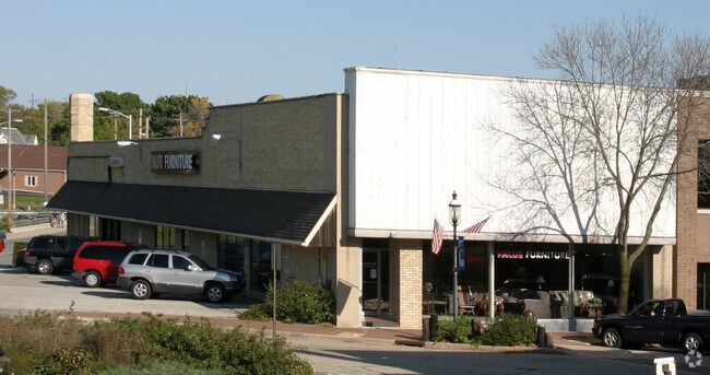
337 N Main St, West Bend, WI 53095

Property Detail
337 N Main St
Milwaukee-Waukesha, WI
WEILS ADDITION BLK 2 LT 7+PT OF LT 8+PT OF NE NE V1676 P675 EXC ROW DOC 1614937
1119-141-0117
WASHINGTON
Commercialnec
Wisconsin
B and X Area of moderate flood hazard, usually the area between the limits of the 100-year and 500-year floods.
7
2025
0.23 AC
2025
North Washington
420401
Milwaukee/Madison
5,680 SF
NEARBY LISTINGS FOR SALE OR LEASE
DEMOGRAPHICS near 337 N Main St
1 mile
3 mile
5 mile
2025 Total Population
9,485
35,695
43,697
2030 Population
9,618
36,030
44,228
Pop Growth 2025-2030
+ 1.40%
+ 0.94%
+ 1.22%
Average Age
41
43
43
2025 Total Households
4,214
15,352
18,509
HH Growth 2025-2030
+ 1.47%
+ 0.98%
+ 1.25%
Median Household Inc
$74,551
$77,903
$82,758
Avg Household Size
2.10
2.30
2.30
2025 Avg HH Vehicles
2.00
2.00
2.00
Median Home Value
$244,298
$278,087
$299,844
Median Year Built
1957
1976
1977
Nearby Places
Map Layers
Map Styles
 Street
 Aerial
Layers
 Traffic
 Biking
Places
Listings with unknown addresses are not visible on the map
- Restaurants
- Banks
- Shops
- Fitness
- Groceries
PUBLIC TRANSPORTATION
AIRPORT
General Mitchell International
Drive
Walk
Distance
General Mitchell International
61 min
44.9 mi
Freight Ports
Port Milwaukee
Drive
Walk
Distance
Port Milwaukee
55 min
41.2 mi
Nearby Properties
Address
Land Use
TOTAL SIZE
Lot Size
Zoning
Address
Land Use
TOTAL SIZE
Lot Size
Zoning
141,874 SF
116.53 AC
Address
Land Use
TOTAL SIZE
Lot Size
Zoning
5,600 SF
10.11 AC
Address
Land Use
TOTAL SIZE
Lot Size
Zoning
190,000 SF
64.03 AC
Address
Land Use
TOTAL SIZE
Lot Size
Zoning
195,055 SF
20.57 AC
Address
Land Use
TOTAL SIZE
Lot Size
Zoning
16.43 AC
Address
Land Use
TOTAL SIZE
Lot Size
Zoning
9.05 AC
Address
Land Use
TOTAL SIZE
Lot Size
Zoning
18.22 AC
Address
Land Use
TOTAL SIZE
Lot Size
Zoning
20.92 AC
Address
Land Use
TOTAL SIZE
Lot Size
Zoning
4,140 SF
29.62 AC
Address
Land Use
TOTAL SIZE
Lot Size
Zoning
62,974 SF
6.25 AC
Address
Land Use
TOTAL SIZE
Lot Size
Zoning
6.85 AC
Address
Land Use
TOTAL SIZE
Lot Size
Zoning
36,915 SF
11.79 AC
Address
Land Use
TOTAL SIZE
Lot Size
Zoning
46.95 AC
Address
Land Use
TOTAL SIZE
Lot Size
Zoning
139,945 SF
4.95 AC
Address
Land Use
TOTAL SIZE
Lot Size
Zoning
30,564 SF
31.65 AC
Address
Land Use
TOTAL SIZE
Lot Size
Zoning
1,620 SF
39.56 AC
Address
Land Use
TOTAL SIZE
Lot Size
Zoning
7.70 AC
Address
Land Use
TOTAL SIZE
Lot Size
Zoning
Address
Land Use
TOTAL SIZE
Lot Size
Zoning
30,046 SF
3.91 AC
Address
Land Use
TOTAL SIZE
Lot Size
Zoning
8.29 AC
Address
Land Use
TOTAL SIZE
Lot Size
Zoning
102,366 SF
9.35 AC
Address
Land Use
TOTAL SIZE
Lot Size
Zoning
12.67 AC
Address
Land Use
TOTAL SIZE
Lot Size
Zoning
3.89 AC
Address
Land Use
TOTAL SIZE
Lot Size
Zoning
Address
Land Use
TOTAL SIZE
Lot Size
Zoning
141,575 SF
4.44 AC
Address
Land Use
TOTAL SIZE
Lot Size
Zoning
12.71 AC
Address
Land Use
TOTAL SIZE
Lot Size
Zoning
50,096 SF
8.91 AC
Address
Land Use
TOTAL SIZE
Lot Size
Zoning
18,400 SF
10.85 AC
Address
Land Use
TOTAL SIZE
Lot Size
Zoning
3,404 SF
49.06 AC
Address
Land Use
TOTAL SIZE
Lot Size
Zoning
4.41 AC
The World's #1 Commercial Real Estate Marketplace
Connect with us
© 2026 CoStar Group
The information above has been obtained from sources believed reliable. While we do not doubt its accuracy we have not verified it and make no guarantee, warranty or representation about it. It is your responsibility to independently confirm its accuracy and completeness. Any projections, opinions, assumptions, or estimates used are for example only and do not represent the current or future performance of the property. The value of this transaction to you depends on tax and other factors which should be evaluated by your tax, financial, and legal advisors. You and your advisors should conduct a careful, independent investigation of the property to determine to your satisfaction the suitability of the property for your needs.