Property Record
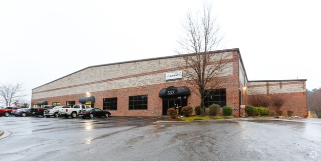
337 Timber Rd, Mooresville, NC 28115


NEARBY LISTINGS FOR SALE OR LEASE
Property Detail
337 Timber Rd
Charlotte
Timber Rd
Charlotte-Concord-Gastonia, NC-SC
L16 TIMBER RIDGE PB 32-149 PH 3
4666-03-0311.000
Iredell
Warehouse
North Carolina
2025
16
2025
4.13 AC
061603
Iredell County
41,500 SF
DEMOGRAPHICS near 337 Timber Rd
1 Mile
3 Mile
5 Mile
2024 Total Population
3,702
40,454
79,798
2029 Population
4,214
45,802
89,625
Pop Growth 2024-2029
+ 13.83%
+ 13.22%
+ 12.31%
Average Age
39
38
39
2024 Total Households
1,429
15,657
30,725
HH Growth 2024-2029
+ 13.72%
+ 13.16%
+ 12.39%
Median Household Inc
$76,652
$75,278
$86,488
Avg Household Size
2.50
2.50
2.50
2024 Avg HH Vehicles
2.00
2.00
2.00
Median Home Value
$249,130
$266,953
$312,015
Median Year Built
1987
2000
2000
Nearby Places
Map Layers
Map Styles
 Street
 Aerial
- Restaurants
- Banks
- Shops
- Fitness
- Groceries
PUBLIC TRANSPORTATION
AIRPORT
Concord-Padgett Regional
DRIVE
WALK
Distance
Concord-Padgett Regional
30 min
17.4 mi
Charlotte/Douglas International
DRIVE
WALK
Distance
Charlotte/Douglas International
46 min
32.5 mi
Nearby Properties
Address
Land Use
TOTAL SIZE
Lot Size
Zoning
Address
Land Use
TOTAL SIZE
Lot Size
Zoning
7,250 SF
136.59 AC
PD
Address
Land Use
TOTAL SIZE
Lot Size
Zoning
55,473 SF
28.69 AC
CM
Address
Land Use
TOTAL SIZE
Lot Size
Zoning
199,918 SF
27.58 AC
CM
Address
Land Use
TOTAL SIZE
Lot Size
Zoning
32,431 SF
23.20 AC
CM
Address
Land Use
TOTAL SIZE
Lot Size
Zoning
8,620 SF
31.12 AC
TN
Address
Land Use
TOTAL SIZE
Lot Size
Zoning
26,946 SF
19.86 AC
TN
Address
Land Use
TOTAL SIZE
Lot Size
Zoning
27,545 SF
20.02 AC
TN
Address
Land Use
TOTAL SIZE
Lot Size
Zoning
7,297 SF
8.65 AC
CM
Address
Land Use
TOTAL SIZE
Lot Size
Zoning
354,759 SF
10.25 AC
RLI
Address
Land Use
TOTAL SIZE
Lot Size
Zoning
7,632 SF
26 AC
TN
Address
Land Use
TOTAL SIZE
Lot Size
Zoning
6,375 SF
25.90 AC
RG
Address
Land Use
TOTAL SIZE
Lot Size
Zoning
20,000 SF
23.91 AC
RLI
Address
Land Use
TOTAL SIZE
Lot Size
Zoning
145,000 SF
42.41 AC
RLS
Address
Land Use
TOTAL SIZE
Lot Size
Zoning
118,825 SF
70.60 AC
RA
Address
Land Use
TOTAL SIZE
Lot Size
Zoning
7,200 SF
35.39 AC
GB
Address
Land Use
TOTAL SIZE
Lot Size
Zoning
10,424 SF
15.90 AC
TN
Address
Land Use
TOTAL SIZE
Lot Size
Zoning
36,376 SF
2.27 AC
TD
Address
Land Use
TOTAL SIZE
Lot Size
Zoning
14,877 SF
13.57 AC
CM
Address
Land Use
TOTAL SIZE
Lot Size
Zoning
13,740 SF
15 AC
CC
Address
Land Use
TOTAL SIZE
Lot Size
Zoning
112,283 SF
57.60 AC
RLS
Address
Land Use
TOTAL SIZE
Lot Size
Zoning
27,766 SF
15.29 AC
RG
Address
Land Use
TOTAL SIZE
Lot Size
Zoning
159,468 SF
16.61 AC
CC
Address
Land Use
TOTAL SIZE
Lot Size
Zoning
87,626 SF
22.38 AC
R3
Address
Land Use
TOTAL SIZE
Lot Size
Zoning
88,045 SF
2.11 AC
TD
Address
Land Use
TOTAL SIZE
Lot Size
Zoning
290,852 SF
28.73 AC
TD
Address
Land Use
TOTAL SIZE
Lot Size
Zoning
34,851 SF
7.43 AC
CC
Address
Land Use
TOTAL SIZE
Lot Size
Zoning
86,542 SF
2.91 AC
CM
Address
Land Use
TOTAL SIZE
Lot Size
Zoning
23,556 SF
5.70 AC
TN
Address
Land Use
TOTAL SIZE
Lot Size
Zoning
12,360 SF
11.45 AC
TN
Address
Land Use
TOTAL SIZE
Lot Size
Zoning
79,117 SF
2.22 AC
CM
The World's #1 Commercial Real Estate Marketplace
Connect with us
© 2026 CoStar Group
The information above has been obtained from sources believed reliable. While we do not doubt its accuracy we have not verified it and make no guarantee, warranty or representation about it. It is your responsibility to independently confirm its accuracy and completeness. Any projections, opinions, assumptions, or estimates used are for example only and do not represent the current or future performance of the property. The value of this transaction to you depends on tax and other factors which should be evaluated by your tax, financial, and legal advisors. You and your advisors should conduct a careful, independent investigation of the property to determine to your satisfaction the suitability of the property for your needs.