Property Record
3375 Copter Rd, Pensacola, FL 32514

Current Lease Availabilities
NEARBY LISTINGS FOR SALE OR LEASE
-
-
View all Pensacola listings for lease on LoopNet.com
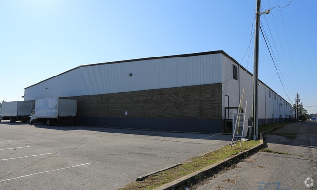
Property Detail
3375 Copter Rd
Pensacola-Ferry Pass-Brent, FL
Subdivision Number: 1002
03-1S-29-1002-002-038
BEG AT NWLY COR OF ELLYSON FIELD (ELLYSON INDUSTRIAL PARK) S 74 DEG 28 MIN 50 SEC E ALG N LI 4301 76/100 FT TO INTER WITH WLY R/W OF US HWY 90 (SR 10-A 80 FT R/W) S 34 DEG 4 MIN 42 SEC E ALG R/W 108 FT S 0 DEG 8 MIN 26 SEC E ALG E LI OF ELLYSON INDUS
Wholesaleoutletdiscountstore
Escambia
X
Florida
12113C0415H
2
2024
5 AC
2025
Ferry Pass/N Pensacola
003511
Pensacola
75,000 SF
DEMOGRAPHICS near 3375 Copter Rd
1 Mile
3 Mile
5 Mile
2024 Total Population
3,358
39,933
85,699
2029 Population
3,399
40,554
87,219
Pop Growth 2024-2029
+ 1.22%
+ 1.56%
+ 1.77%
Average Age
43
41
40
2024 Total Households
1,497
17,517
34,895
HH Growth 2024-2029
+ 1.20%
+ 1.48%
+ 1.77%
Median Household Inc
$62,953
$52,884
$55,499
Avg Household Size
2.20
2.10
2.20
2024 Avg HH Vehicles
2.00
2.00
2.00
Median Home Value
$248,295
$209,613
$216,987
Median Year Built
1985
1982
1981
Nearby Places
Map Layers
Map Styles
 Street
 Aerial
- Restaurants
- Banks
- Shops
- Fitness
- Groceries
PUBLIC TRANSPORTATION
AIRPORT
Pensacola International
DRIVE
WALK
Distance
Pensacola International
15 min
7.2 mi
Freight Ports
Port of Mobile
DRIVE
WALK
Distance
Port of Mobile
66 min
56.3 mi
Nearby Properties
Address
Land Use
TOTAL SIZE
Lot Size
Zoning
Address
Land Use
TOTAL SIZE
Lot Size
Zoning
1 AC
PUB
Address
Land Use
TOTAL SIZE
Lot Size
Zoning
784,999 SF
20.06 AC
COM
Address
Land Use
TOTAL SIZE
Lot Size
Zoning
553,808 SF
35.16 AC
HDR
Address
Land Use
TOTAL SIZE
Lot Size
Zoning
266,096 SF
13.46 AC
HDMU
Address
Land Use
TOTAL SIZE
Lot Size
Zoning
314,269 SF
12.53 AC
HDMU
Address
Land Use
TOTAL SIZE
Lot Size
Zoning
269,404 SF
23.85 AC
HDMU
Address
Land Use
TOTAL SIZE
Lot Size
Zoning
238,060 SF
21.93 AC
HDMU
Address
Land Use
TOTAL SIZE
Lot Size
Zoning
262,823 SF
11.57 AC
HDMU
Address
Land Use
TOTAL SIZE
Lot Size
Zoning
240,998 SF
19.61 AC
HDMU
Address
Land Use
TOTAL SIZE
Lot Size
Zoning
203,587 SF
20.11 AC
HDR
Address
Land Use
TOTAL SIZE
Lot Size
Zoning
191,157 SF
11.77 AC
MDR
Address
Land Use
TOTAL SIZE
Lot Size
Zoning
275,458 SF
8.29 AC
HDMU
Address
Land Use
TOTAL SIZE
Lot Size
Zoning
396,100 SF
102.57 AC
HC/LI
Address
Land Use
TOTAL SIZE
Lot Size
Zoning
329,935 SF
46.34 AC
COM
Address
Land Use
TOTAL SIZE
Lot Size
Zoning
171,283 SF
3.89 AC
HDR
Address
Land Use
TOTAL SIZE
Lot Size
Zoning
202,638 SF
9.43 AC
HDMU
Address
Land Use
TOTAL SIZE
Lot Size
Zoning
517,415 SF
27.78 AC
HC/LI
Address
Land Use
TOTAL SIZE
Lot Size
Zoning
175,834 SF
14.17 AC
COM
Address
Land Use
TOTAL SIZE
Lot Size
Zoning
144,978 SF
9.22 AC
R-2A
Address
Land Use
TOTAL SIZE
Lot Size
Zoning
112,265 SF
25.22 AC
COM
Address
Land Use
TOTAL SIZE
Lot Size
Zoning
193,321 SF
15.03 AC
HDR
Address
Land Use
TOTAL SIZE
Lot Size
Zoning
158,190 SF
22.79 AC
HC/LI
Address
Land Use
TOTAL SIZE
Lot Size
Zoning
109,855 SF
16.70 AC
COM
Address
Land Use
TOTAL SIZE
Lot Size
Zoning
151,275 SF
6.79 AC
R-2A
Address
Land Use
TOTAL SIZE
Lot Size
Zoning
117,603 SF
4.59 AC
HDR
Address
Land Use
TOTAL SIZE
Lot Size
Zoning
176,574 SF
16.97 AC
HC/LI
Address
Land Use
TOTAL SIZE
Lot Size
Zoning
236,704 SF
35.17 AC
R-1AA
Address
Land Use
TOTAL SIZE
Lot Size
Zoning
149,680 SF
7.70 AC
COM
Address
Land Use
TOTAL SIZE
Lot Size
Zoning
225,899 SF
26.47 AC
C-1,R-1AA
Address
Land Use
TOTAL SIZE
Lot Size
Zoning
120,025 SF
7.97 AC
R-2A
The World's #1 Commercial Real Estate Marketplace
Connect with us
© 2026 CoStar Group
The information above has been obtained from sources believed reliable. While we do not doubt its accuracy we have not verified it and make no guarantee, warranty or representation about it. It is your responsibility to independently confirm its accuracy and completeness. Any projections, opinions, assumptions, or estimates used are for example only and do not represent the current or future performance of the property. The value of this transaction to you depends on tax and other factors which should be evaluated by your tax, financial, and legal advisors. You and your advisors should conduct a careful, independent investigation of the property to determine to your satisfaction the suitability of the property for your needs.