Property Record
338 Main St, Byesville, OH 43723


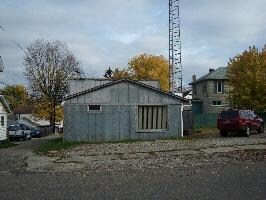
Property Detail
338 Main St
Cambridge, OH
R3 T1 SA02-06 PT 101 RINGER 1
12-0000901.000
Guernsey
Commercialnec
Ohio
B and X Area of moderate flood hazard, usually the area between the limits of the 100-year and 500-year floods.
101pt
2025
0.09 AC
2025
Ohio South Area
977900
Other Market Areas
625 SF
NEARBY LISTINGS FOR SALE OR LEASE
DEMOGRAPHICS near 338 Main St
1 mile
3 mile
5 mile
2025 Total Population
2,826
5,318
17,694
2030 Population
2,772
5,247
17,618
Pop Growth 2025-2030
(1.91%)
(1.34%)
(0.43%)
Average Age
41
41
41
2025 Total Households
1,231
2,274
7,607
HH Growth 2025-2030
(1.87%)
(1.32%)
(0.37%)
Median Household Inc
$46,516
$49,401
$46,780
Avg Household Size
2.20
2.30
2.20
2025 Avg HH Vehicles
2.00
2.00
2.00
Median Home Value
$105,458
$140,645
$136,662
Median Year Built
1972
1975
1960
Nearby Places
Map Layers
Map Styles
 Street
 Aerial
Transit
 Traffic
 Biking
Places
Listings with unknown addresses are not visible on the map
- Restaurants
- Banks
- Shops
- Fitness
- Groceries
Nearby Properties
Address
Land Use
TOTAL SIZE
Lot Size
Zoning
Address
Land Use
TOTAL SIZE
Lot Size
Zoning
79.21 AC
Address
Land Use
TOTAL SIZE
Lot Size
Zoning
Address
Land Use
TOTAL SIZE
Lot Size
Zoning
61,369 SF
60.29 AC
Address
Land Use
TOTAL SIZE
Lot Size
Zoning
37,416 SF
105.91 AC
Address
Land Use
TOTAL SIZE
Lot Size
Zoning
9.58 AC
Address
Land Use
TOTAL SIZE
Lot Size
Zoning
2.82 AC
Address
Land Use
TOTAL SIZE
Lot Size
Zoning
131,636 SF
16.67 AC
Address
Land Use
TOTAL SIZE
Lot Size
Zoning
105.91 AC
Address
Land Use
TOTAL SIZE
Lot Size
Zoning
204,996 SF
15.79 AC
Address
Land Use
TOTAL SIZE
Lot Size
Zoning
7.67 AC
Address
Land Use
TOTAL SIZE
Lot Size
Zoning
34,760 SF
6.96 AC
Address
Land Use
TOTAL SIZE
Lot Size
Zoning
128,296 SF
9.65 AC
Address
Land Use
TOTAL SIZE
Lot Size
Zoning
63,180 SF
12.17 AC
Address
Land Use
TOTAL SIZE
Lot Size
Zoning
Address
Land Use
TOTAL SIZE
Lot Size
Zoning
25,665 SF
20.94 AC
Address
Land Use
TOTAL SIZE
Lot Size
Zoning
5,100 SF
9.58 AC
Address
Land Use
TOTAL SIZE
Lot Size
Zoning
30,520 SF
8.73 AC
Address
Land Use
TOTAL SIZE
Lot Size
Zoning
117,568 SF
8.59 AC
Address
Land Use
TOTAL SIZE
Lot Size
Zoning
20,000 SF
10.13 AC
Address
Land Use
TOTAL SIZE
Lot Size
Zoning
12,985 SF
2.60 AC
Address
Land Use
TOTAL SIZE
Lot Size
Zoning
23.64 AC
Address
Land Use
TOTAL SIZE
Lot Size
Zoning
87,500 SF
6.55 AC
Address
Land Use
TOTAL SIZE
Lot Size
Zoning
45,360 SF
6.02 AC
Address
Land Use
TOTAL SIZE
Lot Size
Zoning
15,635 SF
2.02 AC
Address
Land Use
TOTAL SIZE
Lot Size
Zoning
13,822 SF
2.82 AC
Address
Land Use
TOTAL SIZE
Lot Size
Zoning
70,642 SF
12.92 AC
Address
Land Use
TOTAL SIZE
Lot Size
Zoning
30,600 SF
9.69 AC
Address
Land Use
TOTAL SIZE
Lot Size
Zoning
Address
Land Use
TOTAL SIZE
Lot Size
Zoning
64,000 SF
7.67 AC
Address
Land Use
TOTAL SIZE
Lot Size
Zoning
56,000 SF
11.98 AC
The World's #1 Commercial Real Estate Marketplace
Connect with us
© 2026 CoStar Group
The information above has been obtained from sources believed reliable. While we do not doubt its accuracy we have not verified it and make no guarantee, warranty or representation about it. It is your responsibility to independently confirm its accuracy and completeness. Any projections, opinions, assumptions, or estimates used are for example only and do not represent the current or future performance of the property. The value of this transaction to you depends on tax and other factors which should be evaluated by your tax, financial, and legal advisors. You and your advisors should conduct a careful, independent investigation of the property to determine to your satisfaction the suitability of the property for your needs.