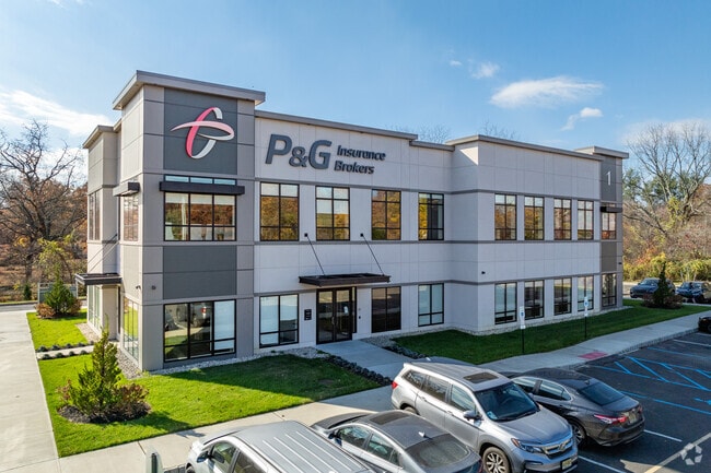
Property Record
338 Whitesville Rd, Jackson, NJ 08527
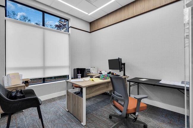

Current Lease Availabilities
NEARBY LISTINGS FOR SALE OR LEASE
Property Detail
338 Whitesville Rd
Northern New Jersey
OFFICE CONDO
New York-Jersey City-White Plains, NY-NJ
Ocean
12-22301-0000-00003-01-C0004
New Jersey
Commercialnec
3.1
2024
1 AC
2025
Ocean County
717502
DEMOGRAPHICS near 338 Whitesville Rd
1 Mile
3 Mile
5 Mile
2024 Total Population
1,209
59,263
176,103
2029 Population
1,244
61,590
182,715
Pop Growth 2024-2029
+ 2.89%
+ 3.93%
+ 3.75%
Average Age
31
33
32
2024 Total Households
325
16,382
49,479
HH Growth 2024-2029
+ 1.85%
+ 3.27%
+ 3.01%
Median Household Inc
$128,378
$64,127
$62,877
Avg Household Size
3.40
3.20
3.20
2024 Avg HH Vehicles
2.00
2.00
2.00
Median Home Value
$458,695
$360,983
$336,116
Median Year Built
1981
1995
1988
Nearby Places
Map Layers
Map Styles
 Street
 Aerial
- Restaurants
- Banks
- Shops
- Fitness
- Groceries
Nearby Properties
Address
Land Use
TOTAL SIZE
Lot Size
Zoning
Address
Land Use
TOTAL SIZE
Lot Size
Zoning
12.43 AC
HD7
Address
Land Use
TOTAL SIZE
Lot Size
Zoning
155.11 AC
PFE/
Address
Land Use
TOTAL SIZE
Lot Size
Zoning
17,952 SF
103.18 AC
PRA
Address
Land Use
TOTAL SIZE
Lot Size
Zoning
27.47 AC
R1
Address
Land Use
TOTAL SIZE
Lot Size
Zoning
17,676 SF
7.25 AC
R15
Address
Land Use
TOTAL SIZE
Lot Size
Zoning
98,518 SF
12.71 AC
HC
Address
Land Use
TOTAL SIZE
Lot Size
Zoning
97,092 SF
15.97 AC
RHB
Address
Land Use
TOTAL SIZE
Lot Size
Zoning
15.17 AC
M1
Address
Land Use
TOTAL SIZE
Lot Size
Zoning
85,995 SF
7.60 AC
M1
Address
Land Use
TOTAL SIZE
Lot Size
Zoning
8.08 AC
HC
Address
Land Use
TOTAL SIZE
Lot Size
Zoning
1,512 SF
411.32 AC
RD9
Address
Land Use
TOTAL SIZE
Lot Size
Zoning
93,712 SF
15.17 AC
M1
Address
Land Use
TOTAL SIZE
Lot Size
Zoning
19.11 AC
M1
Address
Land Use
TOTAL SIZE
Lot Size
Zoning
170,849 SF
12.89 AC
M1
Address
Land Use
TOTAL SIZE
Lot Size
Zoning
2,496 SF
2.63 AC
R20
Address
Land Use
TOTAL SIZE
Lot Size
Zoning
164.93 AC
PED+
Address
Land Use
TOTAL SIZE
Lot Size
Zoning
11,744 SF
9.98 AC
M10A
Address
Land Use
TOTAL SIZE
Lot Size
Zoning
13,220 SF
11.59 AC
HD7
Address
Land Use
TOTAL SIZE
Lot Size
Zoning
6,000 SF
35.03 AC
M1
Address
Land Use
TOTAL SIZE
Lot Size
Zoning
10.37 AC
M12A
Address
Land Use
TOTAL SIZE
Lot Size
Zoning
9,366 SF
12.60 AC
MF10
Address
Land Use
TOTAL SIZE
Lot Size
Zoning
139,558 SF
6.66 AC
RHB
Address
Land Use
TOTAL SIZE
Lot Size
Zoning
6 AC
HD7
Address
Land Use
TOTAL SIZE
Lot Size
Zoning
8,400 SF
87.20 AC
SPLT
Address
Land Use
TOTAL SIZE
Lot Size
Zoning
16,976 SF
7.38 AC
R15
Address
Land Use
TOTAL SIZE
Lot Size
Zoning
13,200 SF
14.71 AC
M1
Address
Land Use
TOTAL SIZE
Lot Size
Zoning
47,584 SF
6.07 AC
HD7
Address
Land Use
TOTAL SIZE
Lot Size
Zoning
1,538 SF
134.90 AC
R40B
Address
Land Use
TOTAL SIZE
Lot Size
Zoning
16.88 AC
M1
Address
Land Use
TOTAL SIZE
Lot Size
Zoning
91,432 SF
5 AC
HD7
The World's #1 Commercial Real Estate Marketplace
Connect with us
© 2025 CoStar Group
The information above has been obtained from sources believed reliable. While we do not doubt its accuracy we have not verified it and make no guarantee, warranty or representation about it. It is your responsibility to independently confirm its accuracy and completeness. Any projections, opinions, assumptions, or estimates used are for example only and do not represent the current or future performance of the property. The value of this transaction to you depends on tax and other factors which should be evaluated by your tax, financial, and legal advisors. You and your advisors should conduct a careful, independent investigation of the property to determine to your satisfaction the suitability of the property for your needs.