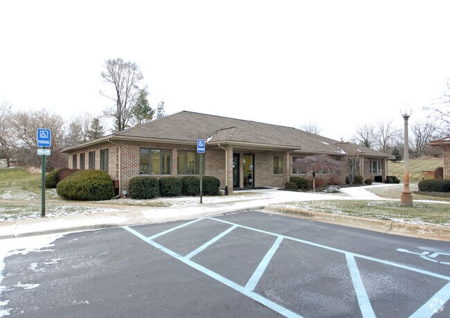
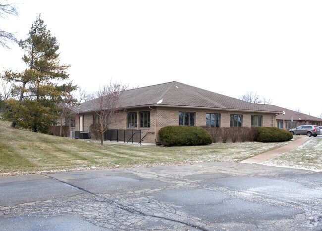
Property Record
3380 Travis Pointe Rd, Ann Arbor, MI 48108

Save to a Folder
{{folder.Name}}
{{folder.ListingIds.length}} Properties
{{folder.ListingIds.length}} Property
Create a New Folder
Property Detail
3380 Travis Pointe Rd
13-13-300-029
PTA 02/20/96 W.D. L3336 P936 ****FROM 1313300020 02/20/96 LO 13-15A COM AT SW COR SEC 13, TH N 00-11-20 W 250.00 FT, TH N
Commercialnec
Washtenaw
C-1
Michigan
B and X Area of moderate flood hazard, usually the area between the limits of the 100-year and 500-year floods.
1.84 AC
2025
Washtenaw W of 23
2026
Detroit
425000
Ann Arbor, MI
5,000 SF
NEARBY LISTINGS FOR SALE OR LEASE
DEMOGRAPHICS near 3380 Travis Pointe Rd
1 mile
3 mile
5 mile
2025 Total Population
1,410
20,340
82,524
2030 Population
1,408
20,650
83,761
Pop Growth 2025-2030
(0.14%)
+ 1.52%
+ 1.50%
Average Age
47
43
40
2025 Total Households
525
8,237
35,438
HH Growth 2025-2030
0.00%
+ 1.44%
+ 1.55%
Median Household Inc
$201,887
$124,131
$96,804
Avg Household Size
2.70
2.40
2.30
2025 Avg HH Vehicles
2.00
2.00
2.00
Median Home Value
$568,306
$457,675
$433,613
Median Year Built
1982
1993
1980
Nearby Places
Map Layers
Map Styles
 Street
 Aerial
Layers
 Traffic
 Biking
Places
Listings with unknown addresses are not visible on the map
- Restaurants
- Banks
- Shops
- Fitness
- Groceries
PUBLIC TRANSPORTATION
COMMUTER RAIL
Drive
Walk
Distance
14 min
6.7 mi
AIRPORT
Detroit Metro Wayne County
Drive
Walk
Distance
Detroit Metro Wayne County
39 min
29.3 mi
Nearby Properties
Address
Land Use
TOTAL SIZE
Lot Size
Zoning
Address
Land Use
TOTAL SIZE
Lot Size
Zoning
334,077 SF
20.41 AC
R4B
Address
Land Use
TOTAL SIZE
Lot Size
Zoning
271,521 SF
15.11 AC
Address
Land Use
TOTAL SIZE
Lot Size
Zoning
268,002 SF
18.34 AC
Address
Land Use
TOTAL SIZE
Lot Size
Zoning
234,076 SF
24.18 AC
R4A
Address
Land Use
TOTAL SIZE
Lot Size
Zoning
175,536 SF
12.98 AC
R4B
Address
Land Use
TOTAL SIZE
Lot Size
Zoning
88,460 SF
28.50 AC
DI
Address
Land Use
TOTAL SIZE
Lot Size
Zoning
74,152 SF
31.63 AC
BI
Address
Land Use
TOTAL SIZE
Lot Size
Zoning
19,236 SF
17.79 AC
BI
Address
Land Use
TOTAL SIZE
Lot Size
Zoning
114,590 SF
7.39 AC
R4B
Address
Land Use
TOTAL SIZE
Lot Size
Zoning
112,525 SF
14.40 AC
BI
Address
Land Use
TOTAL SIZE
Lot Size
Zoning
82,748 SF
3.70 AC
PUD
Address
Land Use
TOTAL SIZE
Lot Size
Zoning
255,870 SF
32.37 AC
Address
Land Use
TOTAL SIZE
Lot Size
Zoning
112,722 SF
12.74 AC
C1B
Address
Land Use
TOTAL SIZE
Lot Size
Zoning
99,663 SF
6.89 AC
R-1A
Address
Land Use
TOTAL SIZE
Lot Size
Zoning
74,522 SF
2.56 AC
O
Address
Land Use
TOTAL SIZE
Lot Size
Zoning
19,236 SF
13.13 AC
BI
Address
Land Use
TOTAL SIZE
Lot Size
Zoning
59,305 SF
5.94 AC
BI
Address
Land Use
TOTAL SIZE
Lot Size
Zoning
88,657 SF
14.98 AC
Address
Land Use
TOTAL SIZE
Lot Size
Zoning
24,000 SF
21.97 AC
Address
Land Use
TOTAL SIZE
Lot Size
Zoning
154,987 SF
17.08 AC
II
Address
Land Use
TOTAL SIZE
Lot Size
Zoning
99,000 SF
12.16 AC
I-2
Address
Land Use
TOTAL SIZE
Lot Size
Zoning
60,362 SF
7.69 AC
Address
Land Use
TOTAL SIZE
Lot Size
Zoning
84,415 SF
9.96 AC
II
Address
Land Use
TOTAL SIZE
Lot Size
Zoning
65,899 SF
6.42 AC
R-3
Address
Land Use
TOTAL SIZE
Lot Size
Zoning
52,649 SF
4.20 AC
PUD
Address
Land Use
TOTAL SIZE
Lot Size
Zoning
33,919 SF
40.32 AC
A-1
Address
Land Use
TOTAL SIZE
Lot Size
Zoning
100,812 SF
7.18 AC
C2B
Address
Land Use
TOTAL SIZE
Lot Size
Zoning
43,500 SF
I-2
Address
Land Use
TOTAL SIZE
Lot Size
Zoning
51,744 SF
7.49 AC
R4B
Address
Land Use
TOTAL SIZE
Lot Size
Zoning
108,952 SF
9 AC
BI
The World's #1 Commercial Real Estate Marketplace
Connect with us
© 2026 CoStar Group
The information above has been obtained from sources believed reliable. While we do not doubt its accuracy we have not verified it and make no guarantee, warranty or representation about it. It is your responsibility to independently confirm its accuracy and completeness. Any projections, opinions, assumptions, or estimates used are for example only and do not represent the current or future performance of the property. The value of this transaction to you depends on tax and other factors which should be evaluated by your tax, financial, and legal advisors. You and your advisors should conduct a careful, independent investigation of the property to determine to your satisfaction the suitability of the property for your needs.