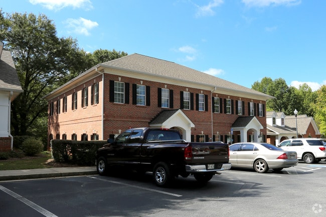
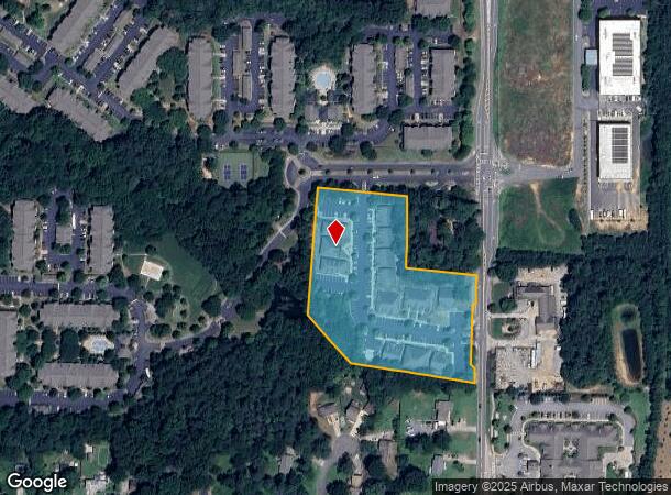
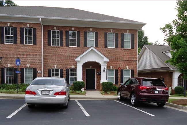
Property Record
Trickum Rd, Woodstock, GA 30188
Current Lease Availabilities
NEARBY LISTINGS FOR SALE OR LEASE
Property Detail
Trickum Rd
Atlanta-Sandy Springs-Roswell, GA
Ivy Village
15N18M-00000-001-000
IVY VILLAGE PH 1 PB 1 PG 140 - REF PAR ONLY
Commercialnec
Cherokee
X
Georgia
13057C0353E
4.40 AC
0
Cherokee County
2025
Atlanta
090911
DEMOGRAPHICS near Trickum Rd
1 Mile
3 Mile
5 Mile
2024 Total Population
8,789
65,965
168,080
2029 Population
9,792
72,259
181,933
Pop Growth 2024-2029
+ 11.41%
+ 9.54%
+ 8.24%
Average Age
41
40
40
2024 Total Households
3,448
24,435
61,104
HH Growth 2024-2029
+ 11.63%
+ 10.03%
+ 8.68%
Median Household Inc
$101,616
$105,169
$106,856
Avg Household Size
2.50
2.60
2.70
2024 Avg HH Vehicles
2.00
2.00
2.00
Median Home Value
$311,066
$361,510
$362,646
Median Year Built
1999
1992
1991
Nearby Places
- Restaurants
- Banks
- Shops
- Fitness
- Groceries
PUBLIC TRANSPORTATION
AIRPORT
Hartsfield - Jackson Atlanta International
DRIVE
WALK
Distance
Hartsfield - Jackson Atlanta International
55 min
40.7 mi
Nearby Properties
Address
Land Use
TOTAL SIZE
Lot Size
Zoning
Address
Land Use
TOTAL SIZE
Lot Size
Zoning
228,644 SF
7.88 AC
DT-CBD
Address
Land Use
TOTAL SIZE
Lot Size
Zoning
604,056 SF
25.03 AC
R-40
Address
Land Use
TOTAL SIZE
Lot Size
Zoning
181,704 SF
17.56 AC
DT-MRA
Address
Land Use
TOTAL SIZE
Lot Size
Zoning
128,196 SF
24.68 AC
R-4
Address
Land Use
TOTAL SIZE
Lot Size
Zoning
266,487 SF
21.69 AC
R-4
Address
Land Use
TOTAL SIZE
Lot Size
Zoning
188,105 SF
25.86 AC
R-5
Address
Land Use
TOTAL SIZE
Lot Size
Zoning
330,192 SF
20.40 AC
GC
Address
Land Use
TOTAL SIZE
Lot Size
Zoning
328,203 SF
71 AC
R-40
Address
Land Use
TOTAL SIZE
Lot Size
Zoning
186,426 SF
32.52 AC
NC-TCT
Address
Land Use
TOTAL SIZE
Lot Size
Zoning
161,310 SF
34.63 AC
R-40
Address
Land Use
TOTAL SIZE
Lot Size
Zoning
85,166 SF
3.41 AC
DT-CBD
Address
Land Use
TOTAL SIZE
Lot Size
Zoning
186,090 SF
30.08 AC
GC
Address
Land Use
TOTAL SIZE
Lot Size
Zoning
158,427 SF
11.17 AC
GC
Address
Land Use
TOTAL SIZE
Lot Size
Zoning
63,264 SF
8 AC
PUD
Address
Land Use
TOTAL SIZE
Lot Size
Zoning
156,752 SF
16.34 AC
NC-TCT
Address
Land Use
TOTAL SIZE
Lot Size
Zoning
89,552 SF
14.69 AC
DT-MR
Address
Land Use
TOTAL SIZE
Lot Size
Zoning
50,375 SF
5.77 AC
R-80
Address
Land Use
TOTAL SIZE
Lot Size
Zoning
88,795 SF
30.92 AC
DT-CI
Address
Land Use
TOTAL SIZE
Lot Size
Zoning
72,376 SF
12.25 AC
GC
Address
Land Use
TOTAL SIZE
Lot Size
Zoning
135,538 SF
12.34 AC
DT-CMU
Address
Land Use
TOTAL SIZE
Lot Size
Zoning
83,076 SF
10.21 AC
GC
Address
Land Use
TOTAL SIZE
Lot Size
Zoning
36,188 SF
1.52 AC
DT-GC
Address
Land Use
TOTAL SIZE
Lot Size
Zoning
35,776 SF
1.50 AC
DT-CBD
Address
Land Use
TOTAL SIZE
Lot Size
Zoning
26,400 SF
1.10 AC
GC
Address
Land Use
TOTAL SIZE
Lot Size
Zoning
78,332 SF
1.74 AC
GC
Address
Land Use
TOTAL SIZE
Lot Size
Zoning
87,085 SF
5.01 AC
GC
Address
Land Use
TOTAL SIZE
Lot Size
Zoning
43,403 SF
4.09 AC
OI
Address
Land Use
TOTAL SIZE
Lot Size
Zoning
41,951 SF
14.17 AC
DT-CI
Address
Land Use
TOTAL SIZE
Lot Size
Zoning
56,010 SF
9.17 AC
DT-CI
Address
Land Use
TOTAL SIZE
Lot Size
Zoning
28,319 SF
0.65 AC
DT-CBD
The World's #1 Commercial Real Estate Marketplace
Connect with us
© 2025 CoStar Group
The information above has been obtained from sources believed reliable. While we do not doubt its accuracy we have not verified it and make no guarantee, warranty or representation about it. It is your responsibility to independently confirm its accuracy and completeness. Any projections, opinions, assumptions, or estimates used are for example only and do not represent the current or future performance of the property. The value of this transaction to you depends on tax and other factors which should be evaluated by your tax, financial, and legal advisors. You and your advisors should conduct a careful, independent investigation of the property to determine to your satisfaction the suitability of the property for your needs.