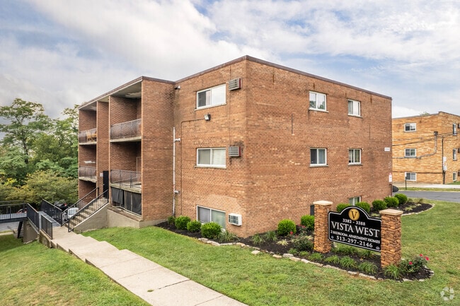
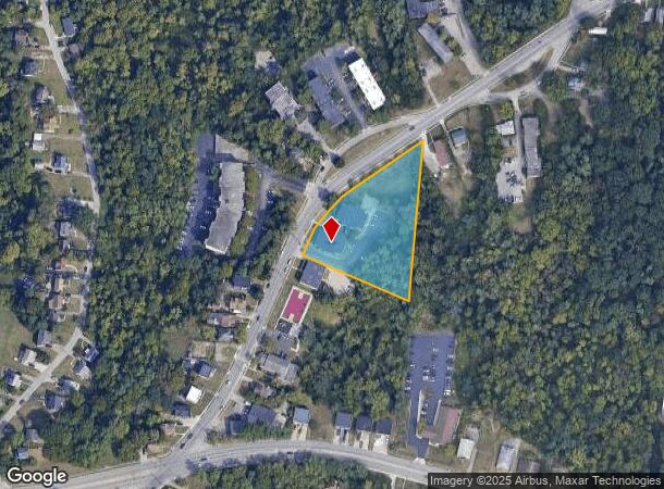
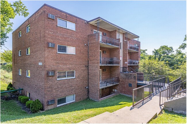
Property Record
3382 Mchenry Ave, Cincinnati, OH 45225
NEARBY LISTINGS FOR SALE OR LEASE
Property Detail
3382 Mchenry Ave
Cincinnati, OH-KY-IN
Bustard Moore Sub
224-0006-0025
MC HENRY RD 2.17 AC 490 X 360 IRR PT LOT 10 BUSTARD MOORE SUB
Apartment
Hamilton
X
Ohio
39061C0214E
10
2025
2.17 AC
2025
East Westwood
008800
Cincinnati/Dayton
15,104 SF
DEMOGRAPHICS near 3382 Mchenry Ave
1 Mile
3 Mile
5 Mile
2024 Total Population
17,906
123,942
315,174
2029 Population
18,480
124,324
315,090
Pop Growth 2024-2029
+ 3.21%
+ 0.31%
(0.03%)
Average Age
34
36
37
2024 Total Households
7,555
52,973
134,878
HH Growth 2024-2029
+ 3.27%
+ 0.22%
(0.01%)
Median Household Inc
$22,654
$38,743
$47,029
Avg Household Size
2.30
2.20
2.20
2024 Avg HH Vehicles
1.00
1.00
1.00
Median Home Value
$111,955
$146,282
$164,853
Median Year Built
1968
1956
1958
Nearby Places
Map Layers
Map Styles
 Street
 Aerial
- Restaurants
- Banks
- Shops
- Fitness
- Groceries
PUBLIC TRANSPORTATION
COMMUTER RAIL
DRIVE
WALK
Distance
10 min
4.7 mi
AIRPORT
Cincinnati/Northern Kentucky International
DRIVE
WALK
Distance
Cincinnati/Northern Kentucky International
35 min
18.7 mi
Nearby Properties
Address
Land Use
TOTAL SIZE
Lot Size
Zoning
Address
Land Use
TOTAL SIZE
Lot Size
Zoning
22.45 AC
Address
Land Use
TOTAL SIZE
Lot Size
Zoning
Address
Land Use
TOTAL SIZE
Lot Size
Zoning
3.09 AC
Address
Land Use
TOTAL SIZE
Lot Size
Zoning
29.60 AC
IR
Address
Land Use
TOTAL SIZE
Lot Size
Zoning
17,857 SF
26.60 AC
CGA
Address
Land Use
TOTAL SIZE
Lot Size
Zoning
Address
Land Use
TOTAL SIZE
Lot Size
Zoning
2.51 AC
MG
Address
Land Use
TOTAL SIZE
Lot Size
Zoning
8.18 AC
SF4
Address
Land Use
TOTAL SIZE
Lot Size
Zoning
2 AC
RM12
Address
Land Use
TOTAL SIZE
Lot Size
Zoning
Address
Land Use
TOTAL SIZE
Lot Size
Zoning
0.92 AC
Address
Land Use
TOTAL SIZE
Lot Size
Zoning
2,678 SF
8.76 AC
Address
Land Use
TOTAL SIZE
Lot Size
Zoning
2.16 AC
MG
Address
Land Use
TOTAL SIZE
Lot Size
Zoning
6,620 SF
16.91 AC
Address
Land Use
TOTAL SIZE
Lot Size
Zoning
414,133 SF
4.07 AC
RMX
Address
Land Use
TOTAL SIZE
Lot Size
Zoning
20,199 SF
9.82 AC
SF10
Address
Land Use
TOTAL SIZE
Lot Size
Zoning
112,560 SF
7.49 AC
IR
Address
Land Use
TOTAL SIZE
Lot Size
Zoning
13.81 AC
Address
Land Use
TOTAL SIZE
Lot Size
Zoning
Address
Land Use
TOTAL SIZE
Lot Size
Zoning
6,537 SF
12.55 AC
Address
Land Use
TOTAL SIZE
Lot Size
Zoning
18,480 SF
6.65 AC
SF20
Address
Land Use
TOTAL SIZE
Lot Size
Zoning
22.17 AC
Address
Land Use
TOTAL SIZE
Lot Size
Zoning
8.66 AC
SF2
Address
Land Use
TOTAL SIZE
Lot Size
Zoning
125,405 SF
16.69 AC
SF6
Address
Land Use
TOTAL SIZE
Lot Size
Zoning
Address
Land Use
TOTAL SIZE
Lot Size
Zoning
6.15 AC
SF2
Address
Land Use
TOTAL SIZE
Lot Size
Zoning
6,000 SF
11.92 AC
G
Address
Land Use
TOTAL SIZE
Lot Size
Zoning
7.27 AC
MG
Address
Land Use
TOTAL SIZE
Lot Size
Zoning
0.35 AC
Address
Land Use
TOTAL SIZE
Lot Size
Zoning
The World's #1 Commercial Real Estate Marketplace
Connect with us
© 2026 CoStar Group
The information above has been obtained from sources believed reliable. While we do not doubt its accuracy we have not verified it and make no guarantee, warranty or representation about it. It is your responsibility to independently confirm its accuracy and completeness. Any projections, opinions, assumptions, or estimates used are for example only and do not represent the current or future performance of the property. The value of this transaction to you depends on tax and other factors which should be evaluated by your tax, financial, and legal advisors. You and your advisors should conduct a careful, independent investigation of the property to determine to your satisfaction the suitability of the property for your needs.