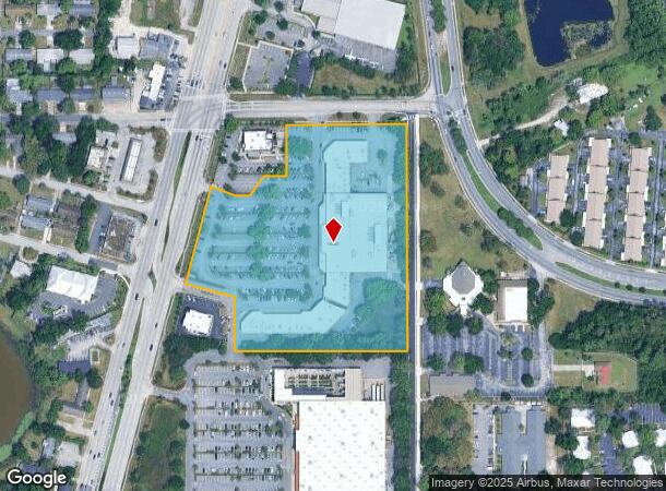
Property Record
3385 S Us Highway 17-92, Casselberry, FL 32707

NEARBY LISTINGS FOR SALE OR LEASE
Property Detail
3385 S Us Highway 17-92
Orlando-Kissimmee-Sanford, FL
Casselberry Collection
08-21-30-527-0000-0030
LOT 3 CASSELBERRY COLLECTION PB 42 PGS 12 & 13
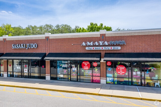
Storebuilding
Seminole
X
Florida
12095C0165F
3
2025
9.03 AC
2025
Casselberry
022104
Orlando
49,536 SF
DEMOGRAPHICS near 3385 S Us Highway 17-92
1 Mile
3 Mile
5 Mile
2024 Total Population
7,988
92,222
226,949
2029 Population
8,410
96,007
236,223
Pop Growth 2024-2029
+ 5.28%
+ 4.10%
+ 4.09%
Average Age
44
42
42
2024 Total Households
3,386
37,941
93,318
HH Growth 2024-2029
+ 5.20%
+ 4.25%
+ 4.26%
Median Household Inc
$56,007
$60,430
$68,285
Avg Household Size
2.20
2.40
2.40
2024 Avg HH Vehicles
2.00
2.00
2.00
Median Home Value
$248,287
$269,418
$312,982
Median Year Built
1982
1978
1982
Nearby Places
Map Layers
Map Styles
 Street
 Aerial
- Restaurants
- Banks
- Shops
- Fitness
- Groceries
PUBLIC TRANSPORTATION
COMMUTER RAIL
DRIVE
WALK
Distance
6 min
2.6 mi
DRIVE
WALK
Distance
6 min
2.6 mi
AIRPORT
Orlando Sanford International
DRIVE
WALK
Distance
Orlando Sanford International
19 min
10.6 mi
Orlando International
DRIVE
WALK
Distance
Orlando International
32 min
18.3 mi
Daytona Beach International
DRIVE
WALK
Distance
Daytona Beach International
59 min
46.2 mi
Freight Ports
Port Canaveral
DRIVE
WALK
Distance
Port Canaveral
77 min
59.9 mi
SALE & LEASE HISTORY
LISTING DATE
SALE/LEASE

Sep 24, 2016
For Lease
Nearby Properties
Address
Land Use
TOTAL SIZE
Lot Size
Zoning
Address
Land Use
TOTAL SIZE
Lot Size
Zoning
2,416 SF
29.71 AC
Address
Land Use
TOTAL SIZE
Lot Size
Zoning
88,256 SF
39.64 AC
MOC3
Address
Land Use
TOTAL SIZE
Lot Size
Zoning
21.25 AC
GC
Address
Land Use
TOTAL SIZE
Lot Size
Zoning
629,182 SF
1.81 AC
R1A
Address
Land Use
TOTAL SIZE
Lot Size
Zoning
1,158 SF
17.22 AC
Address
Land Use
TOTAL SIZE
Lot Size
Zoning
508,923 SF
41.05 AC
C2
Address
Land Use
TOTAL SIZE
Lot Size
Zoning
206 SF
1.43 AC
VMU
Address
Land Use
TOTAL SIZE
Lot Size
Zoning
400 SF
13.82 AC
R1AA
Address
Land Use
TOTAL SIZE
Lot Size
Zoning
540 SF
7.72 AC
GC
Address
Land Use
TOTAL SIZE
Lot Size
Zoning
231,070 SF
35.59 AC
MOR2
Address
Land Use
TOTAL SIZE
Lot Size
Zoning
350,767 SF
11.12 AC
PUD
Address
Land Use
TOTAL SIZE
Lot Size
Zoning
456 SF
9.56 AC
Address
Land Use
TOTAL SIZE
Lot Size
Zoning
1,428 SF
8.56 AC
MOR3
Address
Land Use
TOTAL SIZE
Lot Size
Zoning
377,321 SF
20.58 AC
R3A
Address
Land Use
TOTAL SIZE
Lot Size
Zoning
97,888 SF
3.72 AC
IND
Address
Land Use
TOTAL SIZE
Lot Size
Zoning
6,817 SF
19.84 AC
R3
Address
Land Use
TOTAL SIZE
Lot Size
Zoning
17,728 SF
14.64 AC
GC
Address
Land Use
TOTAL SIZE
Lot Size
Zoning
6,466 SF
18.97 AC
MOC3
Address
Land Use
TOTAL SIZE
Lot Size
Zoning
204 SF
30 AC
R3
Address
Land Use
TOTAL SIZE
Lot Size
Zoning
259,436 SF
11.23 AC
A1
Address
Land Use
TOTAL SIZE
Lot Size
Zoning
223,895 SF
13.16 AC
R3
Address
Land Use
TOTAL SIZE
Lot Size
Zoning
147,310 SF
14.74 AC
GC
Address
Land Use
TOTAL SIZE
Lot Size
Zoning
274,020 SF
19.35 AC
R3
Address
Land Use
TOTAL SIZE
Lot Size
Zoning
390,293 SF
47.33 AC
PI
Address
Land Use
TOTAL SIZE
Lot Size
Zoning
365,430 SF
2.70 AC
RMF13
Address
Land Use
TOTAL SIZE
Lot Size
Zoning
2,062 SF
7.30 AC
MOR2
Address
Land Use
TOTAL SIZE
Lot Size
Zoning
5,935 SF
2.27 AC
RMF13
Address
Land Use
TOTAL SIZE
Lot Size
Zoning
1,518 SF
12.08 AC
PUD
Address
Land Use
TOTAL SIZE
Lot Size
Zoning
212,638 SF
28.72 AC
M1
Address
Land Use
TOTAL SIZE
Lot Size
Zoning
3,486 SF
13.28 AC
R3
The World's #1 Commercial Real Estate Marketplace
Connect with us
© 2026 CoStar Group
The information above has been obtained from sources believed reliable. While we do not doubt its accuracy we have not verified it and make no guarantee, warranty or representation about it. It is your responsibility to independently confirm its accuracy and completeness. Any projections, opinions, assumptions, or estimates used are for example only and do not represent the current or future performance of the property. The value of this transaction to you depends on tax and other factors which should be evaluated by your tax, financial, and legal advisors. You and your advisors should conduct a careful, independent investigation of the property to determine to your satisfaction the suitability of the property for your needs.