Property Record
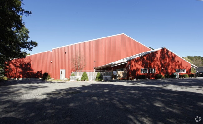
339 N Main St, Middleton, MA 01949

Property Detail
339 N Main St
MIDD-000009-000000-000022
Essex
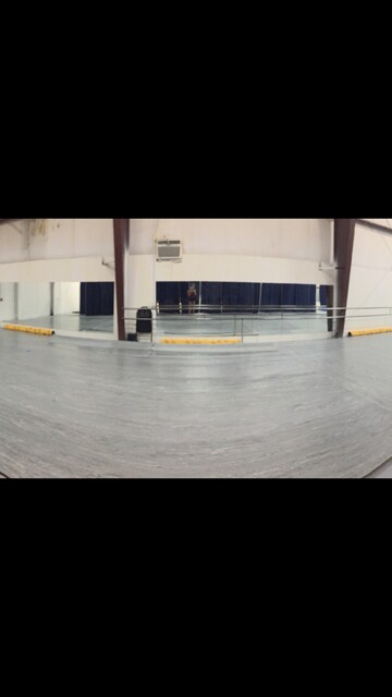
Commercialbuilding
Massachusetts
M1
22
B and X Area of moderate flood hazard, usually the area between the limits of the 100-year and 500-year floods.
2.02 AC
2025
Lawrence/Andover
2025
Boston
212101
Boston-Cambridge-Newton, MA-NH
20,248 SF
NEARBY LISTINGS FOR SALE OR LEASE
-
-
View all Middleton listings for lease on LoopNet.com
DEMOGRAPHICS near 339 N Main St
1 mile
3 mile
5 mile
2025 Total Population
1,487
14,720
68,765
2030 Population
1,525
15,168
70,995
Pop Growth 2025-2030
+ 2.56%
+ 3.04%
+ 3.24%
Average Age
42
41
41
2025 Total Households
520
4,908
23,178
HH Growth 2025-2030
+ 2.50%
+ 3.06%
+ 3.36%
Median Household Inc
$146,249
$184,597
$161,806
Avg Household Size
2.70
3.00
2.80
2025 Avg HH Vehicles
2.00
2.00
2.00
Median Home Value
$816,143
$822,988
$804,585
Median Year Built
2002
1985
1978
Nearby Places
Map Layers
Map Styles
 Street
 Aerial
Transit
 Traffic
 Biking
Places
Listings with unknown addresses are not visible on the map
- Restaurants
- Banks
- Shops
- Fitness
- Groceries
PUBLIC TRANSPORTATION
COMMUTER RAIL
Andover (Haverhill Line - Massachusetts Bay Transportation Authority Commuter Rail (Purple Line))
Drive
Walk
Distance
Andover (Haverhill Line - Massachusetts Bay Transportation Authority Commuter Rail (Purple Line))
13 min
6.7 mi
Lawrence (Haverhill Line - Massachusetts Bay Transportation Authority Commuter Rail (Purple Line))
Drive
Walk
Distance
Lawrence (Haverhill Line - Massachusetts Bay Transportation Authority Commuter Rail (Purple Line))
15 min
7.8 mi
AIRPORT
General Edward Lawrence Logan International
Drive
Walk
Distance
General Edward Lawrence Logan International
39 min
22.3 mi
Manchester Boston Regional
Drive
Walk
Distance
Manchester Boston Regional
57 min
36.8 mi
Portsmouth International at Pease
Drive
Walk
Distance
Portsmouth International at Pease
58 min
41.1 mi
SALE & LEASE HISTORY
LISTING DATE
SALE/LEASE

Sep 11, 2018
For Lease
Mar 10, 2017
For Lease
Aug 30, 2017
For Lease
Nearby Properties
Address
Land Use
TOTAL SIZE
Lot Size
Zoning
Address
Land Use
TOTAL SIZE
Lot Size
Zoning
26.09 AC
R2
Address
Land Use
TOTAL SIZE
Lot Size
Zoning
169,008 SF
33.35 AC
VC
Address
Land Use
TOTAL SIZE
Lot Size
Zoning
36,156 SF
754.25 AC
R1A
Address
Land Use
TOTAL SIZE
Lot Size
Zoning
81,746 SF
10.50 AC
R1A
Address
Land Use
TOTAL SIZE
Lot Size
Zoning
683.90 AC
SRC
Address
Land Use
TOTAL SIZE
Lot Size
Zoning
Address
Land Use
TOTAL SIZE
Lot Size
Zoning
94,999 SF
B1A
Address
Land Use
TOTAL SIZE
Lot Size
Zoning
1,246.80 AC
R2
Address
Land Use
TOTAL SIZE
Lot Size
Zoning
66,660 SF
B1A
Address
Land Use
TOTAL SIZE
Lot Size
Zoning
58,204 SF
15.35 AC
RA
Address
Land Use
TOTAL SIZE
Lot Size
Zoning
56,088 SF
0.18 AC
VR
Address
Land Use
TOTAL SIZE
Lot Size
Zoning
16,114 SF
1 AC
B
Address
Land Use
TOTAL SIZE
Lot Size
Zoning
66,000 SF
3.05 AC
I2
Address
Land Use
TOTAL SIZE
Lot Size
Zoning
86.50 AC
SRC
Address
Land Use
TOTAL SIZE
Lot Size
Zoning
8.66 AC
R-2
Address
Land Use
TOTAL SIZE
Lot Size
Zoning
44,227 SF
M1
Address
Land Use
TOTAL SIZE
Lot Size
Zoning
19,803 SF
2.03 AC
GB
Address
Land Use
TOTAL SIZE
Lot Size
Zoning
1,089 SF
3.52 AC
B2
Address
Land Use
TOTAL SIZE
Lot Size
Zoning
34,814 SF
6.32 AC
M1
Address
Land Use
TOTAL SIZE
Lot Size
Zoning
14,802 SF
3.18 AC
B
Address
Land Use
TOTAL SIZE
Lot Size
Zoning
1.55 AC
B
Address
Land Use
TOTAL SIZE
Lot Size
Zoning
35,434 SF
8.07 AC
I1
Address
Land Use
TOTAL SIZE
Lot Size
Zoning
14,700 SF
M1
Address
Land Use
TOTAL SIZE
Lot Size
Zoning
0.94 AC
B
Address
Land Use
TOTAL SIZE
Lot Size
Zoning
112 AC
R1B
Address
Land Use
TOTAL SIZE
Lot Size
Zoning
15,000 SF
B1A
Address
Land Use
TOTAL SIZE
Lot Size
Zoning
7.41 AC
M1
Address
Land Use
TOTAL SIZE
Lot Size
Zoning
37.90 AC
RR
Address
Land Use
TOTAL SIZE
Lot Size
Zoning
41.80 AC
R2
Address
Land Use
TOTAL SIZE
Lot Size
Zoning
30,520 SF
3.12 AC
I1
The World's #1 Commercial Real Estate Marketplace
Connect with us
© 2026 CoStar Group
The information above has been obtained from sources believed reliable. While we do not doubt its accuracy we have not verified it and make no guarantee, warranty or representation about it. It is your responsibility to independently confirm its accuracy and completeness. Any projections, opinions, assumptions, or estimates used are for example only and do not represent the current or future performance of the property. The value of this transaction to you depends on tax and other factors which should be evaluated by your tax, financial, and legal advisors. You and your advisors should conduct a careful, independent investigation of the property to determine to your satisfaction the suitability of the property for your needs.