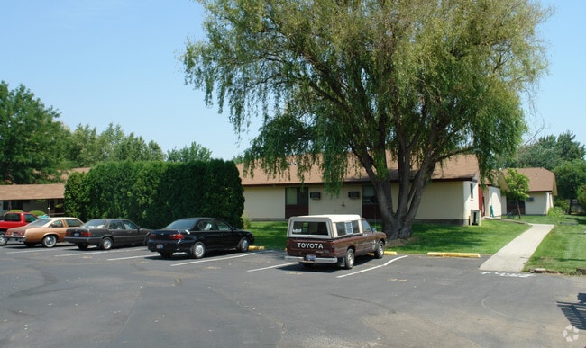
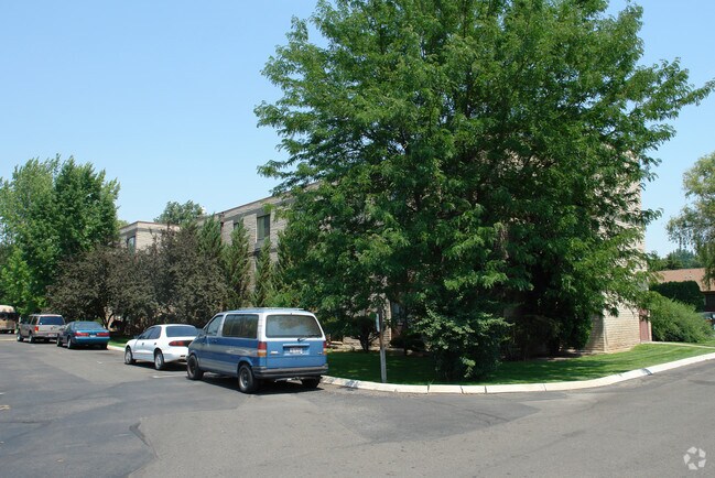
Property Record
3390 N Collister Dr, Boise, ID 83703
Save to a Folder
{{folder.Name}}
{{folder.ListingIds.length}} Properties
{{folder.ListingIds.length}} Property
Create a New Folder
Property Detail
3390 N Collister Dr
R8266000390
PAR #6657 POR SE4SW4 SEC 29 4N 2E #346656-B
Commercialnec
Ada
R-2D
Idaho
C and X Area of minimal flood hazard, usually depicted on FIRMs as above the 500-year flood level.
1.11 AC
2025
Collister
2025
Boise City/Nampa
000302
Boise City, ID
7,006 SF
NEARBY LISTINGS FOR SALE OR LEASE
DEMOGRAPHICS near 3390 N Collister Dr
1 mile
3 mile
5 mile
2025 Total Population
13,336
85,294
198,128
2030 Population
13,880
89,057
207,593
Pop Growth 2025-2030
+ 4.08%
+ 4.41%
+ 4.78%
Average Age
42
42
40
2025 Total Households
5,993
37,576
84,243
HH Growth 2025-2030
+ 4.44%
+ 4.84%
+ 5.28%
Median Household Inc
$68,071
$78,298
$75,280
Avg Household Size
2.10
2.20
2.20
2025 Avg HH Vehicles
2.00
2.00
2.00
Median Home Value
$499,446
$498,503
$488,513
Median Year Built
1990
1984
1987
Nearby Places
Map Layers
Map Styles
 Street
 Aerial
Layers
 Traffic
 Biking
Places
Listings with unknown addresses are not visible on the map
- Restaurants
- Banks
- Shops
- Fitness
- Groceries
PUBLIC TRANSPORTATION
AIRPORT
Boise Air Trml/Gowen Field
Drive
Walk
Distance
Boise Air Trml/Gowen Field
33 min
11.9 mi
Freight Ports
Port of Portland
Drive
Walk
Distance
Port of Portland
481 min
430.5 mi
Nearby Properties
Address
Land Use
TOTAL SIZE
Lot Size
Zoning
Address
Land Use
TOTAL SIZE
Lot Size
Zoning
13.90 AC
R-2D
Address
Land Use
TOTAL SIZE
Lot Size
Zoning
386,225 SF
13.46 AC
C-4D/DA
Address
Land Use
TOTAL SIZE
Lot Size
Zoning
4.02 AC
C-2
Address
Land Use
TOTAL SIZE
Lot Size
Zoning
402,504 SF
5.78 AC
C-5DD
Address
Land Use
TOTAL SIZE
Lot Size
Zoning
207,033 SF
10.67 AC
L-OD
Address
Land Use
TOTAL SIZE
Lot Size
Zoning
225,032 SF
12.75 AC
R-3D
Address
Land Use
TOTAL SIZE
Lot Size
Zoning
245,000 SF
12.28 AC
R-2D
Address
Land Use
TOTAL SIZE
Lot Size
Zoning
216,950 SF
9.03 AC
R-3D
Address
Land Use
TOTAL SIZE
Lot Size
Zoning
151,285 SF
9.54 AC
R-1C
Address
Land Use
TOTAL SIZE
Lot Size
Zoning
222,379 SF
1.37 AC
M
Address
Land Use
TOTAL SIZE
Lot Size
Zoning
150,584 SF
6.77 AC
M
Address
Land Use
TOTAL SIZE
Lot Size
Zoning
211,039 SF
12.21 AC
C-3D
Address
Land Use
TOTAL SIZE
Lot Size
Zoning
7.16 AC
C-2D
Address
Land Use
TOTAL SIZE
Lot Size
Zoning
176,494 SF
10.16 AC
R-1C
Address
Land Use
TOTAL SIZE
Lot Size
Zoning
167,603 SF
6.60 AC
C-2DA
Address
Land Use
TOTAL SIZE
Lot Size
Zoning
10.32 AC
C-2D
Address
Land Use
TOTAL SIZE
Lot Size
Zoning
292,885 SF
13.76 AC
C-1
Address
Land Use
TOTAL SIZE
Lot Size
Zoning
124,286 SF
5 AC
R-3
Address
Land Use
TOTAL SIZE
Lot Size
Zoning
106,155 SF
6.61 AC
R-2D
Address
Land Use
TOTAL SIZE
Lot Size
Zoning
70,705 SF
0.63 AC
H-SD
Address
Land Use
TOTAL SIZE
Lot Size
Zoning
102,272 SF
7.18 AC
R-20
Address
Land Use
TOTAL SIZE
Lot Size
Zoning
49,821 SF
5.45 AC
C-1D/DA
Address
Land Use
TOTAL SIZE
Lot Size
Zoning
135,679 SF
3.11 AC
R-2D
Address
Land Use
TOTAL SIZE
Lot Size
Zoning
92,243 SF
2.05 AC
R-3
Address
Land Use
TOTAL SIZE
Lot Size
Zoning
83,700 SF
6.48 AC
R-2
Address
Land Use
TOTAL SIZE
Lot Size
Zoning
30,492 SF
0.83 AC
C-5DD
Address
Land Use
TOTAL SIZE
Lot Size
Zoning
204,033 SF
12.88 AC
C-1
Address
Land Use
TOTAL SIZE
Lot Size
Zoning
2.08 AC
L-OD/DA
Address
Land Use
TOTAL SIZE
Lot Size
Zoning
159,839 SF
16.94 AC
C-2
Address
Land Use
TOTAL SIZE
Lot Size
Zoning
93,940 SF
6.44 AC
C-2DD
The World's #1 Commercial Real Estate Marketplace
Connect with us
© 2026 CoStar Group
The information above has been obtained from sources believed reliable. While we do not doubt its accuracy we have not verified it and make no guarantee, warranty or representation about it. It is your responsibility to independently confirm its accuracy and completeness. Any projections, opinions, assumptions, or estimates used are for example only and do not represent the current or future performance of the property. The value of this transaction to you depends on tax and other factors which should be evaluated by your tax, financial, and legal advisors. You and your advisors should conduct a careful, independent investigation of the property to determine to your satisfaction the suitability of the property for your needs.