Property Record
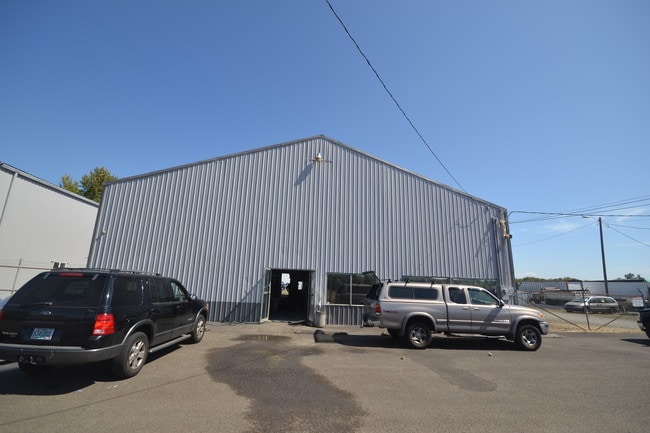
33923 Highway 99E, Tangent, OR 97389

NEARBY LISTINGS FOR SALE OR LEASE
Property Detail
33923 Highway 99E
0727897
11S03W3100
Municipalproperty
Linn
X
Oregon
41043C0528G
0.80 AC
2025
Linn County
2025
Portland
020200
Albany, OR
7,664 SF
DEMOGRAPHICS near 33923 Highway 99E
1 Mile
3 Mile
5 Mile
2024 Total Population
228
9,612
42,797
2029 Population
239
10,029
44,650
Pop Growth 2024-2029
+ 4.82%
+ 4.34%
+ 4.33%
Average Age
40
42
40
2024 Total Households
98
3,845
17,098
HH Growth 2024-2029
+ 5.10%
+ 4.55%
+ 4.49%
Median Household Inc
$68,999
$73,045
$65,534
Avg Household Size
2.30
2.40
2.40
2024 Avg HH Vehicles
2.00
2.00
2.00
Median Home Value
$351,785
$334,050
$308,131
Median Year Built
1983
1990
1977
Nearby Places
Map Layers
Map Styles
 Street
 Aerial
- Restaurants
- Banks
- Shops
- Fitness
- Groceries
PUBLIC TRANSPORTATION
COMMUTER RAIL
Albany Amtrak Station (Amtrak Cascades - Amtrak, Coast Starlight - Amtrak)
DRIVE
WALK
Distance
Albany Amtrak Station (Amtrak Cascades - Amtrak, Coast Starlight - Amtrak)
6 min
4.7 mi
Freight Ports
Port of Portland
DRIVE
WALK
Distance
Port of Portland
98 min
76.8 mi
SALE & LEASE HISTORY
LISTING DATE
SALE/LEASE

Sep 27, 2019
For Lease
Oct 14, 2019
For Lease
Oct 01, 2025
For Lease
May 26, 2023
For Lease
Feb 11, 2022
For Lease
Nearby Properties
Address
Land Use
TOTAL SIZE
Lot Size
Zoning
Address
Land Use
TOTAL SIZE
Lot Size
Zoning
8,842 SF
73.88 AC
RS-6.5
Address
Land Use
TOTAL SIZE
Lot Size
Zoning
104.75 AC
LI
Address
Land Use
TOTAL SIZE
Lot Size
Zoning
29.90 AC
HI
Address
Land Use
TOTAL SIZE
Lot Size
Zoning
9.32 AC
LI
Address
Land Use
TOTAL SIZE
Lot Size
Zoning
41.22 AC
LI
Address
Land Use
TOTAL SIZE
Lot Size
Zoning
84,415 SF
70.68 AC
RS-6.5
Address
Land Use
TOTAL SIZE
Lot Size
Zoning
58,202 SF
5.14 AC
RM
Address
Land Use
TOTAL SIZE
Lot Size
Zoning
45,543 SF
24.28 AC
LI
Address
Land Use
TOTAL SIZE
Lot Size
Zoning
11.43 AC
HC/I
Address
Land Use
TOTAL SIZE
Lot Size
Zoning
56.78 AC
HI
Address
Land Use
TOTAL SIZE
Lot Size
Zoning
8.70 AC
IND
Address
Land Use
TOTAL SIZE
Lot Size
Zoning
13,600 SF
11.89 AC
LI
Address
Land Use
TOTAL SIZE
Lot Size
Zoning
69,760 SF
2.80 AC
RMA
Address
Land Use
TOTAL SIZE
Lot Size
Zoning
10.56 AC
HC/I
Address
Land Use
TOTAL SIZE
Lot Size
Zoning
64,046 SF
5.22 AC
HC/I
Address
Land Use
TOTAL SIZE
Lot Size
Zoning
36,574 SF
5.10 AC
IP
Address
Land Use
TOTAL SIZE
Lot Size
Zoning
55,725 SF
5.98 AC
HC/I
Address
Land Use
TOTAL SIZE
Lot Size
Zoning
4.64 AC
IND
Address
Land Use
TOTAL SIZE
Lot Size
Zoning
7.33 AC
IND
Address
Land Use
TOTAL SIZE
Lot Size
Zoning
105 SF
33.79 AC
EFU
Address
Land Use
TOTAL SIZE
Lot Size
Zoning
32,800 SF
3.51 AC
CC
Address
Land Use
TOTAL SIZE
Lot Size
Zoning
8.09 AC
CC
Address
Land Use
TOTAL SIZE
Lot Size
Zoning
7.43 AC
LI
Address
Land Use
TOTAL SIZE
Lot Size
Zoning
7.61 AC
IP
Address
Land Use
TOTAL SIZE
Lot Size
Zoning
40,416 SF
2.20 AC
RMA
Address
Land Use
TOTAL SIZE
Lot Size
Zoning
50.07 AC
IP
Address
Land Use
TOTAL SIZE
Lot Size
Zoning
5.94 AC
RM
The World's #1 Commercial Real Estate Marketplace
Connect with us
© 2025 CoStar Group
The information above has been obtained from sources believed reliable. While we do not doubt its accuracy we have not verified it and make no guarantee, warranty or representation about it. It is your responsibility to independently confirm its accuracy and completeness. Any projections, opinions, assumptions, or estimates used are for example only and do not represent the current or future performance of the property. The value of this transaction to you depends on tax and other factors which should be evaluated by your tax, financial, and legal advisors. You and your advisors should conduct a careful, independent investigation of the property to determine to your satisfaction the suitability of the property for your needs.