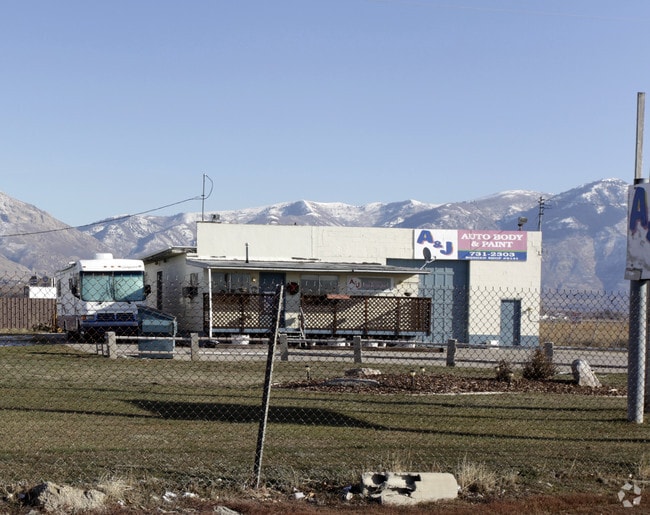
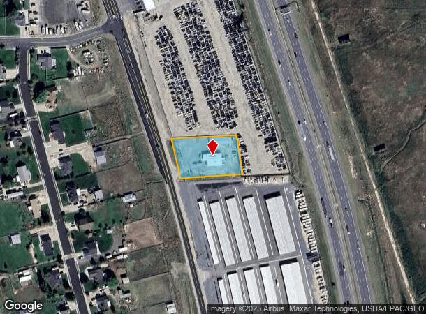
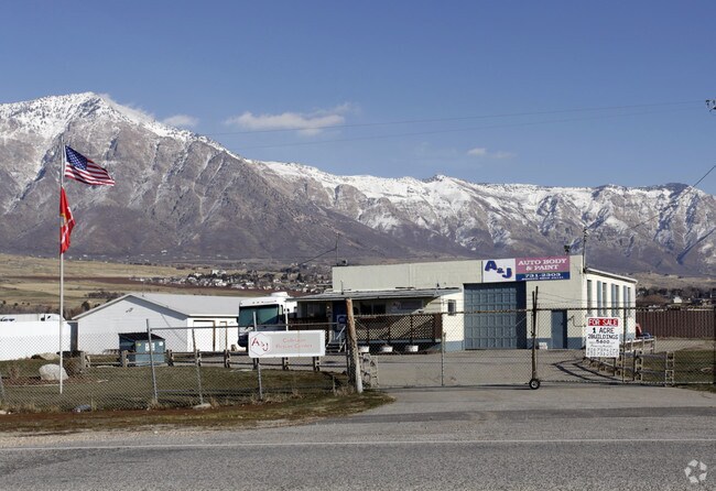
Property Record
3394 N 2000 W, Ogden, UT 84404
NEARBY LISTINGS FOR SALE OR LEASE
Property Detail
3394 N 2000 W
19-017-0093
PART OF THE NORTHEAST QUARTER OF SECTION 26, TOWNSHIP 7 NORTH RANGE 2 WEST, SALT LAKE BASE AND MERIDIAN: BEGINNING AT A POINT
Publicstorage
Weber
X
Utah
49057C0200F
1 AC
2025
Davis/Weber Counties
2025
Salt Lake City
210406
Ogden, UT
2,240 SF
DEMOGRAPHICS near 3394 N 2000 W
1 Mile
3 Mile
5 Mile
2024 Total Population
3,568
33,389
76,518
2029 Population
3,893
36,226
82,672
Pop Growth 2024-2029
+ 9.11%
+ 8.50%
+ 8.04%
Average Age
34
36
36
2024 Total Households
981
10,202
24,146
HH Growth 2024-2029
+ 9.38%
+ 8.67%
+ 8.21%
Median Household Inc
$125,347
$103,161
$87,868
Avg Household Size
3.60
3.30
3.10
2024 Avg HH Vehicles
3.00
3.00
2.00
Median Home Value
$485,210
$448,317
$394,492
Median Year Built
2007
2002
1997
Nearby Places
Map Layers
Map Styles
 Street
 Aerial
- Restaurants
- Banks
- Shops
- Fitness
- Groceries
PUBLIC TRANSPORTATION
COMMUTER RAIL
Ogden (FrontRunner North - Utah Transit Authority (UTA))
DRIVE
WALK
Distance
Ogden (FrontRunner North - Utah Transit Authority (UTA))
13 min
8.8 mi
Freight Ports
Port of Stockton
DRIVE
WALK
Distance
Port of Stockton
753 min
735.9 mi
Nearby Properties
Address
Land Use
TOTAL SIZE
Lot Size
Zoning
Address
Land Use
TOTAL SIZE
Lot Size
Zoning
1,154,674 SF
133.48 AC
Address
Land Use
TOTAL SIZE
Lot Size
Zoning
1,001,933 SF
40.73 AC
Address
Land Use
TOTAL SIZE
Lot Size
Zoning
104,868 SF
22.96 AC
Address
Land Use
TOTAL SIZE
Lot Size
Zoning
292,940 SF
17.83 AC
Address
Land Use
TOTAL SIZE
Lot Size
Zoning
108,917 SF
13.90 AC
Address
Land Use
TOTAL SIZE
Lot Size
Zoning
292,900 SF
14.54 AC
Address
Land Use
TOTAL SIZE
Lot Size
Zoning
264,373 SF
13.52 AC
Address
Land Use
TOTAL SIZE
Lot Size
Zoning
247,962 SF
19.14 AC
Address
Land Use
TOTAL SIZE
Lot Size
Zoning
7,632 SF
6.87 AC
Address
Land Use
TOTAL SIZE
Lot Size
Zoning
228,832 SF
4.61 AC
Address
Land Use
TOTAL SIZE
Lot Size
Zoning
26,418 SF
9.81 AC
Address
Land Use
TOTAL SIZE
Lot Size
Zoning
178,655 SF
11.61 AC
Address
Land Use
TOTAL SIZE
Lot Size
Zoning
102,522 SF
13.14 AC
Address
Land Use
TOTAL SIZE
Lot Size
Zoning
130,740 SF
21.64 AC
Address
Land Use
TOTAL SIZE
Lot Size
Zoning
164,694 SF
10 AC
Address
Land Use
TOTAL SIZE
Lot Size
Zoning
43,946 SF
5.83 AC
Address
Land Use
TOTAL SIZE
Lot Size
Zoning
5,368 SF
53.37 AC
Address
Land Use
TOTAL SIZE
Lot Size
Zoning
7,033 SF
1.63 AC
Address
Land Use
TOTAL SIZE
Lot Size
Zoning
147,776 SF
2.69 AC
Address
Land Use
TOTAL SIZE
Lot Size
Zoning
75,888 SF
6.88 AC
Address
Land Use
TOTAL SIZE
Lot Size
Zoning
75,951 SF
3.38 AC
Address
Land Use
TOTAL SIZE
Lot Size
Zoning
45,932 SF
13.48 AC
Address
Land Use
TOTAL SIZE
Lot Size
Zoning
117,602 SF
12.83 AC
Address
Land Use
TOTAL SIZE
Lot Size
Zoning
60,352 SF
8.95 AC
Address
Land Use
TOTAL SIZE
Lot Size
Zoning
22.97 AC
Address
Land Use
TOTAL SIZE
Lot Size
Zoning
50,400 SF
4.80 AC
Address
Land Use
TOTAL SIZE
Lot Size
Zoning
48,000 SF
2.65 AC
Address
Land Use
TOTAL SIZE
Lot Size
Zoning
73,750 SF
4.75 AC
The World's #1 Commercial Real Estate Marketplace
Connect with us
© 2026 CoStar Group
The information above has been obtained from sources believed reliable. While we do not doubt its accuracy we have not verified it and make no guarantee, warranty or representation about it. It is your responsibility to independently confirm its accuracy and completeness. Any projections, opinions, assumptions, or estimates used are for example only and do not represent the current or future performance of the property. The value of this transaction to you depends on tax and other factors which should be evaluated by your tax, financial, and legal advisors. You and your advisors should conduct a careful, independent investigation of the property to determine to your satisfaction the suitability of the property for your needs.