Property Record
33942 Falcon Ave, Stacy, MN 55079


Property Detail
33942 Falcon Ave
05-00267-00
THAT PT OF N 1/2 OF SEC 18 DES AS FOL: COMM AT THE SE COR OF NW 1/4 OF SAID SEC 18; TH N OF SAID E LINE 292 FT THE PT OF BEG;
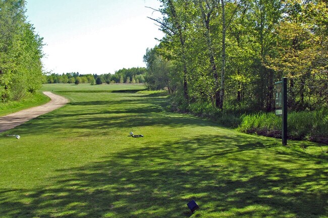
Golfcourse
Chisago
RR
Minnesota
A Areas with a 1% annual chance of flooding and a 26% chance of flooding over the life of a 30-year mortgage.
133.10 AC
2026
Chisago County
2024
Minneapolis/St Paul
110402
Minneapolis-St. Paul-Bloomington, MN-WI
1,280 SF
NEARBY LISTINGS FOR SALE OR LEASE
-
-
View all Stacy listings for sale on LoopNet.com
DEMOGRAPHICS near 33942 Falcon Ave
1 mile
3 mile
5 mile
2025 Total Population
367
4,518
12,864
2030 Population
380
4,655
13,296
Pop Growth 2025-2030
+ 3.54%
+ 3.03%
+ 3.36%
Average Age
42
41
40
2025 Total Households
132
1,674
4,699
HH Growth 2025-2030
+ 3.79%
+ 3.17%
+ 3.43%
Median Household Inc
$89,130
$95,501
$94,937
Avg Household Size
2.50
2.60
2.70
2025 Avg HH Vehicles
2.00
3.00
2.00
Median Home Value
$360,377
$335,061
$332,051
Median Year Built
1992
1991
1993
Nearby Places
Map Layers
Map Styles
 Street
 Aerial
Layers
 Traffic
 Biking
Places
Listings with unknown addresses are not visible on the map
- Restaurants
- Banks
- Shops
- Fitness
- Groceries
SALE & LEASE HISTORY
LISTING DATE
SALE/LEASE

Nov 10, 2021
For Sale
Nearby Properties
Address
Land Use
TOTAL SIZE
Lot Size
Zoning
Address
Land Use
TOTAL SIZE
Lot Size
Zoning
3,328 SF
50.50 AC
RM
Address
Land Use
TOTAL SIZE
Lot Size
Zoning
29,190 SF
7.60 AC
GB
Address
Land Use
TOTAL SIZE
Lot Size
Zoning
7,259 SF
3.50 AC
GB
Address
Land Use
TOTAL SIZE
Lot Size
Zoning
39,600 SF
12.30 AC
GB
Address
Land Use
TOTAL SIZE
Lot Size
Zoning
32,400 SF
7.20 AC
I2
Address
Land Use
TOTAL SIZE
Lot Size
Zoning
20,000 SF
10.13 AC
Address
Land Use
TOTAL SIZE
Lot Size
Zoning
5,200 SF
5.60 AC
RTC
Address
Land Use
TOTAL SIZE
Lot Size
Zoning
15,004 SF
3.25 AC
R1
Address
Land Use
TOTAL SIZE
Lot Size
Zoning
3,580 SF
26.60 AC
RR
Address
Land Use
TOTAL SIZE
Lot Size
Zoning
3,535 SF
0.95 AC
CB
Address
Land Use
TOTAL SIZE
Lot Size
Zoning
12,840 SF
4.10 AC
R3A
Address
Land Use
TOTAL SIZE
Lot Size
Zoning
4,800 SF
2.65 AC
GB
Address
Land Use
TOTAL SIZE
Lot Size
Zoning
7,898 SF
0.72 AC
R3B
Address
Land Use
TOTAL SIZE
Lot Size
Zoning
8,496 SF
10.85 AC
RTC
Address
Land Use
TOTAL SIZE
Lot Size
Zoning
1,956 SF
14.10 AC
RTC
Address
Land Use
TOTAL SIZE
Lot Size
Zoning
7,898 SF
0.60 AC
R3B
Address
Land Use
TOTAL SIZE
Lot Size
Zoning
157 AC
RR
Address
Land Use
TOTAL SIZE
Lot Size
Zoning
2,294 SF
20 AC
RR
Address
Land Use
TOTAL SIZE
Lot Size
Zoning
5,376 SF
0.90 AC
CB
Address
Land Use
TOTAL SIZE
Lot Size
Zoning
1,875 SF
26.60 AC
RR
Address
Land Use
TOTAL SIZE
Lot Size
Zoning
9,100 SF
0.69 AC
CB
Address
Land Use
TOTAL SIZE
Lot Size
Zoning
2,715 SF
39.50 AC
RR
Address
Land Use
TOTAL SIZE
Lot Size
Zoning
9,064 SF
5 AC
RR
Address
Land Use
TOTAL SIZE
Lot Size
Zoning
7,776 SF
8.20 AC
RTC
Address
Land Use
TOTAL SIZE
Lot Size
Zoning
2,300 SF
20.40 AC
Address
Land Use
TOTAL SIZE
Lot Size
Zoning
2,288 SF
0.30 AC
CB
Address
Land Use
TOTAL SIZE
Lot Size
Zoning
912 SF
0.70 AC
Address
Land Use
TOTAL SIZE
Lot Size
Zoning
4,282 SF
0.76 AC
CB
The World's #1 Commercial Real Estate Marketplace
Connect with us
© 2026 CoStar Group
The information above has been obtained from sources believed reliable. While we do not doubt its accuracy we have not verified it and make no guarantee, warranty or representation about it. It is your responsibility to independently confirm its accuracy and completeness. Any projections, opinions, assumptions, or estimates used are for example only and do not represent the current or future performance of the property. The value of this transaction to you depends on tax and other factors which should be evaluated by your tax, financial, and legal advisors. You and your advisors should conduct a careful, independent investigation of the property to determine to your satisfaction the suitability of the property for your needs.