Property Record
3395 Carder Ct, Highlands Ranch, CO 80129
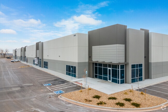

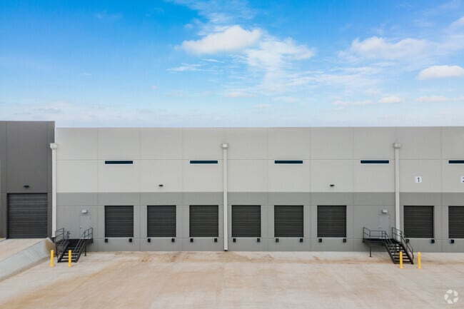
Property Detail
3395 Carder Ct
Denver-Aurora-Centennial, CO
LOT 1A1 SOUTH SANTA FE PLANNED DEVELOPMENT 2ND AMD 21.94 AM/L LSP 10005623
2229-053-05-033
Douglas
Commercialnec
Colorado
B and X Area of moderate flood hazard, usually the area between the limits of the 100-year and 500-year floods.
1
2024
21.94 AC
2025
Highlands Ranch
014131
Denver
345,126 SF
NEARBY LISTINGS FOR SALE OR LEASE
DEMOGRAPHICS near 3395 Carder Ct
1 mile
3 mile
5 mile
2025 Total Population
5,894
64,408
191,848
2030 Population
6,417
67,525
197,761
Pop Growth 2025-2030
+ 8.87%
+ 4.84%
+ 3.08%
Average Age
52
43
42
2025 Total Households
2,605
25,708
75,570
HH Growth 2025-2030
+ 9.56%
+ 5.26%
+ 3.21%
Median Household Inc
$121,710
$133,293
$127,500
Avg Household Size
2.10
2.50
2.50
2025 Avg HH Vehicles
2.00
2.00
2.00
Median Home Value
$712,234
$730,619
$723,534
Median Year Built
2005
1994
1989
Nearby Places
Map Layers
Map Styles
 Street
 Aerial
Layers
 Traffic
 Biking
Places
Listings with unknown addresses are not visible on the map
- Restaurants
- Banks
- Shops
- Fitness
- Groceries
PUBLIC TRANSPORTATION
AIRPORT
Denver International
Drive
Walk
Distance
Denver International
49 min
43.5 mi
Freight Ports
Tulsa Port Of Catoosa
Drive
Walk
Distance
Tulsa Port Of Catoosa
741 min
723.4 mi
SALE & LEASE HISTORY
LISTING DATE
SALE/LEASE

Jul 03, 2018
For Lease
Jan 04, 2019
For Lease
Feb 26, 2021
For Lease
Nearby Properties
Address
Land Use
TOTAL SIZE
Lot Size
Zoning
Address
Land Use
TOTAL SIZE
Lot Size
Zoning
867,858 SF
21.49 AC
Address
Land Use
TOTAL SIZE
Lot Size
Zoning
187,769 SF
16.09 AC
Address
Land Use
TOTAL SIZE
Lot Size
Zoning
622,103 SF
24.61 AC
PDU
Address
Land Use
TOTAL SIZE
Lot Size
Zoning
1,806,344 SF
54.66 AC
Address
Land Use
TOTAL SIZE
Lot Size
Zoning
206,000 SF
70 AC
PDU
Address
Land Use
TOTAL SIZE
Lot Size
Zoning
192,108 SF
20.03 AC
Address
Land Use
TOTAL SIZE
Lot Size
Zoning
133,908 SF
9.39 AC
LPD-C
Address
Land Use
TOTAL SIZE
Lot Size
Zoning
519,330 SF
22.81 AC
PDU
Address
Land Use
TOTAL SIZE
Lot Size
Zoning
177,772 SF
16 AC
Address
Land Use
TOTAL SIZE
Lot Size
Zoning
484,245 SF
18.06 AC
Address
Land Use
TOTAL SIZE
Lot Size
Zoning
215,900 SF
15.32 AC
PDU
Address
Land Use
TOTAL SIZE
Lot Size
Zoning
411,924 SF
26.85 AC
LPDI
Address
Land Use
TOTAL SIZE
Lot Size
Zoning
150,767 SF
14.49 AC
PDU
Address
Land Use
TOTAL SIZE
Lot Size
Zoning
312,130 SF
20.63 AC
PDU
Address
Land Use
TOTAL SIZE
Lot Size
Zoning
1,036,325 SF
51.26 AC
PDU
Address
Land Use
TOTAL SIZE
Lot Size
Zoning
290,636 SF
14.54 AC
PDU
Address
Land Use
TOTAL SIZE
Lot Size
Zoning
61,607 SF
11.60 AC
LPD-C
Address
Land Use
TOTAL SIZE
Lot Size
Zoning
282,692 SF
13.01 AC
Address
Land Use
TOTAL SIZE
Lot Size
Zoning
331,736 SF
Address
Land Use
TOTAL SIZE
Lot Size
Zoning
65,260 SF
11.15 AC
Address
Land Use
TOTAL SIZE
Lot Size
Zoning
248,058 SF
12.24 AC
Address
Land Use
TOTAL SIZE
Lot Size
Zoning
351,792 SF
16.99 AC
LPD-C
Address
Land Use
TOTAL SIZE
Lot Size
Zoning
131,886 SF
8.39 AC
Address
Land Use
TOTAL SIZE
Lot Size
Zoning
68,000 SF
7.47 AC
Address
Land Use
TOTAL SIZE
Lot Size
Zoning
64,186 SF
6.56 AC
Address
Land Use
TOTAL SIZE
Lot Size
Zoning
251,979 SF
14.31 AC
Address
Land Use
TOTAL SIZE
Lot Size
Zoning
81,037 SF
15.31 AC
LPD-C
Address
Land Use
TOTAL SIZE
Lot Size
Zoning
132,152 SF
7.51 AC
PDU
Address
Land Use
TOTAL SIZE
Lot Size
Zoning
308,134 SF
14.56 AC
LPD-C
The World's #1 Commercial Real Estate Marketplace
Connect with us
© 2026 CoStar Group
The information above has been obtained from sources believed reliable. While we do not doubt its accuracy we have not verified it and make no guarantee, warranty or representation about it. It is your responsibility to independently confirm its accuracy and completeness. Any projections, opinions, assumptions, or estimates used are for example only and do not represent the current or future performance of the property. The value of this transaction to you depends on tax and other factors which should be evaluated by your tax, financial, and legal advisors. You and your advisors should conduct a careful, independent investigation of the property to determine to your satisfaction the suitability of the property for your needs.