Property Record
3399 Pollock Rd, Grand Blanc, MI 48439
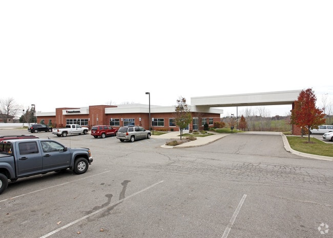

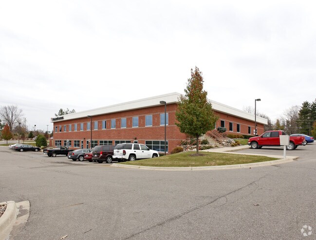
Property Detail
3399 Pollock Rd
12-28-200-021
A POL BEG N 88* 32' 30 SEC E 1340.60 FT FR INTERIOR 1/4 COR OF SEC TH N 1* 22' W 685.05 FT TH S 81* 03' 30 SEC E 257.96 FT TO
Commercialnec
Genesee
GC
Michigan
B and X Area of moderate flood hazard, usually the area between the limits of the 100-year and 500-year floods.
3.90 AC
2024
Flint
2025
Detroit
011102
Flint, MI
27,866 SF
NEARBY LISTINGS FOR SALE OR LEASE
DEMOGRAPHICS near 3399 Pollock Rd
1 mile
3 mile
5 mile
2025 Total Population
1,764
21,707
55,311
2030 Population
1,733
21,330
54,523
Pop Growth 2025-2030
(1.76%)
(1.74%)
(1.42%)
Average Age
42
43
41
2025 Total Households
618
8,650
22,503
HH Growth 2025-2030
(1.62%)
(1.84%)
(1.53%)
Median Household Inc
$108,223
$99,622
$89,833
Avg Household Size
2.70
2.40
2.40
2025 Avg HH Vehicles
2.00
2.00
2.00
Median Home Value
$301,205
$282,010
$259,187
Median Year Built
1994
1990
1982
Nearby Places
Map Layers
Map Styles
 Street
 Aerial
Layers
 Traffic
 Biking
Places
Listings with unknown addresses are not visible on the map
- Restaurants
- Banks
- Shops
- Fitness
- Groceries
PUBLIC TRANSPORTATION
COMMUTER RAIL
Drive
Walk
Distance
17 min
9.4 mi
AIRPORT
Bishop International
Drive
Walk
Distance
Bishop International
24 min
10.8 mi
Nearby Properties
Address
Land Use
TOTAL SIZE
Lot Size
Zoning
Address
Land Use
TOTAL SIZE
Lot Size
Zoning
331,630 SF
63.88 AC
MDM
Address
Land Use
TOTAL SIZE
Lot Size
Zoning
55,378 SF
23 AC
PO
Address
Land Use
TOTAL SIZE
Lot Size
Zoning
248,816 SF
20.22 AC
HCD
Address
Land Use
TOTAL SIZE
Lot Size
Zoning
231,775 SF
I-1
Address
Land Use
TOTAL SIZE
Lot Size
Zoning
86,286 SF
71.83 AC
HCD
Address
Land Use
TOTAL SIZE
Lot Size
Zoning
147,756 SF
59.86 AC
R2
Address
Land Use
TOTAL SIZE
Lot Size
Zoning
173,074 SF
10 AC
MDM
Address
Land Use
TOTAL SIZE
Lot Size
Zoning
22.13 AC
MDM
Address
Land Use
TOTAL SIZE
Lot Size
Zoning
612,305 SF
116.49 AC
I-2
Address
Land Use
TOTAL SIZE
Lot Size
Zoning
Address
Land Use
TOTAL SIZE
Lot Size
Zoning
76,856 SF
28.13 AC
I-1
Address
Land Use
TOTAL SIZE
Lot Size
Zoning
125,825 SF
13.01 AC
B-2
Address
Land Use
TOTAL SIZE
Lot Size
Zoning
674,049 SF
24.02 AC
I-2
Address
Land Use
TOTAL SIZE
Lot Size
Zoning
141,748 SF
8.80 AC
MDM
Address
Land Use
TOTAL SIZE
Lot Size
Zoning
64,897 SF
1.86 AC
GC
Address
Land Use
TOTAL SIZE
Lot Size
Zoning
41,010 SF
37.06 AC
RD
Address
Land Use
TOTAL SIZE
Lot Size
Zoning
104,040 SF
17.02 AC
MDM
Address
Land Use
TOTAL SIZE
Lot Size
Zoning
59,043 SF
8.19 AC
MDM
Address
Land Use
TOTAL SIZE
Lot Size
Zoning
36,638 SF
10.01 AC
GC
Address
Land Use
TOTAL SIZE
Lot Size
Zoning
88,701 SF
10.27 AC
GC
Address
Land Use
TOTAL SIZE
Lot Size
Zoning
210.33 AC
MHP
Address
Land Use
TOTAL SIZE
Lot Size
Zoning
51,625 SF
6 AC
HCD
Address
Land Use
TOTAL SIZE
Lot Size
Zoning
63,088 SF
12.31 AC
I-1
Address
Land Use
TOTAL SIZE
Lot Size
Zoning
243,976 SF
17.67 AC
I-1
Address
Land Use
TOTAL SIZE
Lot Size
Zoning
48,275 SF
8.69 AC
OS
Address
Land Use
TOTAL SIZE
Lot Size
Zoning
199,920 SF
20.47 AC
I-1
Address
Land Use
TOTAL SIZE
Lot Size
Zoning
41,853 SF
4.54 AC
OS
Address
Land Use
TOTAL SIZE
Lot Size
Zoning
42,672 SF
I-1
Address
Land Use
TOTAL SIZE
Lot Size
Zoning
22,026 SF
2.59 AC
GC
The World's #1 Commercial Real Estate Marketplace
Connect with us
© 2026 CoStar Group
The information above has been obtained from sources believed reliable. While we do not doubt its accuracy we have not verified it and make no guarantee, warranty or representation about it. It is your responsibility to independently confirm its accuracy and completeness. Any projections, opinions, assumptions, or estimates used are for example only and do not represent the current or future performance of the property. The value of this transaction to you depends on tax and other factors which should be evaluated by your tax, financial, and legal advisors. You and your advisors should conduct a careful, independent investigation of the property to determine to your satisfaction the suitability of the property for your needs.