Property Record
33Rd St E, Bradenton, FL 34203

Property Detail
33Rd St E
16966-0010-9
PARCEL B: A PARCEL OF LAND IN THE W1/2 OF THE SW1/4 OF THE SE1/4 OF SEC 8, BEING MORE PARTICULARLY DESC AS FOL: COM AT THE NW COR OF THE SD W1/2 OF THE SW1/4 OF THE SE1/4; TH S 89
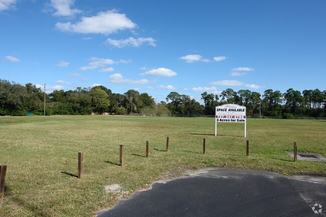
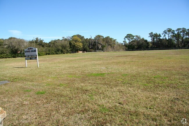
Commercialacreage
MANATEE
NC-M NBRHD
Florida
B and X Area of moderate flood hazard, usually the area between the limits of the 100-year and 500-year floods.
3.06 AC
2024
Manatee
2025
Tampa/St Petersburg
000805
North Port-Bradenton-Sarasota, FL
NEARBY LISTINGS FOR SALE OR LEASE
DEMOGRAPHICS near 33Rd St E
1 mile
3 mile
5 mile
2024 Total Population
8,791
71,721
198,840
2029 Population
9,791
79,843
221,166
Pop Growth 2024-2029
+ 11.38%
+ 11.32%
+ 11.23%
Average Age
45
45
45
2024 Total Households
3,468
28,956
85,191
HH Growth 2024-2029
+ 11.59%
+ 11.75%
+ 11.54%
Median Household Inc
$86,055
$62,460
$64,808
Avg Household Size
2.40
2.40
2.20
2024 Avg HH Vehicles
2.00
2.00
2.00
Median Home Value
$398,362
$331,888
$340,671
Median Year Built
1995
1990
1986
Nearby Places
Map Layers
Map Styles
 Street
 Aerial
Transit
 Traffic
 Biking
Places
Listings with unknown addresses are not visible on the map
- Restaurants
- Banks
- Shops
- Fitness
- Groceries
PUBLIC TRANSPORTATION
AIRPORT
Sarasota/Bradenton International
Drive
Walk
Distance
Sarasota/Bradenton International
16 min
7.7 mi
St Pete-Clearwater International
Drive
Walk
Distance
St Pete-Clearwater International
55 min
40.3 mi
Freight Ports
Port Manatee
Drive
Walk
Distance
Port Manatee
28 min
16.4 mi
Nearby Properties
Address
Land Use
TOTAL SIZE
Lot Size
Zoning
Address
Land Use
TOTAL SIZE
Lot Size
Zoning
385,610 SF
32.65 AC
RMF-6 MULT
Address
Land Use
TOTAL SIZE
Lot Size
Zoning
241,504 SF
27.72 AC
A GENERAL
Address
Land Use
TOTAL SIZE
Lot Size
Zoning
2,401,721 SF
142.14 AC
PD-UI
Address
Land Use
TOTAL SIZE
Lot Size
Zoning
375,171 SF
20 AC
PD-MU
Address
Land Use
TOTAL SIZE
Lot Size
Zoning
115,400 SF
22.55 AC
LM LIGHT M
Address
Land Use
TOTAL SIZE
Lot Size
Zoning
187,000 SF
8.93 AC
Address
Land Use
TOTAL SIZE
Lot Size
Zoning
214,350 SF
16.07 AC
LM LIGHT M
Address
Land Use
TOTAL SIZE
Lot Size
Zoning
296,983 SF
34.84 AC
PD-MU
Address
Land Use
TOTAL SIZE
Lot Size
Zoning
163,394 SF
15.49 AC
PD-MU
Address
Land Use
TOTAL SIZE
Lot Size
Zoning
901,196 SF
48.54 AC
LM LIGHT M
Address
Land Use
TOTAL SIZE
Lot Size
Zoning
145,200 SF
8.66 AC
Address
Land Use
TOTAL SIZE
Lot Size
Zoning
126,505 SF
20 AC
RSF-2
Address
Land Use
TOTAL SIZE
Lot Size
Zoning
419,956 SF
18.46 AC
LM LIGHT M
Address
Land Use
TOTAL SIZE
Lot Size
Zoning
145,200 SF
8.99 AC
Address
Land Use
TOTAL SIZE
Lot Size
Zoning
10,389 SF
57.58 AC
PD-RV
Address
Land Use
TOTAL SIZE
Lot Size
Zoning
124,129 SF
23.29 AC
PDC
Address
Land Use
TOTAL SIZE
Lot Size
Zoning
143,582 SF
14.42 AC
LM LIGHT M
Address
Land Use
TOTAL SIZE
Lot Size
Zoning
231,364 SF
27.50 AC
PD-PI
Address
Land Use
TOTAL SIZE
Lot Size
Zoning
310,215 SF
134.06 AC
A GENERAL
Address
Land Use
TOTAL SIZE
Lot Size
Zoning
220,685 SF
27.21 AC
PD-C
Address
Land Use
TOTAL SIZE
Lot Size
Zoning
322,364 SF
32.93 AC
HM HEAVY M
Address
Land Use
TOTAL SIZE
Lot Size
Zoning
234,818 SF
18.20 AC
BR_R-2
Address
Land Use
TOTAL SIZE
Lot Size
Zoning
141,244 SF
18.08 AC
LM,HM
Address
Land Use
TOTAL SIZE
Lot Size
Zoning
201,632 SF
7.23 AC
A-1 SUBURB
Address
Land Use
TOTAL SIZE
Lot Size
Zoning
121,899 SF
9.88 AC
HM HEAVY M
Address
Land Use
TOTAL SIZE
Lot Size
Zoning
10,094 SF
51.90 AC
PD-RV
Address
Land Use
TOTAL SIZE
Lot Size
Zoning
45,160 SF
12.66 AC
HM HEAVY M
Address
Land Use
TOTAL SIZE
Lot Size
Zoning
313,540 SF
10.51 AC
LM LIGHT M
Address
Land Use
TOTAL SIZE
Lot Size
Zoning
92,466 SF
18.80 AC
A-1 SUBURB
Address
Land Use
TOTAL SIZE
Lot Size
Zoning
251,738 SF
14.60 AC
PD-R
The World's #1 Commercial Real Estate Marketplace
Connect with us
© 2026 CoStar Group
The information above has been obtained from sources believed reliable. While we do not doubt its accuracy we have not verified it and make no guarantee, warranty or representation about it. It is your responsibility to independently confirm its accuracy and completeness. Any projections, opinions, assumptions, or estimates used are for example only and do not represent the current or future performance of the property. The value of this transaction to you depends on tax and other factors which should be evaluated by your tax, financial, and legal advisors. You and your advisors should conduct a careful, independent investigation of the property to determine to your satisfaction the suitability of the property for your needs.