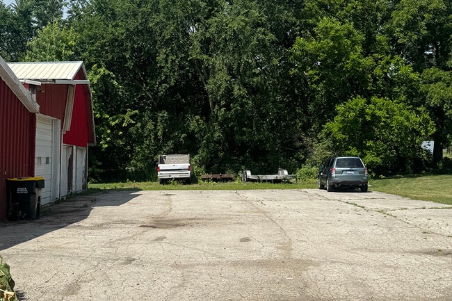
Property Record
33W109 Butterfield Rd, Batavia, IL 60510

Current Lease Availabilities
NEARBY LISTINGS FOR SALE OR LEASE
Property Detail
33W109 Butterfield Rd
Chicago-Naperville-Elgin, IL-IN-WI
Unincorporated East
12-36-400-020
PT SE 1/4 SEC 36-39-8 AS DESC IN DOC 2023K044252
Residentialnec
Kane
X
Illinois
17043C0109J
27f
2024
0.45 AC
2024
I-88 West
846515
Chicago
1,964 SF
DEMOGRAPHICS near 33W109 Butterfield Rd
1 Mile
3 Mile
5 Mile
2024 Total Population
6,564
44,176
175,838
2029 Population
6,545
43,965
174,153
Pop Growth 2024-2029
(0.29%)
(0.48%)
(0.96%)
Average Age
37
39
38
2024 Total Households
2,514
16,119
63,014
HH Growth 2024-2029
(0.48%)
(0.53%)
(0.92%)
Median Household Inc
$110,812
$112,567
$89,837
Avg Household Size
2.60
2.70
2.70
2024 Avg HH Vehicles
2.00
2.00
2.00
Median Home Value
$284,449
$326,060
$275,726
Median Year Built
1995
1992
1985
Nearby Places
Map Layers
Map Styles
 Street
 Aerial
- Restaurants
- Banks
- Shops
- Fitness
- Groceries
PUBLIC TRANSPORTATION
COMMUTER RAIL
Route 59 Station (Burlington Northern-Santa Fe Railway Line - Northeast Illinois Regional Commuter Railroad (Metra))
DRIVE
WALK
Distance
Route 59 Station (Burlington Northern-Santa Fe Railway Line - Northeast Illinois Regional Commuter Railroad (Metra))
11 min
6.4 mi
Aurora Station (Burlington Northern-Santa Fe Railway Line - Northeast Illinois Regional Commuter Railroad (Metra))
DRIVE
WALK
Distance
Aurora Station (Burlington Northern-Santa Fe Railway Line - Northeast Illinois Regional Commuter Railroad (Metra))
13 min
6.9 mi
AIRPORT
Chicago Midway International
DRIVE
WALK
Distance
Chicago Midway International
49 min
32.6 mi
Chicago O'Hare International
DRIVE
WALK
Distance
Chicago O'Hare International
48 min
33.5 mi
Freight Ports
Port Milwaukee
DRIVE
WALK
Distance
Port Milwaukee
129 min
105.2 mi
Nearby Properties
Address
Land Use
TOTAL SIZE
Lot Size
Zoning
Address
Land Use
TOTAL SIZE
Lot Size
Zoning
41.29 AC
Address
Land Use
TOTAL SIZE
Lot Size
Zoning
27.18 AC
Address
Land Use
TOTAL SIZE
Lot Size
Zoning
47.26 AC
Address
Land Use
TOTAL SIZE
Lot Size
Zoning
41.42 AC
Address
Land Use
TOTAL SIZE
Lot Size
Zoning
19.94 AC
R
Address
Land Use
TOTAL SIZE
Lot Size
Zoning
10.62 AC
Address
Land Use
TOTAL SIZE
Lot Size
Zoning
684,925 SF
25.63 AC
Address
Land Use
TOTAL SIZE
Lot Size
Zoning
96.92 AC
I
Address
Land Use
TOTAL SIZE
Lot Size
Zoning
650,361 SF
27.79 AC
I
Address
Land Use
TOTAL SIZE
Lot Size
Zoning
505,720 SF
27.67 AC
Address
Land Use
TOTAL SIZE
Lot Size
Zoning
692,020 SF
33.90 AC
Address
Land Use
TOTAL SIZE
Lot Size
Zoning
522,457 SF
29.33 AC
I
Address
Land Use
TOTAL SIZE
Lot Size
Zoning
23.45 AC
Address
Land Use
TOTAL SIZE
Lot Size
Zoning
397,771 SF
22.12 AC
Address
Land Use
TOTAL SIZE
Lot Size
Zoning
581,960 SF
17.63 AC
Address
Land Use
TOTAL SIZE
Lot Size
Zoning
120,059 SF
13.29 AC
Address
Land Use
TOTAL SIZE
Lot Size
Zoning
479,470 SF
24.67 AC
I
Address
Land Use
TOTAL SIZE
Lot Size
Zoning
12.80 AC
Address
Land Use
TOTAL SIZE
Lot Size
Zoning
521,922 SF
19.87 AC
Address
Land Use
TOTAL SIZE
Lot Size
Zoning
505,584 SF
17.40 AC
Address
Land Use
TOTAL SIZE
Lot Size
Zoning
Address
Land Use
TOTAL SIZE
Lot Size
Zoning
607,706 SF
16.55 AC
Address
Land Use
TOTAL SIZE
Lot Size
Zoning
25.07 AC
Address
Land Use
TOTAL SIZE
Lot Size
Zoning
404,013 SF
22.25 AC
Address
Land Use
TOTAL SIZE
Lot Size
Zoning
398,778 SF
22.76 AC
I
Address
Land Use
TOTAL SIZE
Lot Size
Zoning
Address
Land Use
TOTAL SIZE
Lot Size
Zoning
11.79 AC
Address
Land Use
TOTAL SIZE
Lot Size
Zoning
46,828 SF
5.97 AC
Address
Land Use
TOTAL SIZE
Lot Size
Zoning
65,006 SF
11.96 AC
Address
Land Use
TOTAL SIZE
Lot Size
Zoning
350,000 SF
20.08 AC
I
The World's #1 Commercial Real Estate Marketplace
Connect with us
© 2026 CoStar Group
The information above has been obtained from sources believed reliable. While we do not doubt its accuracy we have not verified it and make no guarantee, warranty or representation about it. It is your responsibility to independently confirm its accuracy and completeness. Any projections, opinions, assumptions, or estimates used are for example only and do not represent the current or future performance of the property. The value of this transaction to you depends on tax and other factors which should be evaluated by your tax, financial, and legal advisors. You and your advisors should conduct a careful, independent investigation of the property to determine to your satisfaction the suitability of the property for your needs.