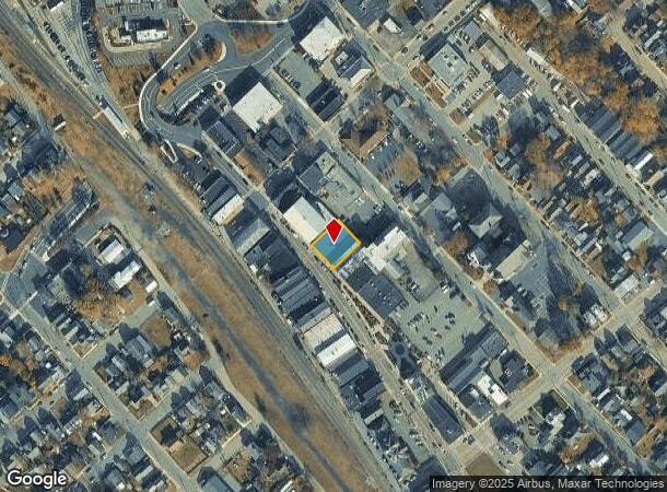
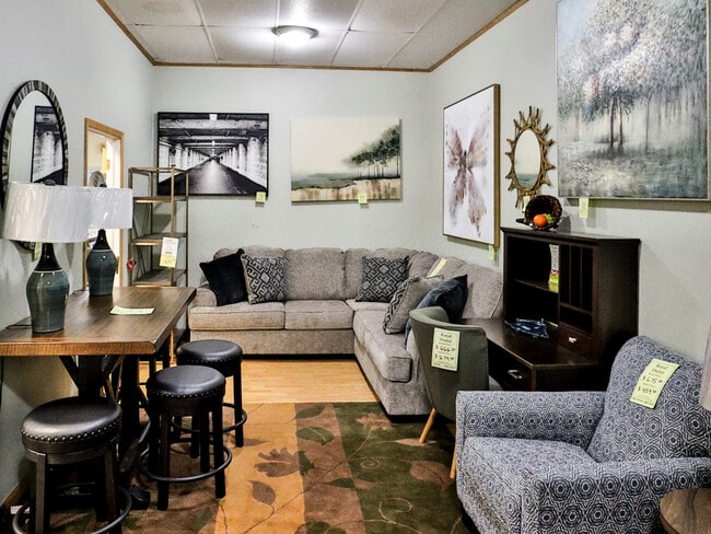
Property Record
34 Front St, Port Jervis, NY 12771
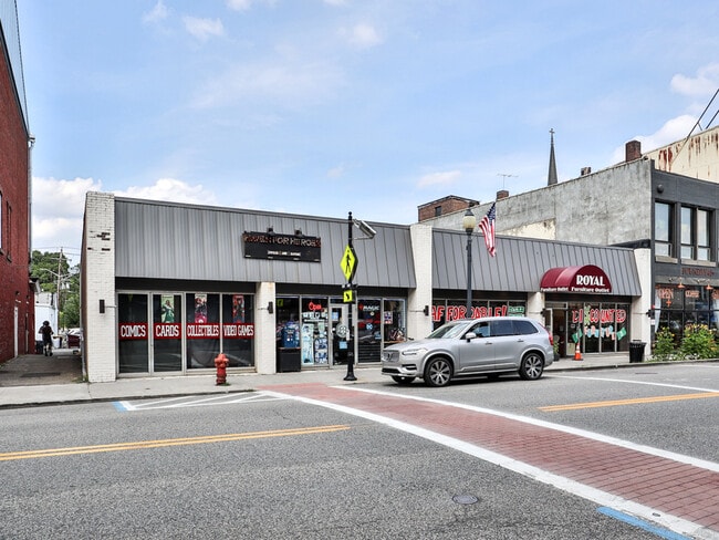
This Property Is For Sale
NEARBY LISTINGS FOR SALE OR LEASE
Property Detail
34 Front St
331300-013-000-0005-028.000-0000
Orange
Commercialnec
New York
X
28.00
34037C0027E
0.19 AC
2024
Middletown
2024
Northern New Jersey
002200
Kiryas Joel-Poughkeepsie-Newburgh, NY
14,592 SF
DEMOGRAPHICS near 34 Front St
1 Mile
3 Mile
5 Mile
2024 Total Population
10,553
15,651
20,719
2029 Population
11,270
16,741
22,103
Pop Growth 2024-2029
+ 6.79%
+ 6.96%
+ 6.68%
Average Age
40
42
42
2024 Total Households
4,288
6,388
8,381
HH Growth 2024-2029
+ 6.90%
+ 7.14%
+ 6.87%
Median Household Inc
$59,587
$64,834
$68,360
Avg Household Size
2.40
2.40
2.40
2024 Avg HH Vehicles
1.00
2.00
2.00
Median Home Value
$254,483
$268,707
$273,374
Median Year Built
1948
1955
1963
Nearby Places
Map Layers
Map Styles
 Street
 Aerial
- Restaurants
- Banks
- Shops
- Fitness
- Groceries
PUBLIC TRANSPORTATION
COMMUTER RAIL
Port Jervis (Bergen County/Port Jervis Line - NJ Transit Commuter Rail (NJ Transit), Main/Port Jervis Line - NJ Transit Commuter Rail (NJ Transit))
DRIVE
WALK
Distance
Port Jervis (Bergen County/Port Jervis Line - NJ Transit Commuter Rail (NJ Transit), Main/Port Jervis Line - NJ Transit Commuter Rail (NJ Transit))
2 min
7 min
0.3 mi
Nearby Properties
Address
Land Use
TOTAL SIZE
Lot Size
Zoning
Address
Land Use
TOTAL SIZE
Lot Size
Zoning
4.40 AC
NMU
Address
Land Use
TOTAL SIZE
Lot Size
Zoning
1,664 SF
1.10 AC
R2
Address
Land Use
TOTAL SIZE
Lot Size
Zoning
4.30 AC
07
Address
Land Use
TOTAL SIZE
Lot Size
Zoning
16.92 AC
C2
Address
Land Use
TOTAL SIZE
Lot Size
Zoning
49.20 AC
Address
Land Use
TOTAL SIZE
Lot Size
Zoning
53,580 SF
7.80 AC
Address
Land Use
TOTAL SIZE
Lot Size
Zoning
14,077 SF
2.20 AC
MCD
Address
Land Use
TOTAL SIZE
Lot Size
Zoning
Address
Land Use
TOTAL SIZE
Lot Size
Zoning
94,928 SF
77.10 AC
Address
Land Use
TOTAL SIZE
Lot Size
Zoning
213,940 SF
31.45 AC
Address
Land Use
TOTAL SIZE
Lot Size
Zoning
4.10 AC
R2
Address
Land Use
TOTAL SIZE
Lot Size
Zoning
3,030 SF
10.50 AC
Address
Land Use
TOTAL SIZE
Lot Size
Zoning
3,030 SF
13.84 AC
Address
Land Use
TOTAL SIZE
Lot Size
Zoning
215,446 SF
23.85 AC
Address
Land Use
TOTAL SIZE
Lot Size
Zoning
53,254 SF
4.10 AC
SCAH
Address
Land Use
TOTAL SIZE
Lot Size
Zoning
20,914 SF
1.10 AC
NMU
Address
Land Use
TOTAL SIZE
Lot Size
Zoning
141,186 SF
15.22 AC
Address
Land Use
TOTAL SIZE
Lot Size
Zoning
97,962 SF
8.90 AC
CBD
Address
Land Use
TOTAL SIZE
Lot Size
Zoning
56,864 SF
2.54 AC
Address
Land Use
TOTAL SIZE
Lot Size
Zoning
102,497 SF
3.90 AC
LI
Address
Land Use
TOTAL SIZE
Lot Size
Zoning
1 AC
C2
Address
Land Use
TOTAL SIZE
Lot Size
Zoning
3.50 AC
C2
Address
Land Use
TOTAL SIZE
Lot Size
Zoning
3.48 AC
C-2
Address
Land Use
TOTAL SIZE
Lot Size
Zoning
72,575 SF
7.26 AC
Address
Land Use
TOTAL SIZE
Lot Size
Zoning
25,042 SF
2.10 AC
07
Address
Land Use
TOTAL SIZE
Lot Size
Zoning
3,007 SF
59.03 AC
R-1
Address
Land Use
TOTAL SIZE
Lot Size
Zoning
28,725 SF
1.40 AC
NMU
Address
Land Use
TOTAL SIZE
Lot Size
Zoning
21.10 AC
R1
Address
Land Use
TOTAL SIZE
Lot Size
Zoning
87,263 SF
10.78 AC
Address
Land Use
TOTAL SIZE
Lot Size
Zoning
92,444 SF
12.40 AC
LI
The World's #1 Commercial Real Estate Marketplace
Connect with us
© 2026 CoStar Group
The information above has been obtained from sources believed reliable. While we do not doubt its accuracy we have not verified it and make no guarantee, warranty or representation about it. It is your responsibility to independently confirm its accuracy and completeness. Any projections, opinions, assumptions, or estimates used are for example only and do not represent the current or future performance of the property. The value of this transaction to you depends on tax and other factors which should be evaluated by your tax, financial, and legal advisors. You and your advisors should conduct a careful, independent investigation of the property to determine to your satisfaction the suitability of the property for your needs.