Property Record
34 Hull Ave, Clintondale, NY 12515

NEARBY LISTINGS FOR SALE OR LEASE
Property Detail
34 Hull Ave
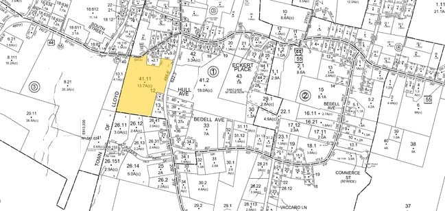
4200-095.003-0001-041.011-0000
Ulster
Warehouse
New York
X
41.011
36111C0760E
14.40 AC
2025
Newburgh/Kingston
2024
Other Market Areas
954000
Kingston, NY
9,450 SF
DEMOGRAPHICS near 34 Hull Ave
1 Mile
3 Mile
5 Mile
2024 Total Population
839
7,038
31,182
2029 Population
815
6,952
31,014
Pop Growth 2024-2029
(2.86%)
(1.22%)
(0.54%)
Average Age
42
44
41
2024 Total Households
335
2,809
11,372
HH Growth 2024-2029
(2.99%)
(1.32%)
(0.71%)
Median Household Inc
$78,049
$89,910
$86,702
Avg Household Size
2.40
2.40
2.40
2024 Avg HH Vehicles
2.00
2.00
2.00
Median Home Value
$296,268
$318,682
$338,088
Median Year Built
1971
1979
1978
Nearby Places
Map Layers
Map Styles
 Street
 Aerial
- Restaurants
- Banks
- Shops
- Fitness
- Groceries
PUBLIC TRANSPORTATION
COMMUTER RAIL
Poughkeepsie Station (Hudson Line - Metro-North Commuter Railroad Company (Metro-North))
DRIVE
WALK
Distance
Poughkeepsie Station (Hudson Line - Metro-North Commuter Railroad Company (Metro-North))
16 min
8.4 mi
AIRPORT
New York Stewart International
DRIVE
WALK
Distance
New York Stewart International
36 min
19.4 mi
Freight Ports
Port of New Haven
DRIVE
WALK
Distance
Port of New Haven
122 min
87.9 mi
Nearby Properties
Address
Land Use
TOTAL SIZE
Lot Size
Zoning
Address
Land Use
TOTAL SIZE
Lot Size
Zoning
31.40 AC
R1
Address
Land Use
TOTAL SIZE
Lot Size
Zoning
94,258 SF
55 AC
I1
Address
Land Use
TOTAL SIZE
Lot Size
Zoning
80,656 SF
34.63 AC
I1
Address
Land Use
TOTAL SIZE
Lot Size
Zoning
43,372 SF
138 AC
M3
Address
Land Use
TOTAL SIZE
Lot Size
Zoning
1,715 SF
170.40 AC
A15
Address
Land Use
TOTAL SIZE
Lot Size
Zoning
8,155 SF
4.90 AC
R1
Address
Land Use
TOTAL SIZE
Lot Size
Zoning
27,472 SF
5.50 AC
R1
Address
Land Use
TOTAL SIZE
Lot Size
Zoning
84,742 SF
6.50 AC
A15
Address
Land Use
TOTAL SIZE
Lot Size
Zoning
1,456 SF
46 AC
HR-1
Address
Land Use
TOTAL SIZE
Lot Size
Zoning
Address
Land Use
TOTAL SIZE
Lot Size
Zoning
4,866 SF
6.90 AC
RA
Address
Land Use
TOTAL SIZE
Lot Size
Zoning
7,039 SF
31.90 AC
AG1.5
Address
Land Use
TOTAL SIZE
Lot Size
Zoning
980 SF
11.80 AC
HR-1
Address
Land Use
TOTAL SIZE
Lot Size
Zoning
5,000 SF
123.90 AC
R1
Address
Land Use
TOTAL SIZE
Lot Size
Zoning
25,000 SF
3.49 AC
I1
Address
Land Use
TOTAL SIZE
Lot Size
Zoning
8,136 SF
14 AC
R1
Address
Land Use
TOTAL SIZE
Lot Size
Zoning
3,379 SF
194.80 AC
RR1.5
Address
Land Use
TOTAL SIZE
Lot Size
Zoning
2,080 SF
63.90 AC
BD60
Address
Land Use
TOTAL SIZE
Lot Size
Zoning
38,970 SF
26.50 AC
RR1.5
Address
Land Use
TOTAL SIZE
Lot Size
Zoning
27,864 SF
69.30 AC
RR1.5
Address
Land Use
TOTAL SIZE
Lot Size
Zoning
1,512 SF
10.50 AC
AG1.5
Address
Land Use
TOTAL SIZE
Lot Size
Zoning
840 SF
2.60 AC
RR1.5
Address
Land Use
TOTAL SIZE
Lot Size
Zoning
22,619 SF
3.40 AC
R1
Address
Land Use
TOTAL SIZE
Lot Size
Zoning
13,660 SF
18.70 AC
A15
Address
Land Use
TOTAL SIZE
Lot Size
Zoning
6,561 SF
0.88 AC
HR 1
Address
Land Use
TOTAL SIZE
Lot Size
Zoning
10,082 SF
26.50 AC
RR1.5
Address
Land Use
TOTAL SIZE
Lot Size
Zoning
5,100 SF
1.70 AC
HR 1
Address
Land Use
TOTAL SIZE
Lot Size
Zoning
264.70 AC
RA
Address
Land Use
TOTAL SIZE
Lot Size
Zoning
3,212 SF
10.70 AC
A15
The World's #1 Commercial Real Estate Marketplace
Connect with us
© 2026 CoStar Group
The information above has been obtained from sources believed reliable. While we do not doubt its accuracy we have not verified it and make no guarantee, warranty or representation about it. It is your responsibility to independently confirm its accuracy and completeness. Any projections, opinions, assumptions, or estimates used are for example only and do not represent the current or future performance of the property. The value of this transaction to you depends on tax and other factors which should be evaluated by your tax, financial, and legal advisors. You and your advisors should conduct a careful, independent investigation of the property to determine to your satisfaction the suitability of the property for your needs.