Property Record
34 Main St, Seven Valleys, PA 17360


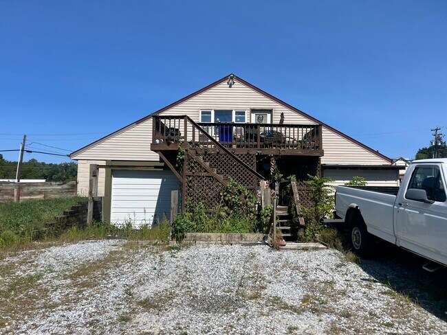
Property Detail
34 Main St
83-000-FH-0112.D0-00000
LOT 1 & 7; PP NN-773 QQ 790 1959
Agriculturalland
York
RA
Pennsylvania
A Areas with a 1% annual chance of flooding and a 26% chance of flooding over the life of a 30-year mortgage.
15.04 AC
2026
York County
2026
Philadelphia
021712
York-Hanover, PA
4,724 SF
NEARBY LISTINGS FOR SALE OR LEASE
DEMOGRAPHICS near 34 Main St
1 mile
3 mile
5 mile
2025 Total Population
778
8,199
25,836
2030 Population
789
8,452
26,597
Pop Growth 2025-2030
+ 1.41%
+ 3.09%
+ 2.95%
Average Age
42
42
42
2025 Total Households
305
3,177
9,874
HH Growth 2025-2030
+ 1.31%
+ 3.12%
+ 3.06%
Median Household Inc
$66,428
$87,061
$95,012
Avg Household Size
2.60
2.50
2.60
2025 Avg HH Vehicles
2.00
2.00
2.00
Median Home Value
$181,481
$284,723
$292,772
Median Year Built
1952
1976
1976
Nearby Places
Map Layers
Map Styles
 Street
 Aerial
Layers
 Traffic
 Biking
Places
Listings with unknown addresses are not visible on the map
- Restaurants
- Banks
- Shops
- Fitness
- Groceries
PUBLIC TRANSPORTATION
AIRPORT
Harrisburg International
Drive
Walk
Distance
Harrisburg International
59 min
40.0 mi
Freight Ports
Port of Baltimore
Drive
Walk
Distance
Port of Baltimore
69 min
48.0 mi
SALE & LEASE HISTORY
LISTING DATE
SALE/LEASE

Sep 20, 2024
For Sale
Nearby Properties
Address
Land Use
TOTAL SIZE
Lot Size
Zoning
Address
Land Use
TOTAL SIZE
Lot Size
Zoning
16,800 SF
12.73 AC
Address
Land Use
TOTAL SIZE
Lot Size
Zoning
48,384 SF
3.46 AC
Address
Land Use
TOTAL SIZE
Lot Size
Zoning
64,872 SF
14.42 AC
I
Address
Land Use
TOTAL SIZE
Lot Size
Zoning
28.32 AC
R2
Address
Land Use
TOTAL SIZE
Lot Size
Zoning
5,100 SF
28.30 AC
RA
Address
Land Use
TOTAL SIZE
Lot Size
Zoning
11,244 SF
7.05 AC
R2
Address
Land Use
TOTAL SIZE
Lot Size
Zoning
1,056 SF
4.76 AC
HC
Address
Land Use
TOTAL SIZE
Lot Size
Zoning
4,214 SF
93.95 AC
AG
Address
Land Use
TOTAL SIZE
Lot Size
Zoning
3,922 SF
200.05 AC
A
Address
Land Use
TOTAL SIZE
Lot Size
Zoning
2,402 SF
197.82 AC
AG
Address
Land Use
TOTAL SIZE
Lot Size
Zoning
4,627 SF
49.52 AC
AG
Address
Land Use
TOTAL SIZE
Lot Size
Zoning
6,576 SF
3.41 AC
HC
Address
Land Use
TOTAL SIZE
Lot Size
Zoning
29,936 SF
3.90 AC
CM
Address
Land Use
TOTAL SIZE
Lot Size
Zoning
11,532 SF
2.56 AC
AG
Address
Land Use
TOTAL SIZE
Lot Size
Zoning
4,316 SF
339.51 AC
AG
Address
Land Use
TOTAL SIZE
Lot Size
Zoning
5,736 SF
2.26 AC
Address
Land Use
TOTAL SIZE
Lot Size
Zoning
3,120 SF
149.07 AC
RAC
Address
Land Use
TOTAL SIZE
Lot Size
Zoning
2,016 SF
256.63 AC
AG
Address
Land Use
TOTAL SIZE
Lot Size
Zoning
3,461 SF
2 AC
AG
Address
Land Use
TOTAL SIZE
Lot Size
Zoning
5,205 SF
55.30 AC
AG
Address
Land Use
TOTAL SIZE
Lot Size
Zoning
3,615 SF
32.92 AC
AG
Address
Land Use
TOTAL SIZE
Lot Size
Zoning
4,165 SF
6.27 AC
R1
Address
Land Use
TOTAL SIZE
Lot Size
Zoning
4,032 SF
21.96 AC
RAC
Address
Land Use
TOTAL SIZE
Lot Size
Zoning
3,276 SF
119.37 AC
AG
Address
Land Use
TOTAL SIZE
Lot Size
Zoning
4,154 SF
10.02 AC
Address
Land Use
TOTAL SIZE
Lot Size
Zoning
21,406 SF
1.83 AC
I
Address
Land Use
TOTAL SIZE
Lot Size
Zoning
2,116 SF
24.69 AC
RAC
Address
Land Use
TOTAL SIZE
Lot Size
Zoning
31,609 SF
2.16 AC
I
Address
Land Use
TOTAL SIZE
Lot Size
Zoning
2,808 SF
7 AC
RAC
Address
Land Use
TOTAL SIZE
Lot Size
Zoning
7,018 SF
0.49 AC
VC
The World's #1 Commercial Real Estate Marketplace
Connect with us
© 2026 CoStar Group
The information above has been obtained from sources believed reliable. While we do not doubt its accuracy we have not verified it and make no guarantee, warranty or representation about it. It is your responsibility to independently confirm its accuracy and completeness. Any projections, opinions, assumptions, or estimates used are for example only and do not represent the current or future performance of the property. The value of this transaction to you depends on tax and other factors which should be evaluated by your tax, financial, and legal advisors. You and your advisors should conduct a careful, independent investigation of the property to determine to your satisfaction the suitability of the property for your needs.