Property Record
34 N Baldwin Ave, Sierra Madre, CA 91024


Property Detail
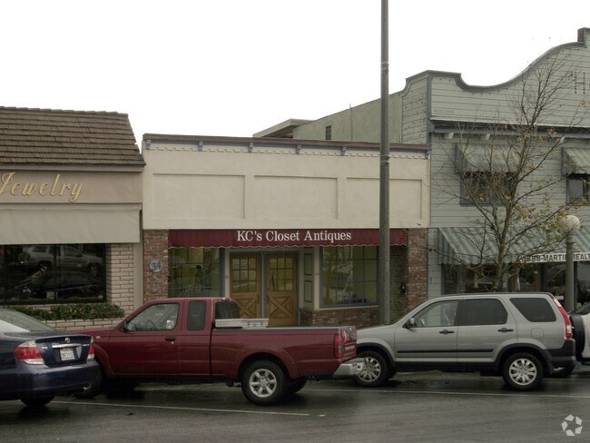
34 N Baldwin Ave
5767-015-033
A HAWKS ADD TO SIERRA MADRE S 25 FT MEASURED ON E AND W LINES OF LOT 3 BLK B
Storemultistory
Los Angeles
SRC1CC*
California
B and X Area of moderate flood hazard, usually the area between the limits of the 100-year and 500-year floods.
3
2025
0.09 AC
2025
Western SGV
430502
Los Angeles
2,075 SF
Los Angeles-Long Beach-Glendale, CA
NEARBY LISTINGS FOR SALE OR LEASE
DEMOGRAPHICS near 34 N Baldwin Ave
1 mile
3 mile
5 mile
2025 Total Population
13,454
99,201
294,172
2030 Population
13,352
98,447
291,827
Pop Growth 2025-2030
(0.76%)
(0.76%)
(0.80%)
Average Age
46
44
43
2025 Total Households
5,415
36,697
107,339
HH Growth 2025-2030
(1.02%)
(1.02%)
(0.98%)
Median Household Inc
$150,449
$115,942
$109,577
Avg Household Size
2.40
2.60
2.60
2025 Avg HH Vehicles
2.00
2.00
2.00
Median Home Value
$1,108,716
$1,068,113
$1,038,670
Median Year Built
1956
1959
1957
Nearby Places
Map Layers
Map Styles
 Street
 Aerial
Layers
 Traffic
 Biking
Places
Listings with unknown addresses are not visible on the map
- Restaurants
- Banks
- Shops
- Fitness
- Groceries
PUBLIC TRANSPORTATION
COMMUTER RAIL
El Monte (San Bernardino Line - Southern California Regional Rail Authority (Metrolink))
Drive
Walk
Distance
El Monte (San Bernardino Line - Southern California Regional Rail Authority (Metrolink))
16 min
7.2 mi
AIRPORT
Bob Hope
Drive
Walk
Distance
Bob Hope
31 min
22.8 mi
Los Angeles International
Drive
Walk
Distance
Los Angeles International
49 min
34.6 mi
Long Beach (Daugherty Field)
Drive
Walk
Distance
Long Beach (Daugherty Field)
47 min
35.5 mi
Freight Ports
Port of Long Beach
Drive
Walk
Distance
Port of Long Beach
52 min
33.9 mi
Nearby Properties
Address
Land Use
TOTAL SIZE
Lot Size
Zoning
Address
Land Use
TOTAL SIZE
Lot Size
Zoning
945,101 SF
38.07 AC
ARC2DH-S1-
Address
Land Use
TOTAL SIZE
Lot Size
Zoning
230,045 SF
3.20 AC
PSC*
Address
Land Use
TOTAL SIZE
Lot Size
Zoning
165,341 SF
2.70 AC
ARC2YY
Address
Land Use
TOTAL SIZE
Lot Size
Zoning
531,606 SF
8.20 AC
PSC*
Address
Land Use
TOTAL SIZE
Lot Size
Zoning
299,385 SF
4.37 AC
PSC*
Address
Land Use
TOTAL SIZE
Lot Size
Zoning
237,930 SF
2.98 AC
PSC*
Address
Land Use
TOTAL SIZE
Lot Size
Zoning
210,083 SF
9.61 AC
PSMG
Address
Land Use
TOTAL SIZE
Lot Size
Zoning
294,320 SF
8.30 AC
PSC*
Address
Land Use
TOTAL SIZE
Lot Size
Zoning
144,947 SF
19.93 AC
PSC*
Address
Land Use
TOTAL SIZE
Lot Size
Zoning
127,085 SF
1.97 AC
MOCG-P/QP*
Address
Land Use
TOTAL SIZE
Lot Size
Zoning
324,664 SF
7.97 AC
PSC*
Address
Land Use
TOTAL SIZE
Lot Size
Zoning
266,084 SF
3.71 AC
PSC*
Address
Land Use
TOTAL SIZE
Lot Size
Zoning
433,378 SF
8.27 AC
PSC*
Address
Land Use
TOTAL SIZE
Lot Size
Zoning
68,417 SF
0.78 AC
ARC2H*
Address
Land Use
TOTAL SIZE
Lot Size
Zoning
358,500 SF
5.11 AC
ARC2DH-S1-
Address
Land Use
TOTAL SIZE
Lot Size
Zoning
255,384 SF
6.74 AC
ARC2*
Address
Land Use
TOTAL SIZE
Lot Size
Zoning
635,556 SF
11.05 AC
ARC2
Address
Land Use
TOTAL SIZE
Lot Size
Zoning
756,195 SF
15.48 AC
ARC2DH-S1-
Address
Land Use
TOTAL SIZE
Lot Size
Zoning
241,189 SF
0.90 AC
ARC2*
Address
Land Use
TOTAL SIZE
Lot Size
Zoning
24,015 SF
3.23 AC
ARCPD1*
Address
Land Use
TOTAL SIZE
Lot Size
Zoning
325,776 SF
8.33 AC
PSM*
Address
Land Use
TOTAL SIZE
Lot Size
Zoning
53,306 SF
0.90 AC
ARC2
Address
Land Use
TOTAL SIZE
Lot Size
Zoning
69,352 SF
4.78 AC
ARC2
Address
Land Use
TOTAL SIZE
Lot Size
Zoning
220,753 SF
3.75 AC
ARCPD1*
Address
Land Use
TOTAL SIZE
Lot Size
Zoning
131,527 SF
3.75 AC
ARCPD1&H*
Address
Land Use
TOTAL SIZE
Lot Size
Zoning
144,228 SF
2.05 AC
LCC4
Address
Land Use
TOTAL SIZE
Lot Size
Zoning
216,961 SF
1.75 AC
ARC2YY
Address
Land Use
TOTAL SIZE
Lot Size
Zoning
87,163 SF
2.99 AC
ARCO&H*
Address
Land Use
TOTAL SIZE
Lot Size
Zoning
54,465 SF
0.79 AC
MORPD*
Address
Land Use
TOTAL SIZE
Lot Size
Zoning
137,290 SF
2.07 AC
ARC2DH-S1-
The World's #1 Commercial Real Estate Marketplace
Connect with us
© 2026 CoStar Group
The information above has been obtained from sources believed reliable. While we do not doubt its accuracy we have not verified it and make no guarantee, warranty or representation about it. It is your responsibility to independently confirm its accuracy and completeness. Any projections, opinions, assumptions, or estimates used are for example only and do not represent the current or future performance of the property. The value of this transaction to you depends on tax and other factors which should be evaluated by your tax, financial, and legal advisors. You and your advisors should conduct a careful, independent investigation of the property to determine to your satisfaction the suitability of the property for your needs.