Property Record
34 Sr, Hurricane, WV 25526
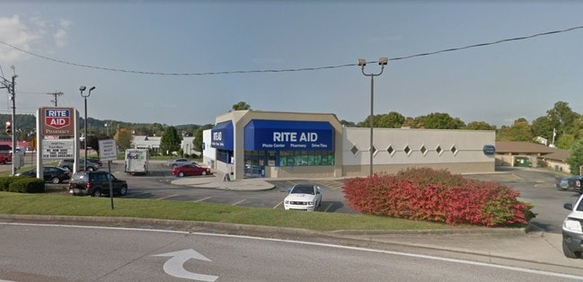

Property Detail
34 Sr
Huntington-Ashland, WV-KY-OH
TRACT 2 (40' STRIP)
10-223G-00870012
PUTNAM
Parkingstructure
West Virginia
B and X Area of moderate flood hazard, usually the area between the limits of the 100-year and 500-year floods.
0.22 AC
0
Putnam County
2025
Charleston WV
020609
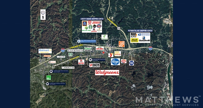
NEARBY LISTINGS FOR SALE OR LEASE
DEMOGRAPHICS near 34 Sr
1 mile
3 mile
5 mile
2025 Total Population
5,598
17,822
28,758
2030 Population
5,569
17,766
28,668
Pop Growth 2025-2030
(0.52%)
(0.31%)
(0.31%)
Average Age
41
42
41
2025 Total Households
2,193
7,073
11,412
HH Growth 2025-2030
(0.46%)
(0.27%)
(0.29%)
Median Household Inc
$74,396
$102,301
$90,099
Avg Household Size
2.50
2.50
2.50
2025 Avg HH Vehicles
2.00
2.00
2.00
Median Home Value
$269,043
$281,653
$267,958
Median Year Built
1988
1991
1989
Nearby Places
Map Layers
Map Styles
 Street
 Aerial
Layers
 Traffic
 Biking
Places
Listings with unknown addresses are not visible on the map
- Restaurants
- Banks
- Shops
- Fitness
- Groceries
PUBLIC TRANSPORTATION
AIRPORT
West Virginia International Yeager
Drive
Walk
Distance
West Virginia International Yeager
36 min
26.2 mi
Freight Ports
Port of Toledo
Drive
Walk
Distance
Port of Toledo
356 min
278.9 mi
SALE & LEASE HISTORY
LISTING DATE
SALE/LEASE

Jul 24, 2019
For Sale
Jul 22, 2024
For Sale
Jul 13, 2020
For Sale
Jan 24, 2017
For Sale
Dec 04, 2018
For Sale
Nearby Properties
Address
Land Use
TOTAL SIZE
Lot Size
Zoning
Address
Land Use
TOTAL SIZE
Lot Size
Zoning
92.62 AC
Address
Land Use
TOTAL SIZE
Lot Size
Zoning
1,336 SF
6.84 AC
Address
Land Use
TOTAL SIZE
Lot Size
Zoning
10.81 AC
Address
Land Use
TOTAL SIZE
Lot Size
Zoning
18.85 AC
Address
Land Use
TOTAL SIZE
Lot Size
Zoning
10.65 AC
Address
Land Use
TOTAL SIZE
Lot Size
Zoning
Address
Land Use
TOTAL SIZE
Lot Size
Zoning
4.34 AC
Address
Land Use
TOTAL SIZE
Lot Size
Zoning
11.41 AC
Address
Land Use
TOTAL SIZE
Lot Size
Zoning
Address
Land Use
TOTAL SIZE
Lot Size
Zoning
Address
Land Use
TOTAL SIZE
Lot Size
Zoning
14.01 AC
Address
Land Use
TOTAL SIZE
Lot Size
Zoning
Address
Land Use
TOTAL SIZE
Lot Size
Zoning
25.65 AC
Address
Land Use
TOTAL SIZE
Lot Size
Zoning
Address
Land Use
TOTAL SIZE
Lot Size
Zoning
10.11 AC
Address
Land Use
TOTAL SIZE
Lot Size
Zoning
4.06 AC
Address
Land Use
TOTAL SIZE
Lot Size
Zoning
6.90 AC
Address
Land Use
TOTAL SIZE
Lot Size
Zoning
1,690 SF
3.99 AC
Address
Land Use
TOTAL SIZE
Lot Size
Zoning
Address
Land Use
TOTAL SIZE
Lot Size
Zoning
Address
Land Use
TOTAL SIZE
Lot Size
Zoning
Address
Land Use
TOTAL SIZE
Lot Size
Zoning
Address
Land Use
TOTAL SIZE
Lot Size
Zoning
Address
Land Use
TOTAL SIZE
Lot Size
Zoning
4.53 AC
Address
Land Use
TOTAL SIZE
Lot Size
Zoning
Address
Land Use
TOTAL SIZE
Lot Size
Zoning
Address
Land Use
TOTAL SIZE
Lot Size
Zoning
5.88 AC
Address
Land Use
TOTAL SIZE
Lot Size
Zoning
Address
Land Use
TOTAL SIZE
Lot Size
Zoning
Address
Land Use
TOTAL SIZE
Lot Size
Zoning
The World's #1 Commercial Real Estate Marketplace
Connect with us
© 2026 CoStar Group
The information above has been obtained from sources believed reliable. While we do not doubt its accuracy we have not verified it and make no guarantee, warranty or representation about it. It is your responsibility to independently confirm its accuracy and completeness. Any projections, opinions, assumptions, or estimates used are for example only and do not represent the current or future performance of the property. The value of this transaction to you depends on tax and other factors which should be evaluated by your tax, financial, and legal advisors. You and your advisors should conduct a careful, independent investigation of the property to determine to your satisfaction the suitability of the property for your needs.