Property Record
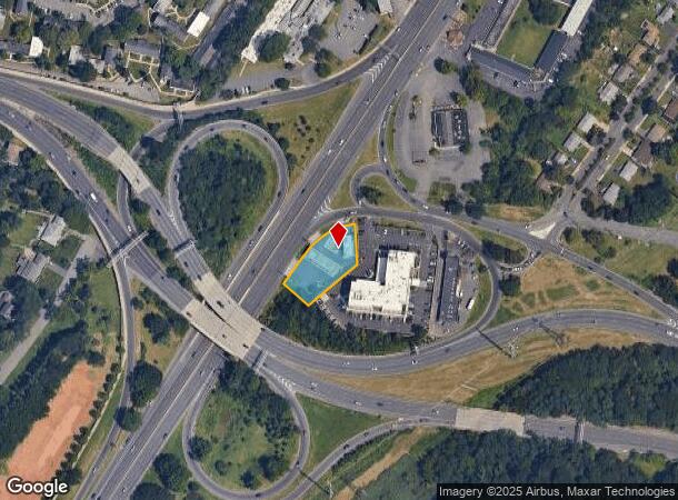
34 Us Highway 1, New Brunswick, NJ 08901


NEARBY LISTINGS FOR SALE OR LEASE
Property Detail
34 Us Highway 1
13-00710-02-00006-07
0.5200
Servicestation
Middlesex
X
New Jersey
34023C0131F
6.7
2024
0.52 AC
2025
Brunswick
006001
Northern New Jersey
1,484 SF
New York-Jersey City-White Plains, NY-NJ
DEMOGRAPHICS near 34 Us Highway 1
1 Mile
3 Mile
5 Mile
2024 Total Population
11,667
134,129
286,918
2029 Population
11,738
133,230
284,961
Pop Growth 2024-2029
+ 0.61%
(0.67%)
(0.68%)
Average Age
36
36
38
2024 Total Households
4,282
44,386
96,242
HH Growth 2024-2029
+ 0.77%
(0.44%)
(0.62%)
Median Household Inc
$82,318
$79,227
$97,504
Avg Household Size
2.50
2.70
2.80
2024 Avg HH Vehicles
2.00
2.00
2.00
Median Home Value
$355,444
$371,126
$393,771
Median Year Built
1960
1965
1970
Nearby Places
Map Layers
Map Styles
 Street
 Aerial
- Restaurants
- Banks
- Shops
- Fitness
- Groceries
PUBLIC TRANSPORTATION
COMMUTER RAIL
New Brunswick (Northeast Corridor Line - NJ Transit Commuter Rail (NJ Transit))
DRIVE
WALK
Distance
New Brunswick (Northeast Corridor Line - NJ Transit Commuter Rail (NJ Transit))
5 min
2.5 mi
Edison (Northeast Corridor Line - NJ Transit Commuter Rail (NJ Transit))
DRIVE
WALK
Distance
Edison (Northeast Corridor Line - NJ Transit Commuter Rail (NJ Transit))
7 min
3.4 mi
AIRPORT
Newark Liberty International
DRIVE
WALK
Distance
Newark Liberty International
33 min
26.5 mi
Trenton Mercer
DRIVE
WALK
Distance
Trenton Mercer
42 min
29.8 mi
Freight Ports
New York Container Terminal
DRIVE
WALK
Distance
New York Container Terminal
28 min
19.3 mi
Nearby Properties
Address
Land Use
TOTAL SIZE
Lot Size
Zoning
Address
Land Use
TOTAL SIZE
Lot Size
Zoning
8.25 AC
D-HI
Address
Land Use
TOTAL SIZE
Lot Size
Zoning
Address
Land Use
TOTAL SIZE
Lot Size
Zoning
38,536 SF
149.61 AC
IN-2
Address
Land Use
TOTAL SIZE
Lot Size
Zoning
11.50 AC
HI
Address
Land Use
TOTAL SIZE
Lot Size
Zoning
37.80 AC
IN-2
Address
Land Use
TOTAL SIZE
Lot Size
Zoning
77.04 AC
I2
Address
Land Use
TOTAL SIZE
Lot Size
Zoning
138,550 SF
104.63 AC
E
Address
Land Use
TOTAL SIZE
Lot Size
Zoning
17 AC
O-1
Address
Land Use
TOTAL SIZE
Lot Size
Zoning
21.30 AC
IN-1
Address
Land Use
TOTAL SIZE
Lot Size
Zoning
Address
Land Use
TOTAL SIZE
Lot Size
Zoning
1.15 AC
C-4
Address
Land Use
TOTAL SIZE
Lot Size
Zoning
0.25 AC
C-4
Address
Land Use
TOTAL SIZE
Lot Size
Zoning
0.92 AC
D-HI
Address
Land Use
TOTAL SIZE
Lot Size
Zoning
6,495 SF
5.74 AC
IN-1
Address
Land Use
TOTAL SIZE
Lot Size
Zoning
1.81 AC
D-HI
Address
Land Use
TOTAL SIZE
Lot Size
Zoning
53,900 SF
4.69 AC
IN-1
Address
Land Use
TOTAL SIZE
Lot Size
Zoning
5.54 AC
C-5
Address
Land Use
TOTAL SIZE
Lot Size
Zoning
Address
Land Use
TOTAL SIZE
Lot Size
Zoning
Address
Land Use
TOTAL SIZE
Lot Size
Zoning
Address
Land Use
TOTAL SIZE
Lot Size
Zoning
1,200 SF
0.01 AC
D-HI
Address
Land Use
TOTAL SIZE
Lot Size
Zoning
11.44 AC
Address
Land Use
TOTAL SIZE
Lot Size
Zoning
Address
Land Use
TOTAL SIZE
Lot Size
Zoning
81,600 SF
49.89 AC
LI
Address
Land Use
TOTAL SIZE
Lot Size
Zoning
Address
Land Use
TOTAL SIZE
Lot Size
Zoning
3,250 SF
1.52 AC
IN-1
Address
Land Use
TOTAL SIZE
Lot Size
Zoning
4.89 AC
R-7
Address
Land Use
TOTAL SIZE
Lot Size
Zoning
8,430 SF
10.51 AC
I-2
Address
Land Use
TOTAL SIZE
Lot Size
Zoning
Address
Land Use
TOTAL SIZE
Lot Size
Zoning
4,600 SF
33.13 AC
IN-2
The World's #1 Commercial Real Estate Marketplace
Connect with us
© 2025 CoStar Group
The information above has been obtained from sources believed reliable. While we do not doubt its accuracy we have not verified it and make no guarantee, warranty or representation about it. It is your responsibility to independently confirm its accuracy and completeness. Any projections, opinions, assumptions, or estimates used are for example only and do not represent the current or future performance of the property. The value of this transaction to you depends on tax and other factors which should be evaluated by your tax, financial, and legal advisors. You and your advisors should conduct a careful, independent investigation of the property to determine to your satisfaction the suitability of the property for your needs.