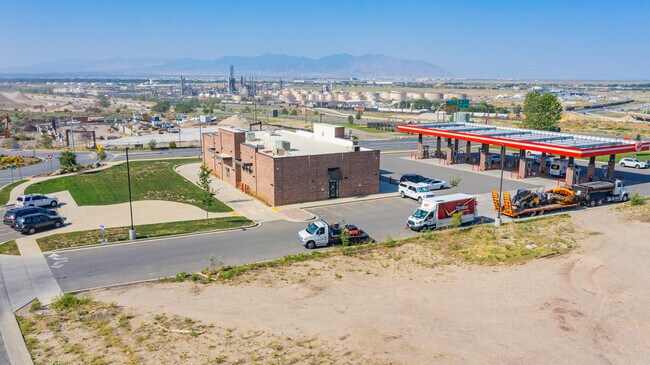
Property Record
34 W Eagle Gate Dr, North Salt Lake, UT 84054


NEARBY LISTINGS FOR SALE OR LEASE
Property Detail
34 W Eagle Gate Dr
Ogden-Clearfield, UT
Eaglewood Village Sub
01-484-0006
ALL OF LOT 6, EAGLEWOOD VILLAGE SUBDIVISION (2ND AMENDMENT). CONT. 1.70000 ACRES
Bakery
Davis
X
Utah
49035C0133G
6
2025
1.70 AC
2025
Davis/Weber Counties
126404
Salt Lake City
4,928 SF
DEMOGRAPHICS near 34 W Eagle Gate Dr
1 Mile
3 Mile
5 Mile
2024 Total Population
8,865
52,823
144,164
2029 Population
9,456
55,507
150,150
Pop Growth 2024-2029
+ 6.67%
+ 5.08%
+ 4.15%
Average Age
35
35
36
2024 Total Households
3,091
16,876
54,054
HH Growth 2024-2029
+ 6.76%
+ 5.20%
+ 4.26%
Median Household Inc
$74,816
$87,635
$72,560
Avg Household Size
2.90
3.10
2.60
2024 Avg HH Vehicles
2.00
2.00
2.00
Median Home Value
$523,644
$436,226
$440,380
Median Year Built
2000
1992
1979
Nearby Places
Map Layers
Map Styles
 Street
 Aerial
- Restaurants
- Banks
- Shops
- Fitness
- Groceries
SALE & LEASE HISTORY
LISTING DATE
SALE/LEASE

Sep 16, 2021
For Lease
Nov 15, 2016
For Sale
Mar 13, 2020
For Sale
Jul 28, 2017
For Sale
Jul 26, 2022
For Sale
Jul 16, 2020
For Sale
Aug 26, 2021
For Sale
Nearby Properties
Address
Land Use
TOTAL SIZE
Lot Size
Zoning
Address
Land Use
TOTAL SIZE
Lot Size
Zoning
1,140,230 SF
53.87 AC
B-P
Address
Land Use
TOTAL SIZE
Lot Size
Zoning
6,673 SF
345.82 AC
Address
Land Use
TOTAL SIZE
Lot Size
Zoning
463,000 SF
25.21 AC
B-P
Address
Land Use
TOTAL SIZE
Lot Size
Zoning
354,506 SF
18.44 AC
B-P
Address
Land Use
TOTAL SIZE
Lot Size
Zoning
380,631 SF
20.34 AC
BP
Address
Land Use
TOTAL SIZE
Lot Size
Zoning
341,830 SF
17.75 AC
BP
Address
Land Use
TOTAL SIZE
Lot Size
Zoning
167,620 SF
114.91 AC
M-1
Address
Land Use
TOTAL SIZE
Lot Size
Zoning
152,165 SF
8.47 AC
4144
Address
Land Use
TOTAL SIZE
Lot Size
Zoning
63,793 SF
113.37 AC
M-2
Address
Land Use
TOTAL SIZE
Lot Size
Zoning
132.55 AC
6192
Address
Land Use
TOTAL SIZE
Lot Size
Zoning
181,565 SF
11.31 AC
M-1
Address
Land Use
TOTAL SIZE
Lot Size
Zoning
240,104 SF
37.03 AC
C2
Address
Land Use
TOTAL SIZE
Lot Size
Zoning
264.04 AC
B-P
Address
Land Use
TOTAL SIZE
Lot Size
Zoning
657,526 SF
35.95 AC
MD
Address
Land Use
TOTAL SIZE
Lot Size
Zoning
4,241 SF
8.67 AC
P
Address
Land Use
TOTAL SIZE
Lot Size
Zoning
208,638 SF
56.05 AC
Address
Land Use
TOTAL SIZE
Lot Size
Zoning
190,822 SF
17.69 AC
PL
Address
Land Use
TOTAL SIZE
Lot Size
Zoning
3,026 SF
14.42 AC
P
Address
Land Use
TOTAL SIZE
Lot Size
Zoning
138,720 SF
8.76 AC
BP
Address
Land Use
TOTAL SIZE
Lot Size
Zoning
13,126 SF
7.83 AC
P
Address
Land Use
TOTAL SIZE
Lot Size
Zoning
77.59 AC
AIRPRT
Address
Land Use
TOTAL SIZE
Lot Size
Zoning
113,265 SF
0.55 AC
CG
Address
Land Use
TOTAL SIZE
Lot Size
Zoning
230,020 SF
27.33 AC
MD
Address
Land Use
TOTAL SIZE
Lot Size
Zoning
259,942 SF
18.52 AC
MD
Address
Land Use
TOTAL SIZE
Lot Size
Zoning
155,896 SF
8.96 AC
Address
Land Use
TOTAL SIZE
Lot Size
Zoning
58,273 SF
3.80 AC
I1
Address
Land Use
TOTAL SIZE
Lot Size
Zoning
40,345 SF
21.52 AC
IP-M-1
Address
Land Use
TOTAL SIZE
Lot Size
Zoning
103,430 SF
6.67 AC
BP
Address
Land Use
TOTAL SIZE
Lot Size
Zoning
19,299 SF
3.06 AC
Address
Land Use
TOTAL SIZE
Lot Size
Zoning
113,197 SF
3.62 AC
The World's #1 Commercial Real Estate Marketplace
Connect with us
© 2025 CoStar Group
The information above has been obtained from sources believed reliable. While we do not doubt its accuracy we have not verified it and make no guarantee, warranty or representation about it. It is your responsibility to independently confirm its accuracy and completeness. Any projections, opinions, assumptions, or estimates used are for example only and do not represent the current or future performance of the property. The value of this transaction to you depends on tax and other factors which should be evaluated by your tax, financial, and legal advisors. You and your advisors should conduct a careful, independent investigation of the property to determine to your satisfaction the suitability of the property for your needs.