Property Record
340 Ballardvale St, Andover, MA 01810
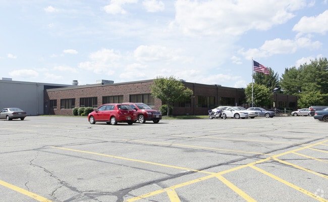

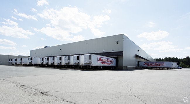

Property Detail
340 Ballardvale St
ANDO-000162-000004
Essex
Industrialgeneral
Massachusetts
IA
38.66 AC
B and X Area of moderate flood hazard, usually the area between the limits of the 100-year and 500-year floods.
Lawrence/Andover
2025
Boston
2025
Boston-Cambridge-Newton, MA-NH
254301
NEARBY LISTINGS FOR SALE OR LEASE
DEMOGRAPHICS near 340 Ballardvale St
1 mile
3 mile
5 mile
2025 Total Population
1,277
36,216
109,206
2030 Population
1,317
37,522
113,054
Pop Growth 2025-2030
+ 3.13%
+ 3.61%
+ 3.52%
Average Age
42
43
42
2025 Total Households
433
13,120
39,045
HH Growth 2025-2030
+ 3.00%
+ 3.73%
+ 3.63%
Median Household Inc
$169,711
$147,689
$141,909
Avg Household Size
2.90
2.60
2.70
2025 Avg HH Vehicles
2.00
2.00
2.00
Median Home Value
$797,058
$728,461
$727,765
Median Year Built
1980
1978
1975
Nearby Places
Map Layers
Map Styles
 Street
 Aerial
Layers
 Traffic
 Biking
Places
Listings with unknown addresses are not visible on the map
- Restaurants
- Banks
- Shops
- Fitness
- Groceries
PUBLIC TRANSPORTATION
COMMUTER RAIL
Ballardvale (Haverhill Line - Massachusetts Bay Transportation Authority Commuter Rail (Purple Line))
Drive
Walk
Distance
Ballardvale (Haverhill Line - Massachusetts Bay Transportation Authority Commuter Rail (Purple Line))
4 min
1.7 mi
North Wilmington (Haverhill Line - Massachusetts Bay Transportation Authority Commuter Rail (Purple Line))
Drive
Walk
Distance
North Wilmington (Haverhill Line - Massachusetts Bay Transportation Authority Commuter Rail (Purple Line))
7 min
3.1 mi
AIRPORT
General Edward Lawrence Logan International
Drive
Walk
Distance
General Edward Lawrence Logan International
32 min
22.0 mi
Manchester Boston Regional
Drive
Walk
Distance
Manchester Boston Regional
51 min
35.2 mi
Freight Ports
Port of Boston
Drive
Walk
Distance
Port of Boston
33 min
21.8 mi
Nearby Properties
Address
Land Use
TOTAL SIZE
Lot Size
Zoning
Address
Land Use
TOTAL SIZE
Lot Size
Zoning
502,199 SF
47.78 AC
IO
Address
Land Use
TOTAL SIZE
Lot Size
Zoning
272,632 SF
22.49 AC
IND
Address
Land Use
TOTAL SIZE
Lot Size
Zoning
1,616 SF
206.08 AC
R40
Address
Land Use
TOTAL SIZE
Lot Size
Zoning
591,906 SF
153.43 AC
IA
Address
Land Use
TOTAL SIZE
Lot Size
Zoning
341,215 SF
16.94 AC
IND
Address
Land Use
TOTAL SIZE
Lot Size
Zoning
19.04 AC
MFD
Address
Land Use
TOTAL SIZE
Lot Size
Zoning
102.84 AC
IA
Address
Land Use
TOTAL SIZE
Lot Size
Zoning
63.72 AC
IA
Address
Land Use
TOTAL SIZE
Lot Size
Zoning
343,105 SF
60.18 AC
IND
Address
Land Use
TOTAL SIZE
Lot Size
Zoning
140,376 SF
135.08 AC
SRB
Address
Land Use
TOTAL SIZE
Lot Size
Zoning
447,869 SF
27.06 AC
ID
Address
Land Use
TOTAL SIZE
Lot Size
Zoning
78,384 SF
34.20 AC
IO
Address
Land Use
TOTAL SIZE
Lot Size
Zoning
221,927 SF
27.88 AC
IND
Address
Land Use
TOTAL SIZE
Lot Size
Zoning
161,736 SF
13.91 AC
Address
Land Use
TOTAL SIZE
Lot Size
Zoning
150,000 SF
30.73 AC
LS
Address
Land Use
TOTAL SIZE
Lot Size
Zoning
129,522 SF
20.22 AC
SRB
Address
Land Use
TOTAL SIZE
Lot Size
Zoning
484,857 SF
42.05 AC
HI
Address
Land Use
TOTAL SIZE
Lot Size
Zoning
238,042 SF
28 AC
IND
Address
Land Use
TOTAL SIZE
Lot Size
Zoning
180,640 SF
15.85 AC
ID2
Address
Land Use
TOTAL SIZE
Lot Size
Zoning
9.80 AC
R40
Address
Land Use
TOTAL SIZE
Lot Size
Zoning
13.16 AC
IA
Address
Land Use
TOTAL SIZE
Lot Size
Zoning
113,912 SF
5.67 AC
MFD
Address
Land Use
TOTAL SIZE
Lot Size
Zoning
124,741 SF
13.35 AC
HB
Address
Land Use
TOTAL SIZE
Lot Size
Zoning
107,001 SF
21.82 AC
MN
Address
Land Use
TOTAL SIZE
Lot Size
Zoning
112,330 SF
17.06 AC
IA
Address
Land Use
TOTAL SIZE
Lot Size
Zoning
120,682 SF
12.03 AC
ID2
Address
Land Use
TOTAL SIZE
Lot Size
Zoning
133,877 SF
16.30 AC
IND
Address
Land Use
TOTAL SIZE
Lot Size
Zoning
167,654 SF
14.84 AC
GI
Address
Land Use
TOTAL SIZE
Lot Size
Zoning
123,700 SF
9.43 AC
The World's #1 Commercial Real Estate Marketplace
Connect with us
© 2026 CoStar Group
The information above has been obtained from sources believed reliable. While we do not doubt its accuracy we have not verified it and make no guarantee, warranty or representation about it. It is your responsibility to independently confirm its accuracy and completeness. Any projections, opinions, assumptions, or estimates used are for example only and do not represent the current or future performance of the property. The value of this transaction to you depends on tax and other factors which should be evaluated by your tax, financial, and legal advisors. You and your advisors should conduct a careful, independent investigation of the property to determine to your satisfaction the suitability of the property for your needs.