Property Record
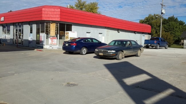
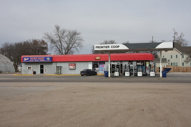
340 E 6Th St, North Bend, NE 68649

Property Detail
340 E 6Th St
270068173
LOTS 7 & 8 BLK 50; MAP NUMBER: 2395-07-1-03000-050-0003
Conveniencestore
Dodge
COMMERCIAL
Nebraska
AE The base floodplain where base flood elevations are provided. AE Zones are now used on new format FIRMs instead of A1-A30 Zones.
7-8
2025
0.40 AC
2025
Nebraska Area
963700
Other Market Areas
7,916 SF
Fremont, NE
NEARBY LISTINGS FOR SALE OR LEASE
-
-
View all North Bend listings for sale on LoopNet.com
DEMOGRAPHICS near 340 E 6Th St
1 mile
3 mile
5 mile
2025 Total Population
1,470
1,936
2,409
2030 Population
1,555
2,038
2,528
Pop Growth 2025-2030
+ 5.78%
+ 5.27%
+ 4.94%
Average Age
41
42
42
2025 Total Households
578
767
956
HH Growth 2025-2030
+ 5.71%
+ 5.22%
+ 4.92%
Median Household Inc
$87,086
$85,947
$85,279
Avg Household Size
2.60
2.50
2.50
2025 Avg HH Vehicles
2.00
3.00
3.00
Median Home Value
$226,595
$218,182
$222,815
Median Year Built
1972
1970
1969
Nearby Places
Map Layers
Map Styles
 Street
 Aerial
Layers
 Traffic
 Biking
Places
Listings with unknown addresses are not visible on the map
- Restaurants
- Banks
- Shops
- Fitness
- Groceries
SALE & LEASE HISTORY
LISTING DATE
SALE/LEASE

Feb 10, 2022
For Sale
Nearby Properties
Address
Land Use
TOTAL SIZE
Lot Size
Zoning
Address
Land Use
TOTAL SIZE
Lot Size
Zoning
2,400 SF
16.34 AC
INDUSTRIAL
Address
Land Use
TOTAL SIZE
Lot Size
Zoning
9,622 SF
INDUSTRIAL
Address
Land Use
TOTAL SIZE
Lot Size
Zoning
142.97 AC
AGRICULTUR
Address
Land Use
TOTAL SIZE
Lot Size
Zoning
149.60 AC
AGRICULTUR
Address
Land Use
TOTAL SIZE
Lot Size
Zoning
9,190 SF
2.62 AC
COMMERCIAL
Address
Land Use
TOTAL SIZE
Lot Size
Zoning
60,900 SF
5.01 AC
COMMERCIAL
Address
Land Use
TOTAL SIZE
Lot Size
Zoning
728 SF
80 AC
AGRICULTUR
Address
Land Use
TOTAL SIZE
Lot Size
Zoning
18,837 SF
2.01 AC
COMMERCIAL
Address
Land Use
TOTAL SIZE
Lot Size
Zoning
2,560 SF
41.76 AC
COMMERCIAL
Address
Land Use
TOTAL SIZE
Lot Size
Zoning
1,552 SF
80 AC
AGRICULTUR
Address
Land Use
TOTAL SIZE
Lot Size
Zoning
2,560 SF
20.74 AC
COMMERCIAL
Address
Land Use
TOTAL SIZE
Lot Size
Zoning
59.11 AC
AGRICULTUR
Address
Land Use
TOTAL SIZE
Lot Size
Zoning
6,050 SF
4.98 AC
COMMERCIAL
Address
Land Use
TOTAL SIZE
Lot Size
Zoning
2,816 SF
0.80 AC
COMMERCIAL
Address
Land Use
TOTAL SIZE
Lot Size
Zoning
157.75 AC
AGRICULTUR
Address
Land Use
TOTAL SIZE
Lot Size
Zoning
2,059 SF
57.60 AC
AGRICULTUR
Address
Land Use
TOTAL SIZE
Lot Size
Zoning
9,600 SF
1.39 AC
COMMERCIAL
Address
Land Use
TOTAL SIZE
Lot Size
Zoning
9,926 SF
0.74 AC
COMMERCIAL
Address
Land Use
TOTAL SIZE
Lot Size
Zoning
23,827 SF
6.10 AC
INDUSTRIAL
Address
Land Use
TOTAL SIZE
Lot Size
Zoning
792 SF
105.46 AC
AGRICULTUR
Address
Land Use
TOTAL SIZE
Lot Size
Zoning
1,040 SF
2.47 AC
INDUSTRIAL
Address
Land Use
TOTAL SIZE
Lot Size
Zoning
4,529 SF
0.13 AC
COMMERCIAL
Address
Land Use
TOTAL SIZE
Lot Size
Zoning
6,600 SF
0.89 AC
COMMERCIAL
Address
Land Use
TOTAL SIZE
Lot Size
Zoning
4,288 SF
0.20 AC
SINGLE-FAM
Address
Land Use
TOTAL SIZE
Lot Size
Zoning
4.80 AC
AGRICULTUR
Address
Land Use
TOTAL SIZE
Lot Size
Zoning
10,872 SF
1.16 AC
COMMERCIAL
Address
Land Use
TOTAL SIZE
Lot Size
Zoning
3,560 SF
3.50 AC
COMMERCIAL
Address
Land Use
TOTAL SIZE
Lot Size
Zoning
11,920 SF
0.80 AC
COMMERCIAL
Address
Land Use
TOTAL SIZE
Lot Size
Zoning
5,006 SF
0.60 AC
COMMERCIAL
The World's #1 Commercial Real Estate Marketplace
Connect with us
© 2026 CoStar Group
The information above has been obtained from sources believed reliable. While we do not doubt its accuracy we have not verified it and make no guarantee, warranty or representation about it. It is your responsibility to independently confirm its accuracy and completeness. Any projections, opinions, assumptions, or estimates used are for example only and do not represent the current or future performance of the property. The value of this transaction to you depends on tax and other factors which should be evaluated by your tax, financial, and legal advisors. You and your advisors should conduct a careful, independent investigation of the property to determine to your satisfaction the suitability of the property for your needs.