Property Record
340 E Evesham Ave, Magnolia, NJ 08049
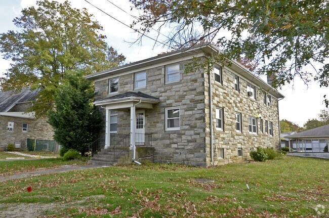


Property Detail
340 E Evesham Ave
Philadelphia-Camden-Wilmington, PA-NJ-DE-MD
FACILITY NAME: SCHOOL
23-00003-01-00001
Camden
Commercialnec
New Jersey
B and X Area of moderate flood hazard, usually the area between the limits of the 100-year and 500-year floods.
1
2025
2.02 AC
2025
South Camden County
607300
Philadelphia
3,144 SF
NEARBY LISTINGS FOR SALE OR LEASE
DEMOGRAPHICS near 340 E Evesham Ave
1 mile
3 mile
5 mile
2025 Total Population
11,539
101,694
275,843
2030 Population
11,776
103,412
280,390
Pop Growth 2025-2030
+ 2.05%
+ 1.69%
+ 1.65%
Average Age
41
41
41
2025 Total Households
4,564
40,321
111,426
HH Growth 2025-2030
+ 2.10%
+ 1.70%
+ 1.68%
Median Household Inc
$88,555
$100,923
$94,079
Avg Household Size
2.50
2.50
2.40
2025 Avg HH Vehicles
2.00
2.00
2.00
Median Home Value
$264,158
$307,265
$327,097
Median Year Built
1962
1964
1966
Nearby Places
Map Layers
Map Styles
 Street
 Aerial
Transit
 Traffic
 Biking
Places
Listings with unknown addresses are not visible on the map
- Restaurants
- Banks
- Shops
- Fitness
- Groceries
PUBLIC TRANSPORTATION
COMMUTER RAIL
Lindenwold (NJT) (Atlantic City Line - NJ Transit Commuter Rail (NJ Transit))
Drive
Walk
Distance
Lindenwold (NJT) (Atlantic City Line - NJ Transit Commuter Rail (NJ Transit))
5 min
2.7 mi
Cherry Hill (Atlantic City Line - NJ Transit Commuter Rail (NJ Transit))
Drive
Walk
Distance
Cherry Hill (Atlantic City Line - NJ Transit Commuter Rail (NJ Transit))
13 min
7.6 mi
AIRPORT
Philadelphia International
Drive
Walk
Distance
Philadelphia International
29 min
16.8 mi
Trenton Mercer
Drive
Walk
Distance
Trenton Mercer
57 min
40.8 mi
Atlantic City International
Drive
Walk
Distance
Atlantic City International
72 min
41.2 mi
Freight Ports
Broadway Terminal - Pier 5
Drive
Walk
Distance
Broadway Terminal - Pier 5
13 min
8.3 mi
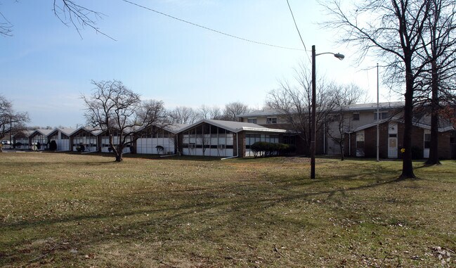
Nearby Properties
Address
Land Use
TOTAL SIZE
Lot Size
Zoning
Address
Land Use
TOTAL SIZE
Lot Size
Zoning
Address
Land Use
TOTAL SIZE
Lot Size
Zoning
18.79 AC
Address
Land Use
TOTAL SIZE
Lot Size
Zoning
Address
Land Use
TOTAL SIZE
Lot Size
Zoning
46,360 SF
8.07 AC
Address
Land Use
TOTAL SIZE
Lot Size
Zoning
231,652 SF
24.41 AC
B
Address
Land Use
TOTAL SIZE
Lot Size
Zoning
164,434 SF
30.98 AC
TC
Address
Land Use
TOTAL SIZE
Lot Size
Zoning
56,408 SF
11.25 AC
TC
Address
Land Use
TOTAL SIZE
Lot Size
Zoning
40,487 SF
32.42 AC
SH
Address
Land Use
TOTAL SIZE
Lot Size
Zoning
48,840 SF
11.04 AC
TC
Address
Land Use
TOTAL SIZE
Lot Size
Zoning
112,443 SF
15.75 AC
TC
Address
Land Use
TOTAL SIZE
Lot Size
Zoning
Address
Land Use
TOTAL SIZE
Lot Size
Zoning
34.62 AC
Address
Land Use
TOTAL SIZE
Lot Size
Zoning
48,840 SF
9.55 AC
TC
Address
Land Use
TOTAL SIZE
Lot Size
Zoning
86,568 SF
11.30 AC
TC
Address
Land Use
TOTAL SIZE
Lot Size
Zoning
40,116 SF
2.84 AC
TC
Address
Land Use
TOTAL SIZE
Lot Size
Zoning
Address
Land Use
TOTAL SIZE
Lot Size
Zoning
Address
Land Use
TOTAL SIZE
Lot Size
Zoning
69,604 SF
11.99 AC
R10
Address
Land Use
TOTAL SIZE
Lot Size
Zoning
8.18 AC
Address
Land Use
TOTAL SIZE
Lot Size
Zoning
41.09 AC
Address
Land Use
TOTAL SIZE
Lot Size
Zoning
33.62 AC
Address
Land Use
TOTAL SIZE
Lot Size
Zoning
9.14 AC
Address
Land Use
TOTAL SIZE
Lot Size
Zoning
128,662 SF
15.87 AC
TC-1
Address
Land Use
TOTAL SIZE
Lot Size
Zoning
Address
Land Use
TOTAL SIZE
Lot Size
Zoning
222,056 SF
25.98 AC
O3
Address
Land Use
TOTAL SIZE
Lot Size
Zoning
126,080 SF
TC-1
Address
Land Use
TOTAL SIZE
Lot Size
Zoning
3.50 AC
Address
Land Use
TOTAL SIZE
Lot Size
Zoning
2,560 SF
167.08 AC
ROC
Address
Land Use
TOTAL SIZE
Lot Size
Zoning
5.29 AC
Address
Land Use
TOTAL SIZE
Lot Size
Zoning
17.27 AC
The World's #1 Commercial Real Estate Marketplace
Connect with us
© 2026 CoStar Group
The information above has been obtained from sources believed reliable. While we do not doubt its accuracy we have not verified it and make no guarantee, warranty or representation about it. It is your responsibility to independently confirm its accuracy and completeness. Any projections, opinions, assumptions, or estimates used are for example only and do not represent the current or future performance of the property. The value of this transaction to you depends on tax and other factors which should be evaluated by your tax, financial, and legal advisors. You and your advisors should conduct a careful, independent investigation of the property to determine to your satisfaction the suitability of the property for your needs.