Property Record
340 E University Dr, Tempe, AZ 85281
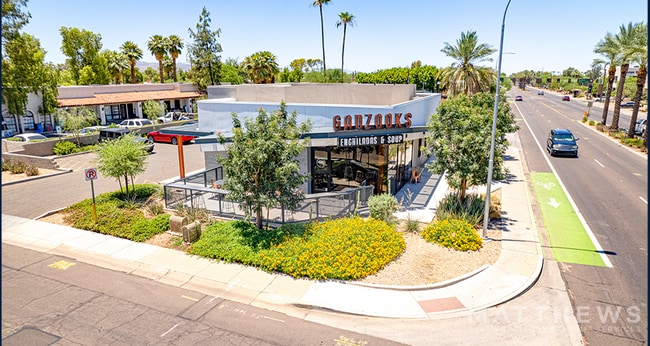


Property Detail
340 E University Dr
132-26-100
EAST TEMPE PT OF CENTER ST 3RD ST & PORTION OF SECOND ALLEY PT OF 2ND ST PORT OF 1ST ALLEY & PORT OF 1ST ST PER A E FERGUSON SURVEY 7 NOV 1956
Taxexempt
MARICOPA
R-3
Arizona
C and X Area of minimal flood hazard, usually depicted on FIRMs as above the 500-year flood level.
6.13 AC
0
Tempe
2025
Phoenix
318700
Phoenix-Mesa-Chandler, AZ
NEARBY LISTINGS FOR SALE OR LEASE
DEMOGRAPHICS near 340 E University Dr
1 mile
3 mile
5 mile
2025 Total Population
31,284
135,987
351,479
2030 Population
32,995
142,015
365,801
Pop Growth 2025-2030
+ 5.47%
+ 4.43%
+ 4.07%
Average Age
28
33
36
2025 Total Households
11,548
59,036
149,825
HH Growth 2025-2030
+ 7.03%
+ 4.85%
+ 4.34%
Median Household Inc
$48,933
$67,880
$72,740
Avg Household Size
1.90
2.10
2.20
2025 Avg HH Vehicles
1.00
2.00
2.00
Median Home Value
$580,373
$443,124
$442,124
Median Year Built
2005
1985
1981
Nearby Places
Map Layers
Map Styles
 Street
 Aerial
Layers
 Traffic
 Biking
Places
Listings with unknown addresses are not visible on the map
- Restaurants
- Banks
- Shops
- Fitness
- Groceries
PUBLIC TRANSPORTATION
TRANSIT/SUBWAY
Tempe Transportation Center (METRO Light Rail - Valley Metro (Phoenix Light Rail))
Drive
Walk
Distance
Tempe Transportation Center (METRO Light Rail - Valley Metro (Phoenix Light Rail))
2 min
7 min
0.3 mi
University Dr/Rural Rd (METRO Light Rail - Valley Metro (Phoenix Light Rail))
Drive
Walk
Distance
University Dr/Rural Rd (METRO Light Rail - Valley Metro (Phoenix Light Rail))
2 min
9 min
0.5 mi
Mill Ave/3rd St (METRO Light Rail - Valley Metro (Phoenix Light Rail))
Drive
Walk
Distance
Mill Ave/3rd St (METRO Light Rail - Valley Metro (Phoenix Light Rail))
3 min
13 min
0.7 mi
AIRPORT
Phoenix Sky Harbor International
Drive
Walk
Distance
Phoenix Sky Harbor International
13 min
6.2 mi
Phoenix-Mesa Gateway
Drive
Walk
Distance
Phoenix-Mesa Gateway
37 min
23.6 mi
SALE & LEASE HISTORY
LISTING DATE
SALE/LEASE

Aug 04, 2022
For Sale
Nearby Properties
Address
Land Use
TOTAL SIZE
Lot Size
Zoning
Address
Land Use
TOTAL SIZE
Lot Size
Zoning
4.59 AC
I-1
Address
Land Use
TOTAL SIZE
Lot Size
Zoning
75,000 SF
12.19 AC
I-1
Address
Land Use
TOTAL SIZE
Lot Size
Zoning
2.63 AC
I-1
Address
Land Use
TOTAL SIZE
Lot Size
Zoning
Address
Land Use
TOTAL SIZE
Lot Size
Zoning
401,544 SF
64.59 AC
GID
Address
Land Use
TOTAL SIZE
Lot Size
Zoning
2,089,643 SF
33.80 AC
MU-ED
Address
Land Use
TOTAL SIZE
Lot Size
Zoning
1,227,029 SF
7.39 AC
R-6
Address
Land Use
TOTAL SIZE
Lot Size
Zoning
106,575 SF
2.50 AC
I-1
Address
Land Use
TOTAL SIZE
Lot Size
Zoning
1,056,321 SF
35.93 AC
R1-6
Address
Land Use
TOTAL SIZE
Lot Size
Zoning
5.13 AC
Address
Land Use
TOTAL SIZE
Lot Size
Zoning
1,102,629 SF
12.33 AC
R-3
Address
Land Use
TOTAL SIZE
Lot Size
Zoning
2.54 AC
Address
Land Use
TOTAL SIZE
Lot Size
Zoning
649,656 SF
10.19 AC
PAD
Address
Land Use
TOTAL SIZE
Lot Size
Zoning
571,804 SF
0.98 AC
CSS
Address
Land Use
TOTAL SIZE
Lot Size
Zoning
1,020,776 SF
11.33 AC
I-1
Address
Land Use
TOTAL SIZE
Lot Size
Zoning
331,050 SF
39 AC
I-1
Address
Land Use
TOTAL SIZE
Lot Size
Zoning
44,971 SF
2.06 AC
C-R
Address
Land Use
TOTAL SIZE
Lot Size
Zoning
58,061 SF
5.43 AC
C-C
Address
Land Use
TOTAL SIZE
Lot Size
Zoning
697,894 SF
8.43 AC
PAD
Address
Land Use
TOTAL SIZE
Lot Size
Zoning
197,454 SF
18.97 AC
PF
Address
Land Use
TOTAL SIZE
Lot Size
Zoning
511,014 SF
5.01 AC
I-1
Address
Land Use
TOTAL SIZE
Lot Size
Zoning
301,376 SF
8.77 AC
PAD
Address
Land Use
TOTAL SIZE
Lot Size
Zoning
548,227 SF
1.62 AC
C-G
Address
Land Use
TOTAL SIZE
Lot Size
Zoning
746,457 SF
20.95 AC
I-1
Address
Land Use
TOTAL SIZE
Lot Size
Zoning
776,898 SF
27.32 AC
C-R
Address
Land Use
TOTAL SIZE
Lot Size
Zoning
352,244 SF
5.55 AC
R-6
The World's #1 Commercial Real Estate Marketplace
Connect with us
© 2026 CoStar Group
The information above has been obtained from sources believed reliable. While we do not doubt its accuracy we have not verified it and make no guarantee, warranty or representation about it. It is your responsibility to independently confirm its accuracy and completeness. Any projections, opinions, assumptions, or estimates used are for example only and do not represent the current or future performance of the property. The value of this transaction to you depends on tax and other factors which should be evaluated by your tax, financial, and legal advisors. You and your advisors should conduct a careful, independent investigation of the property to determine to your satisfaction the suitability of the property for your needs.