Property Record
340 La White Dr, Fletcher, NC 28732

Property Detail
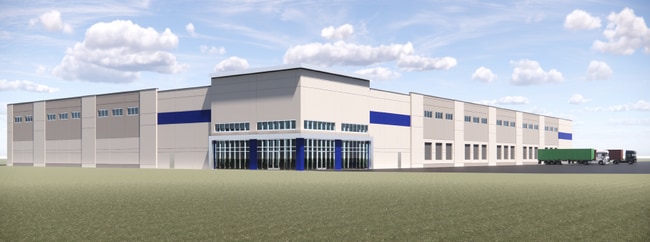
340 La White Dr
0702518
SURVEY 36.15AC PL2021-13703
Officebuilding
Henderson
702518~M-1
North Carolina
AE The base floodplain where base flood elevations are provided. AE Zones are now used on new format FIRMs instead of A1-A30 Zones.
7946
2025
36.15 AC
2025
Henderson County
930502
Asheville
10,328 SF
Asheville, NC
NEARBY LISTINGS FOR SALE OR LEASE
DEMOGRAPHICS near 340 La White Dr
1 mile
3 mile
5 mile
2025 Total Population
1,889
23,322
50,167
2030 Population
1,953
23,959
51,520
Pop Growth 2025-2030
+ 3.39%
+ 2.73%
+ 2.70%
Average Age
43
42
43
2025 Total Households
792
9,711
21,179
HH Growth 2025-2030
+ 3.41%
+ 2.68%
+ 2.61%
Median Household Inc
$73,020
$75,126
$78,751
Avg Household Size
2.40
2.40
2.30
2025 Avg HH Vehicles
2.00
2.00
2.00
Median Home Value
$379,706
$364,221
$411,177
Median Year Built
2001
1994
1994
Nearby Places
Map Layers
Map Styles
 Street
 Aerial
Layers
 Traffic
 Biking
Places
Listings with unknown addresses are not visible on the map
- Restaurants
- Banks
- Shops
- Fitness
- Groceries
PUBLIC TRANSPORTATION
AIRPORT
Asheville Regional
Drive
Walk
Distance
Asheville Regional
12 min
5.9 mi
Freight Ports
North Charleston Terminal
Drive
Walk
Distance
North Charleston Terminal
278 min
245.7 mi
SALE & LEASE HISTORY
LISTING DATE
SALE/LEASE

Feb 26, 2024
For Lease
Nearby Properties
Address
Land Use
TOTAL SIZE
Lot Size
Zoning
Address
Land Use
TOTAL SIZE
Lot Size
Zoning
85,103 SF
11.69 AC
RES EXP
Address
Land Use
TOTAL SIZE
Lot Size
Zoning
207,701 SF
458.72 AC
R-3
Address
Land Use
TOTAL SIZE
Lot Size
Zoning
73,420 SF
10.24 AC
RM16
Address
Land Use
TOTAL SIZE
Lot Size
Zoning
481,731 SF
86.32 AC
1009658~I
Address
Land Use
TOTAL SIZE
Lot Size
Zoning
3,466 SF
11.32 AC
10000832~M
Address
Land Use
TOTAL SIZE
Lot Size
Zoning
4,839 SF
9.46 AC
10002512~C
Address
Land Use
TOTAL SIZE
Lot Size
Zoning
92,772 SF
12.30 AC
R-2
Address
Land Use
TOTAL SIZE
Lot Size
Zoning
899,676 SF
46.99 AC
1006235~M-
Address
Land Use
TOTAL SIZE
Lot Size
Zoning
43,882 SF
9.71 AC
1016337~C1
Address
Land Use
TOTAL SIZE
Lot Size
Zoning
24.83 AC
1012291~M-
Address
Land Use
TOTAL SIZE
Lot Size
Zoning
87,220 SF
39.11 AC
PS
Address
Land Use
TOTAL SIZE
Lot Size
Zoning
208,715 SF
33.50 AC
CI
Address
Land Use
TOTAL SIZE
Lot Size
Zoning
41,104 SF
5.45 AC
CR
Address
Land Use
TOTAL SIZE
Lot Size
Zoning
76,255 SF
10.55 AC
EMP
Address
Land Use
TOTAL SIZE
Lot Size
Zoning
415,861 SF
59.02 AC
9927651~M-
Address
Land Use
TOTAL SIZE
Lot Size
Zoning
82,096 SF
19.67 AC
1015839~R1
Address
Land Use
TOTAL SIZE
Lot Size
Zoning
43,030 SF
5.15 AC
1016338~C1
Address
Land Use
TOTAL SIZE
Lot Size
Zoning
57,827 SF
1.68 AC
1017417~C-
Address
Land Use
TOTAL SIZE
Lot Size
Zoning
355,552 SF
40.75 AC
EMP
Address
Land Use
TOTAL SIZE
Lot Size
Zoning
39,080 SF
71.04 AC
1001876~R1
Address
Land Use
TOTAL SIZE
Lot Size
Zoning
22,949 SF
21.69 AC
10002520~C
Address
Land Use
TOTAL SIZE
Lot Size
Zoning
67,471 SF
8.99 AC
9957309~C-
Address
Land Use
TOTAL SIZE
Lot Size
Zoning
62.87 AC
RM16
Address
Land Use
TOTAL SIZE
Lot Size
Zoning
199,065 SF
50.12 AC
702878~M-1
Address
Land Use
TOTAL SIZE
Lot Size
Zoning
26,430 SF
5.03 AC
9969880~R-
Address
Land Use
TOTAL SIZE
Lot Size
Zoning
177,124 SF
22.31 AC
10007851~M
Address
Land Use
TOTAL SIZE
Lot Size
Zoning
49,815 SF
12.33 AC
R-2
Address
Land Use
TOTAL SIZE
Lot Size
Zoning
83,718 SF
8.11 AC
CI
Address
Land Use
TOTAL SIZE
Lot Size
Zoning
60,437 SF
6.90 AC
EMP
Address
Land Use
TOTAL SIZE
Lot Size
Zoning
251,303 SF
29.84 AC
701688~M-1
The World's #1 Commercial Real Estate Marketplace
Connect with us
© 2026 CoStar Group
The information above has been obtained from sources believed reliable. While we do not doubt its accuracy we have not verified it and make no guarantee, warranty or representation about it. It is your responsibility to independently confirm its accuracy and completeness. Any projections, opinions, assumptions, or estimates used are for example only and do not represent the current or future performance of the property. The value of this transaction to you depends on tax and other factors which should be evaluated by your tax, financial, and legal advisors. You and your advisors should conduct a careful, independent investigation of the property to determine to your satisfaction the suitability of the property for your needs.