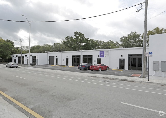
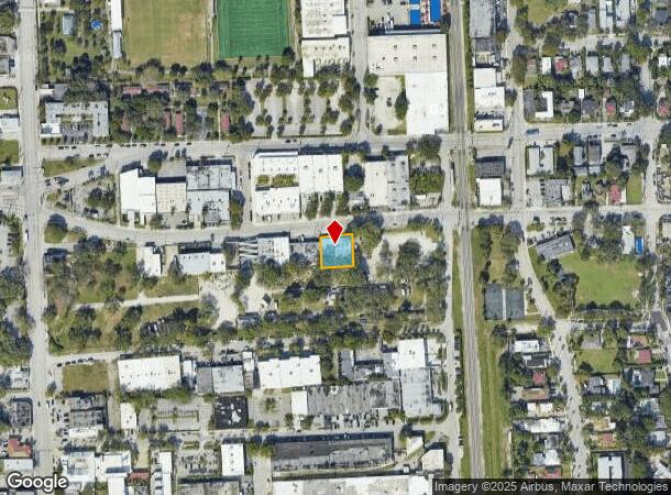
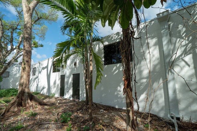
Property Record
340 Ne 61St St, Miami, FL 33137
NEARBY LISTINGS FOR SALE OR LEASE
Property Detail
340 Ne 61St St
Miami-Miami Beach-Kendall, FL
Dullams Unrecorded Plat
01-3218-022-0040
18 53 42 DULLAMS UNRECORDED PLAT SAME BEG 204.5FTS & 918.5FTE OF NW COR SW1/4 S100FT E100FT N100FT W100FT LOT 5 & 6 LESS N2.5FT FOR ST LOT SIZE 9750 SQUARE FEET OR 13857-2158 0588 5
Storemultistory
Miami/Dade
X
Florida
12086C0304L
5
2024
0.22 AC
2025
East Miami
002004
South Florida
6,500 SF
DEMOGRAPHICS near 340 Ne 61St St
1 Mile
3 Mile
5 Mile
2024 Total Population
23,015
180,360
580,200
2029 Population
22,868
179,653
576,821
Pop Growth 2024-2029
(0.64%)
(0.39%)
(0.58%)
Average Age
41
39
41
2024 Total Households
9,259
72,042
240,459
HH Growth 2024-2029
(0.77%)
(0.32%)
(0.42%)
Median Household Inc
$41,274
$48,062
$51,355
Avg Household Size
2.30
2.40
2.30
2024 Avg HH Vehicles
1.00
1.00
1.00
Median Home Value
$506,937
$406,944
$395,170
Median Year Built
1970
1974
1973
Nearby Places
Map Layers
Map Styles
 Street
 Aerial
- Restaurants
- Banks
- Shops
- Fitness
- Groceries
PUBLIC TRANSPORTATION
COMMUTER RAIL
Allapattah (Metrorail Green Line - Miami-Dade Transit (Metrorail/Metromover))
DRIVE
WALK
Distance
Allapattah (Metrorail Green Line - Miami-Dade Transit (Metrorail/Metromover))
8 min
3.4 mi
Dr. Martin Luther King Jr. Plaza (Metrorail Green Line - Miami-Dade Transit (Metrorail/Metromover))
DRIVE
WALK
Distance
Dr. Martin Luther King Jr. Plaza (Metrorail Green Line - Miami-Dade Transit (Metrorail/Metromover))
8 min
3.5 mi
AIRPORT
Miami International
DRIVE
WALK
Distance
Miami International
23 min
10.8 mi
Fort Lauderdale/Hollywood International
DRIVE
WALK
Distance
Fort Lauderdale/Hollywood International
29 min
20.0 mi
Freight Ports
Port of Miami
DRIVE
WALK
Distance
Port of Miami
14 min
5.5 mi
SALE & LEASE HISTORY
LISTING DATE
SALE/LEASE

Feb 27, 2019
For Lease
Nearby Properties
Address
Land Use
TOTAL SIZE
Lot Size
Zoning
Address
Land Use
TOTAL SIZE
Lot Size
Zoning
16.13 AC
6100
Address
Land Use
TOTAL SIZE
Lot Size
Zoning
1,938,271 SF
6.62 AC
6402
Address
Land Use
TOTAL SIZE
Lot Size
Zoning
1,075,124 SF
1.61 AC
6405
Address
Land Use
TOTAL SIZE
Lot Size
Zoning
256,089 SF
20.35 AC
7600
Address
Land Use
TOTAL SIZE
Lot Size
Zoning
585,775 SF
1.86 AC
6101
Address
Land Use
TOTAL SIZE
Lot Size
Zoning
868,860 SF
2.14 AC
6402
Address
Land Use
TOTAL SIZE
Lot Size
Zoning
615,785 SF
3.81 AC
4604
Address
Land Use
TOTAL SIZE
Lot Size
Zoning
790,139 SF
1.80 AC
6110
Address
Land Use
TOTAL SIZE
Lot Size
Zoning
570,694 SF
1.37 AC
4604
Address
Land Use
TOTAL SIZE
Lot Size
Zoning
566,165 SF
2.09 AC
6101
Address
Land Use
TOTAL SIZE
Lot Size
Zoning
701,056 SF
1.58 AC
6402
Address
Land Use
TOTAL SIZE
Lot Size
Zoning
600,250 SF
2.03 AC
6402
Address
Land Use
TOTAL SIZE
Lot Size
Zoning
627,685 SF
2.06 AC
6100
Address
Land Use
TOTAL SIZE
Lot Size
Zoning
519,775 SF
2.27 AC
6100
Address
Land Use
TOTAL SIZE
Lot Size
Zoning
669,245 SF
0.69 AC
6600
Address
Land Use
TOTAL SIZE
Lot Size
Zoning
768,663 SF
2.85 AC
4600
Address
Land Use
TOTAL SIZE
Lot Size
Zoning
737,810 SF
1.05 AC
6600
Address
Land Use
TOTAL SIZE
Lot Size
Zoning
595,100 SF
0.92 AC
4604
Address
Land Use
TOTAL SIZE
Lot Size
Zoning
428,154 SF
1.39 AC
6101
Address
Land Use
TOTAL SIZE
Lot Size
Zoning
221,570 SF
1.79 AC
6100
Address
Land Use
TOTAL SIZE
Lot Size
Zoning
596,081 SF
4.33 AC
9600
Address
Land Use
TOTAL SIZE
Lot Size
Zoning
264,272 SF
2.18 AC
6110
Address
Land Use
TOTAL SIZE
Lot Size
Zoning
545,562 SF
1.71 AC
6110
Address
Land Use
TOTAL SIZE
Lot Size
Zoning
469,492 SF
2.06 AC
4604
Address
Land Use
TOTAL SIZE
Lot Size
Zoning
567,884 SF
4.51 AC
4000
Address
Land Use
TOTAL SIZE
Lot Size
Zoning
505,007 SF
1.99 AC
4604
Address
Land Use
TOTAL SIZE
Lot Size
Zoning
473,168 SF
3.27 AC
6405
Address
Land Use
TOTAL SIZE
Lot Size
Zoning
690,466 SF
0.85 AC
6420
Address
Land Use
TOTAL SIZE
Lot Size
Zoning
303,688 SF
1.01 AC
6100
The World's #1 Commercial Real Estate Marketplace
Connect with us
© 2025 CoStar Group
The information above has been obtained from sources believed reliable. While we do not doubt its accuracy we have not verified it and make no guarantee, warranty or representation about it. It is your responsibility to independently confirm its accuracy and completeness. Any projections, opinions, assumptions, or estimates used are for example only and do not represent the current or future performance of the property. The value of this transaction to you depends on tax and other factors which should be evaluated by your tax, financial, and legal advisors. You and your advisors should conduct a careful, independent investigation of the property to determine to your satisfaction the suitability of the property for your needs.