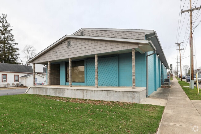
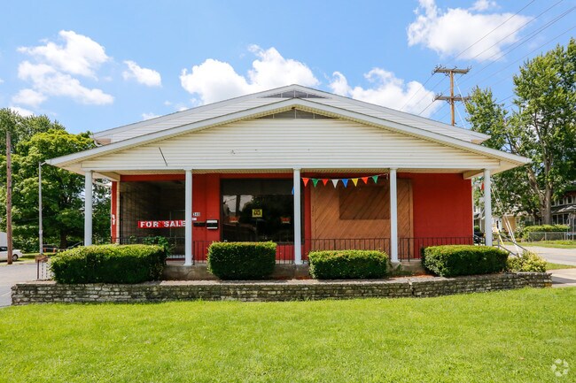
Property Record
340 Nw 5Th St, Richmond, IN 47374
NEARBY LISTINGS FOR SALE OR LEASE
Property Detail
340 Nw 5Th St
Richmond, IN
Levi Peacucks First Addition
89-16-31-440-101.000-030
LOT 11 & 12 LEVI PEACOCK SUB 1ST
Commercialnec
Wayne
X
Indiana
18177C0258E
11-12
0
0.35 AC
2024
Indiana South Area
000800
Other Market Areas
9,610 SF
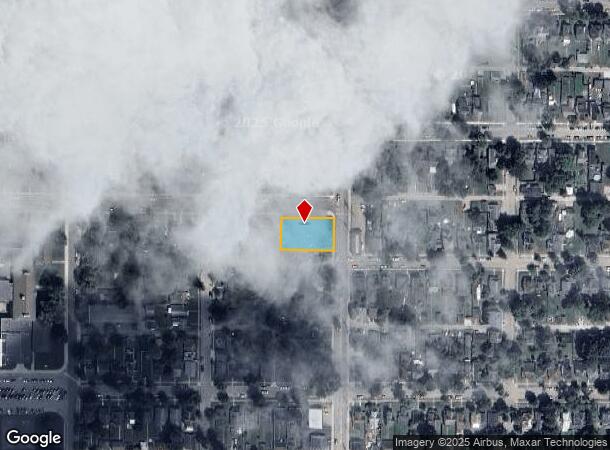
DEMOGRAPHICS near 340 Nw 5Th St
1 Mile
3 Mile
5 Mile
2024 Total Population
10,170
38,226
47,291
2029 Population
10,247
38,427
47,403
Pop Growth 2024-2029
+ 0.76%
+ 0.53%
+ 0.24%
Average Age
39
40
41
2024 Total Households
4,282
16,017
19,876
HH Growth 2024-2029
+ 0.75%
+ 0.51%
+ 0.19%
Median Household Inc
$43,449
$43,833
$46,112
Avg Household Size
2.20
2.20
2.20
2024 Avg HH Vehicles
2.00
2.00
2.00
Median Home Value
$64,135
$100,078
$116,667
Median Year Built
1949
1957
1960
Nearby Places
Map Layers
Map Styles
 Street
 Aerial
- Restaurants
- Banks
- Shops
- Fitness
- Groceries
SALE & LEASE HISTORY
LISTING DATE
SALE/LEASE

May 27, 2025
For Sale
Jul 16, 2018
For Sale
Aug 09, 2018
For Sale
Aug 03, 2017
For Sale
Nearby Properties
Address
Land Use
TOTAL SIZE
Lot Size
Zoning
Address
Land Use
TOTAL SIZE
Lot Size
Zoning
171,768 SF
72.69 AC
ZO01
Address
Land Use
TOTAL SIZE
Lot Size
Zoning
1,744 SF
73.12 AC
Address
Land Use
TOTAL SIZE
Lot Size
Zoning
9,708 SF
9.11 AC
ZO01
Address
Land Use
TOTAL SIZE
Lot Size
Zoning
287,419 SF
50.34 AC
ZO01
Address
Land Use
TOTAL SIZE
Lot Size
Zoning
126,136 SF
28.16 AC
Address
Land Use
TOTAL SIZE
Lot Size
Zoning
6,496 SF
33.80 AC
ZO01
Address
Land Use
TOTAL SIZE
Lot Size
Zoning
562,670 SF
29.97 AC
ZO01
Address
Land Use
TOTAL SIZE
Lot Size
Zoning
2,871 SF
4.05 AC
ZO01
Address
Land Use
TOTAL SIZE
Lot Size
Zoning
249,600 SF
25.31 AC
ZO01
Address
Land Use
TOTAL SIZE
Lot Size
Zoning
158,114 SF
21.58 AC
ZO01
Address
Land Use
TOTAL SIZE
Lot Size
Zoning
102,360 SF
15.03 AC
Address
Land Use
TOTAL SIZE
Lot Size
Zoning
21,048 SF
14.95 AC
ZO01
Address
Land Use
TOTAL SIZE
Lot Size
Zoning
207,981 SF
ZO01
Address
Land Use
TOTAL SIZE
Lot Size
Zoning
114,080 SF
0.78 AC
ZO01
Address
Land Use
TOTAL SIZE
Lot Size
Zoning
13,510 SF
10.75 AC
ZO01
Address
Land Use
TOTAL SIZE
Lot Size
Zoning
8,877 SF
66.35 AC
ZO01
Address
Land Use
TOTAL SIZE
Lot Size
Zoning
175,000 SF
11.16 AC
ZO01
Address
Land Use
TOTAL SIZE
Lot Size
Zoning
82,585 SF
15.91 AC
ZO01
Address
Land Use
TOTAL SIZE
Lot Size
Zoning
504,175 SF
25.07 AC
Address
Land Use
TOTAL SIZE
Lot Size
Zoning
6,144 SF
6.16 AC
ZO01
Address
Land Use
TOTAL SIZE
Lot Size
Zoning
3,264 SF
9.86 AC
ZO01
Address
Land Use
TOTAL SIZE
Lot Size
Zoning
47,041 SF
24.11 AC
ZO01
Address
Land Use
TOTAL SIZE
Lot Size
Zoning
6,077 SF
39.92 AC
ZO01
Address
Land Use
TOTAL SIZE
Lot Size
Zoning
49,444 SF
7.27 AC
ZO01
Address
Land Use
TOTAL SIZE
Lot Size
Zoning
524,920 SF
54.13 AC
ZO01
Address
Land Use
TOTAL SIZE
Lot Size
Zoning
319,888 SF
28.44 AC
Address
Land Use
TOTAL SIZE
Lot Size
Zoning
1,440 SF
38.93 AC
Address
Land Use
TOTAL SIZE
Lot Size
Zoning
69,108 SF
9.30 AC
Address
Land Use
TOTAL SIZE
Lot Size
Zoning
3,680 SF
17.40 AC
ZO01
Address
Land Use
TOTAL SIZE
Lot Size
Zoning
72,710 SF
6.77 AC
ZO01
The World's #1 Commercial Real Estate Marketplace
Connect with us
© 2025 CoStar Group
The information above has been obtained from sources believed reliable. While we do not doubt its accuracy we have not verified it and make no guarantee, warranty or representation about it. It is your responsibility to independently confirm its accuracy and completeness. Any projections, opinions, assumptions, or estimates used are for example only and do not represent the current or future performance of the property. The value of this transaction to you depends on tax and other factors which should be evaluated by your tax, financial, and legal advisors. You and your advisors should conduct a careful, independent investigation of the property to determine to your satisfaction the suitability of the property for your needs.