Property Record
340 S Patterson Dr, Bloomington, IN 47403
NEARBY LISTINGS FOR SALE OR LEASE
Property Detail
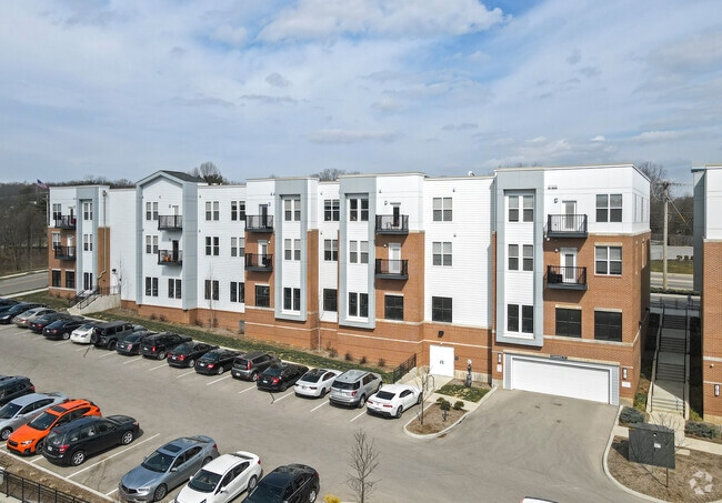
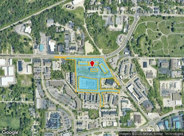
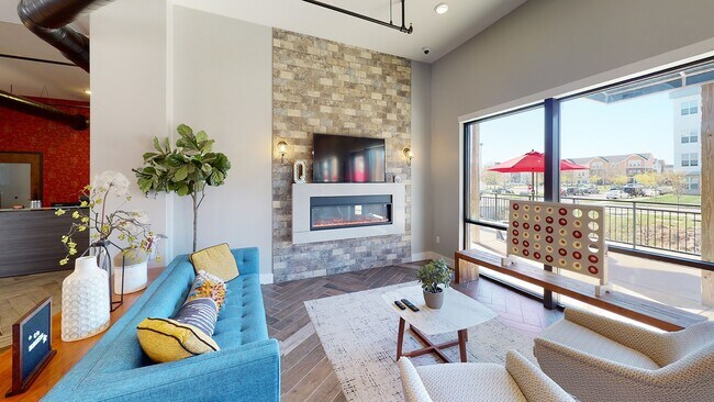
340 S Patterson Dr
Bloomington, IN
Patterson Pointe
53-08-05-202-018.002-009
Monroe
Residentialcommonelementscondominiumcorporation
Indiana
X
4 AC
18105C0141D
Downtown Bloomington IN
21,812 SF
Other Market Areas
DEMOGRAPHICS near 340 S Patterson Dr
1 Mile
3 Mile
5 Mile
2024 Total Population
9,915
73,460
107,628
2029 Population
10,046
73,355
107,249
Pop Growth 2024-2029
+ 1.32%
(0.14%)
(0.35%)
Average Age
34
33
35
2024 Total Households
4,880
30,558
45,406
HH Growth 2024-2029
+ 1.15%
(0.13%)
(0.40%)
Median Household Inc
$36,774
$39,380
$46,642
Avg Household Size
1.90
2.00
2.10
2024 Avg HH Vehicles
1.00
2.00
2.00
Median Home Value
$187,277
$201,614
$243,790
Median Year Built
1987
1984
1987
Nearby Places
Map Layers
Map Styles
 Street
 Aerial
- Restaurants
- Banks
- Shops
- Fitness
- Groceries
SALE & LEASE HISTORY
LISTING DATE
SALE/LEASE

Jul 10, 2017
For Lease
Aug 23, 2021
For Lease
Nearby Properties
Address
Land Use
TOTAL SIZE
Lot Size
Zoning
Address
Land Use
TOTAL SIZE
Lot Size
Zoning
442,250 SF
37.15 AC
Address
Land Use
TOTAL SIZE
Lot Size
Zoning
7,804 SF
7.22 AC
Address
Land Use
TOTAL SIZE
Lot Size
Zoning
496,556 SF
1.73 AC
Address
Land Use
TOTAL SIZE
Lot Size
Zoning
13,910 SF
3.86 AC
Address
Land Use
TOTAL SIZE
Lot Size
Zoning
Address
Land Use
TOTAL SIZE
Lot Size
Zoning
261,278 SF
4.62 AC
Address
Land Use
TOTAL SIZE
Lot Size
Zoning
318,600 SF
43.80 AC
IL
Address
Land Use
TOTAL SIZE
Lot Size
Zoning
10,573 SF
3.28 AC
Address
Land Use
TOTAL SIZE
Lot Size
Zoning
8,064 SF
1.29 AC
Address
Land Use
TOTAL SIZE
Lot Size
Zoning
14,964 SF
12.34 AC
Address
Land Use
TOTAL SIZE
Lot Size
Zoning
35,777 SF
11.68 AC
Address
Land Use
TOTAL SIZE
Lot Size
Zoning
19,128 SF
24.44 AC
Address
Land Use
TOTAL SIZE
Lot Size
Zoning
60,434 SF
29.85 AC
IG
Address
Land Use
TOTAL SIZE
Lot Size
Zoning
169,170 SF
0.72 AC
Address
Land Use
TOTAL SIZE
Lot Size
Zoning
8,190 SF
4.22 AC
Address
Land Use
TOTAL SIZE
Lot Size
Zoning
64,687 SF
9.96 AC
Address
Land Use
TOTAL SIZE
Lot Size
Zoning
134,566 SF
0.60 AC
Address
Land Use
TOTAL SIZE
Lot Size
Zoning
7,500 SF
0.40 AC
Address
Land Use
TOTAL SIZE
Lot Size
Zoning
181,798 SF
0.80 AC
Address
Land Use
TOTAL SIZE
Lot Size
Zoning
32,737 SF
0.93 AC
Address
Land Use
TOTAL SIZE
Lot Size
Zoning
18,772 SF
2.69 AC
Address
Land Use
TOTAL SIZE
Lot Size
Zoning
53,005 SF
10.03 AC
PUD
Address
Land Use
TOTAL SIZE
Lot Size
Zoning
17,312 SF
31.90 AC
Address
Land Use
TOTAL SIZE
Lot Size
Zoning
14,376 SF
11.03 AC
Address
Land Use
TOTAL SIZE
Lot Size
Zoning
576 SF
13 AC
Address
Land Use
TOTAL SIZE
Lot Size
Zoning
38,208 SF
8.03 AC
Address
Land Use
TOTAL SIZE
Lot Size
Zoning
1,986 SF
3.28 AC
Address
Land Use
TOTAL SIZE
Lot Size
Zoning
1,120 SF
11.95 AC
Address
Land Use
TOTAL SIZE
Lot Size
Zoning
64,798 SF
18.32 AC
RE1
Address
Land Use
TOTAL SIZE
Lot Size
Zoning
22,654 SF
5.36 AC
The World's #1 Commercial Real Estate Marketplace
Connect with us
© 2026 CoStar Group
The information above has been obtained from sources believed reliable. While we do not doubt its accuracy we have not verified it and make no guarantee, warranty or representation about it. It is your responsibility to independently confirm its accuracy and completeness. Any projections, opinions, assumptions, or estimates used are for example only and do not represent the current or future performance of the property. The value of this transaction to you depends on tax and other factors which should be evaluated by your tax, financial, and legal advisors. You and your advisors should conduct a careful, independent investigation of the property to determine to your satisfaction the suitability of the property for your needs.