Property Record
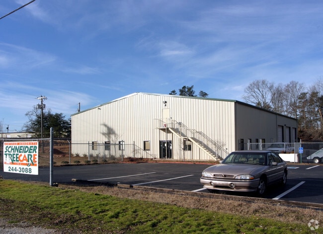
340 Tripp Rd, Marietta, SC 29661


NEARBY LISTINGS FOR SALE OR LEASE
-
-
View all Marietta listings for sale on LoopNet.com
Property Detail
340 Tripp Rd
Greenville-Anderson-Mauldin, SC
Joe Mckinney
0524.03-01-013.00
MAP 0524.03
Agriculturalland
Greenville
X
South Carolina
45045C0200E
013.00
2024
82.90 AC
2024
Rt 29 Rutherford Rd
004101
Greenville/Spartanburg
3,799 SF
DEMOGRAPHICS near 340 Tripp Rd
1 Mile
3 Mile
5 Mile
2024 Total Population
5,989
50,781
131,980
2029 Population
6,546
55,591
144,770
Pop Growth 2024-2029
+ 9.30%
+ 9.47%
+ 9.69%
Average Age
41
40
40
2024 Total Households
2,431
20,534
54,080
HH Growth 2024-2029
+ 9.42%
+ 9.55%
+ 9.84%
Median Household Inc
$62,051
$65,740
$69,782
Avg Household Size
2.40
2.40
2.30
2024 Avg HH Vehicles
2.00
2.00
2.00
Median Home Value
$212,868
$238,123
$265,505
Median Year Built
1980
1979
1983
Nearby Places
Map Layers
Map Styles
 Street
 Aerial
- Restaurants
- Banks
- Shops
- Fitness
- Groceries
PUBLIC TRANSPORTATION
AIRPORT
Greenville Spartanburg International
DRIVE
WALK
Distance
Greenville Spartanburg International
52 min
28.9 mi
Asheville Regional
DRIVE
WALK
Distance
Asheville Regional
49 min
36.4 mi
Freight Ports
North Charleston Terminal
DRIVE
WALK
Distance
North Charleston Terminal
262 min
220.4 mi
Nearby Properties
Address
Land Use
TOTAL SIZE
Lot Size
Zoning
Address
Land Use
TOTAL SIZE
Lot Size
Zoning
822 AC
UNZONED
Address
Land Use
TOTAL SIZE
Lot Size
Zoning
847.64 AC
UNZONED
Address
Land Use
TOTAL SIZE
Lot Size
Zoning
272.60 AC
UNZONED
Address
Land Use
TOTAL SIZE
Lot Size
Zoning
1.10 AC
UNZONED
Address
Land Use
TOTAL SIZE
Lot Size
Zoning
4.29 AC
UNZONED
Address
Land Use
TOTAL SIZE
Lot Size
Zoning
46.90 AC
UNZONED
Address
Land Use
TOTAL SIZE
Lot Size
Zoning
36.30 AC
UNZONED
Address
Land Use
TOTAL SIZE
Lot Size
Zoning
240 SF
1.30 AC
UNZONED
Address
Land Use
TOTAL SIZE
Lot Size
Zoning
1,870 SF
0.50 AC
UNZONED
Address
Land Use
TOTAL SIZE
Lot Size
Zoning
18.50 AC
UNZONED
Address
Land Use
TOTAL SIZE
Lot Size
Zoning
16.30 AC
UNZONED
Address
Land Use
TOTAL SIZE
Lot Size
Zoning
3.83 AC
NZ
Address
Land Use
TOTAL SIZE
Lot Size
Zoning
12.10 AC
UNZONED
Address
Land Use
TOTAL SIZE
Lot Size
Zoning
8.80 AC
UNZONED
Address
Land Use
TOTAL SIZE
Lot Size
Zoning
13.50 AC
UNZONED
Address
Land Use
TOTAL SIZE
Lot Size
Zoning
938 SF
4.21 AC
UNZONED
Address
Land Use
TOTAL SIZE
Lot Size
Zoning
2.10 AC
UNZONED
Address
Land Use
TOTAL SIZE
Lot Size
Zoning
10 AC
UNZONED
Address
Land Use
TOTAL SIZE
Lot Size
Zoning
6.40 AC
UNZONED
Address
Land Use
TOTAL SIZE
Lot Size
Zoning
1,974 SF
0.70 AC
UNZONED
Address
Land Use
TOTAL SIZE
Lot Size
Zoning
1.43 AC
UNZONED
Address
Land Use
TOTAL SIZE
Lot Size
Zoning
5.30 AC
UNZONED
Address
Land Use
TOTAL SIZE
Lot Size
Zoning
2.99 AC
UNZONED
Address
Land Use
TOTAL SIZE
Lot Size
Zoning
5 AC
UNZONED
Address
Land Use
TOTAL SIZE
Lot Size
Zoning
5 AC
UNZONED
Address
Land Use
TOTAL SIZE
Lot Size
Zoning
9.30 AC
UNZONED
Address
Land Use
TOTAL SIZE
Lot Size
Zoning
2 AC
UNZONED
Address
Land Use
TOTAL SIZE
Lot Size
Zoning
2.01 AC
UNZONED
Address
Land Use
TOTAL SIZE
Lot Size
Zoning
2.80 AC
UNZONED
Address
Land Use
TOTAL SIZE
Lot Size
Zoning
984 SF
2.60 AC
UNZONED
The World's #1 Commercial Real Estate Marketplace
Connect with us
© 2025 CoStar Group
The information above has been obtained from sources believed reliable. While we do not doubt its accuracy we have not verified it and make no guarantee, warranty or representation about it. It is your responsibility to independently confirm its accuracy and completeness. Any projections, opinions, assumptions, or estimates used are for example only and do not represent the current or future performance of the property. The value of this transaction to you depends on tax and other factors which should be evaluated by your tax, financial, and legal advisors. You and your advisors should conduct a careful, independent investigation of the property to determine to your satisfaction the suitability of the property for your needs.