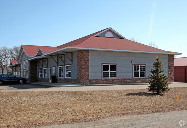
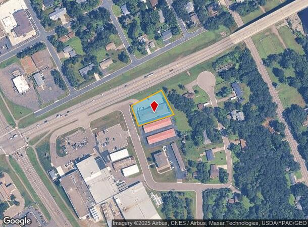
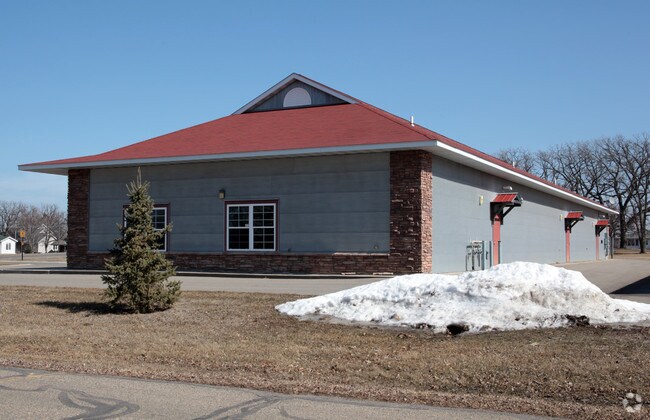
Property Record
340 Walnut St S, Clearwater, MN 55320
NEARBY LISTINGS FOR SALE OR LEASE
Property Detail
340 Walnut St S
Minneapolis/St Paul
Clearwater Heights
Minneapolis-St. Paul-Bloomington, MN-WI
SECT-35 TWP-123 RANGE-027 CLEARWATER HEIGHTS LOT-002 BLOCK-002 LTS 1&2 BLK2 EX TR DES IN DOC1236666(002021 02 LTS 1&2 BLK2 EX
104-011-002020
Wright
Stripcommercialcenter
Minnesota
2025
1-2
2025
0.58 AC
100300
Wright County
6,816 SF
DEMOGRAPHICS near 340 Walnut St S
1 Mile
3 Mile
5 Mile
2024 Total Population
1,942
4,072
7,778
2029 Population
2,163
4,501
8,570
Pop Growth 2024-2029
+ 11.38%
+ 10.54%
+ 10.18%
Average Age
38
39
41
2024 Total Households
794
1,619
3,009
HH Growth 2024-2029
+ 11.46%
+ 10.62%
+ 10.20%
Median Household Inc
$83,403
$86,514
$90,429
Avg Household Size
2.40
2.50
2.60
2024 Avg HH Vehicles
2.00
2.00
2.00
Median Home Value
$243,045
$262,686
$291,218
Median Year Built
1994
1993
1991
Nearby Places
Map Layers
Map Styles
 Street
 Aerial
- Restaurants
- Banks
- Shops
- Fitness
- Groceries
Nearby Properties
Address
Land Use
TOTAL SIZE
Lot Size
Zoning
Address
Land Use
TOTAL SIZE
Lot Size
Zoning
88,540 SF
51.21 AC
A
Address
Land Use
TOTAL SIZE
Lot Size
Zoning
69,751 SF
4.61 AC
Address
Land Use
TOTAL SIZE
Lot Size
Zoning
38,844 SF
4.37 AC
Address
Land Use
TOTAL SIZE
Lot Size
Zoning
13,700 SF
46.75 AC
Address
Land Use
TOTAL SIZE
Lot Size
Zoning
Address
Land Use
TOTAL SIZE
Lot Size
Zoning
57,634 SF
6.78 AC
Address
Land Use
TOTAL SIZE
Lot Size
Zoning
33,688 SF
15.83 AC
Address
Land Use
TOTAL SIZE
Lot Size
Zoning
12.55 AC
Address
Land Use
TOTAL SIZE
Lot Size
Zoning
10,933 SF
49.57 AC
Address
Land Use
TOTAL SIZE
Lot Size
Zoning
Address
Land Use
TOTAL SIZE
Lot Size
Zoning
Address
Land Use
TOTAL SIZE
Lot Size
Zoning
Address
Land Use
TOTAL SIZE
Lot Size
Zoning
Address
Land Use
TOTAL SIZE
Lot Size
Zoning
1,498 SF
2.70 AC
Address
Land Use
TOTAL SIZE
Lot Size
Zoning
2,532 SF
101.62 AC
R
Address
Land Use
TOTAL SIZE
Lot Size
Zoning
12,400 SF
4.61 AC
Address
Land Use
TOTAL SIZE
Lot Size
Zoning
52,140 SF
4.08 AC
Address
Land Use
TOTAL SIZE
Lot Size
Zoning
3,294 SF
24.94 AC
Address
Land Use
TOTAL SIZE
Lot Size
Zoning
12,459 SF
8.12 AC
Address
Land Use
TOTAL SIZE
Lot Size
Zoning
23,112 SF
1.81 AC
Address
Land Use
TOTAL SIZE
Lot Size
Zoning
25,920 SF
7.06 AC
PL20B1
Address
Land Use
TOTAL SIZE
Lot Size
Zoning
28,533 SF
5 AC
Address
Land Use
TOTAL SIZE
Lot Size
Zoning
Address
Land Use
TOTAL SIZE
Lot Size
Zoning
7,118 SF
9 AC
Address
Land Use
TOTAL SIZE
Lot Size
Zoning
10,432 SF
1.15 AC
Address
Land Use
TOTAL SIZE
Lot Size
Zoning
28,432 SF
2.69 AC
Address
Land Use
TOTAL SIZE
Lot Size
Zoning
19,020 SF
1.81 AC
The World's #1 Commercial Real Estate Marketplace
Connect with us
© 2025 CoStar Group
The information above has been obtained from sources believed reliable. While we do not doubt its accuracy we have not verified it and make no guarantee, warranty or representation about it. It is your responsibility to independently confirm its accuracy and completeness. Any projections, opinions, assumptions, or estimates used are for example only and do not represent the current or future performance of the property. The value of this transaction to you depends on tax and other factors which should be evaluated by your tax, financial, and legal advisors. You and your advisors should conduct a careful, independent investigation of the property to determine to your satisfaction the suitability of the property for your needs.