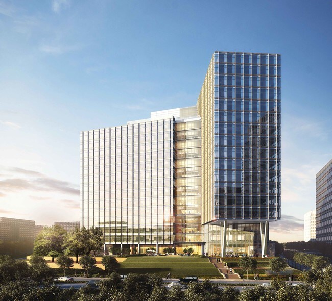
Property Record
3400 Blackburn St, Dallas, TX 75219

NEARBY LISTINGS FOR SALE OR LEASE
Property Detail
3400 Blackburn St
00000139402000000
BLK 1035 LOT 5 ACS 1.854 INT201500297160 DD11052015 CO-DC 1035 000 00500 1DA1035 000
Governmentalpublicusegeneral
Dallas
AE
Texas
48113C0345J
5
2024
2.64 AC
2025
Uptown/Turtle Creek
000605
Dallas/Ft Worth
12,300 SF
Dallas-Fort Worth-Arlington, TX
DEMOGRAPHICS near 3400 Blackburn St
1 Mile
3 Mile
5 Mile
2024 Total Population
44,553
203,913
392,756
2029 Population
44,870
207,304
396,889
Pop Growth 2024-2029
+ 0.71%
+ 1.66%
+ 1.05%
Average Age
37
37
37
2024 Total Households
29,606
111,646
188,422
HH Growth 2024-2029
+ 0.53%
+ 1.67%
+ 1.14%
Median Household Inc
$94,771
$79,797
$73,074
Avg Household Size
1.50
1.70
2.00
2024 Avg HH Vehicles
1.00
1.00
2.00
Median Home Value
$448,791
$480,232
$480,065
Median Year Built
2002
2001
1992
Nearby Places
Map Layers
Map Styles
 Street
 Aerial
- Restaurants
- Banks
- Shops
- Fitness
- Groceries
PUBLIC TRANSPORTATION
TRANSIT/SUBWAY
Cole And Blackburn (McKinney Avenue Streetcar - Dallas Area Rapid Transit (DART))
DRIVE
WALK
Distance
Cole And Blackburn (McKinney Avenue Streetcar - Dallas Area Rapid Transit (DART))
2 min
8 min
0.5 mi
Cole And Lemmon East (McKinney Avenue Streetcar - Dallas Area Rapid Transit (DART))
DRIVE
WALK
Distance
Cole And Lemmon East (McKinney Avenue Streetcar - Dallas Area Rapid Transit (DART))
1 min
9 min
0.5 mi
Mckinney And Blackburn (McKinney Avenue Streetcar - Dallas Area Rapid Transit (DART))
DRIVE
WALK
Distance
Mckinney And Blackburn (McKinney Avenue Streetcar - Dallas Area Rapid Transit (DART))
2 min
9 min
0.5 mi
Cole And Lemmon (McKinney Avenue Streetcar - Dallas Area Rapid Transit (DART))
DRIVE
WALK
Distance
Cole And Lemmon (McKinney Avenue Streetcar - Dallas Area Rapid Transit (DART))
2 min
9 min
0.5 mi
Mckinney And Lemmon West (McKinney Avenue Streetcar - Dallas Area Rapid Transit (DART))
DRIVE
WALK
Distance
Mckinney And Lemmon West (McKinney Avenue Streetcar - Dallas Area Rapid Transit (DART))
2 min
10 min
0.6 mi
COMMUTER RAIL
Victory Station (DART LIGHT RAIL - GREEN LINE - Dallas Area Rapid Transit (DART), DART LIGHT RAIL - ORANGE LINE - Dallas Area Rapid Transit (DART), TRINITY RAILWAY - Dallas Area Rapid Transit (DART))
DRIVE
WALK
Distance
Victory Station (DART LIGHT RAIL - GREEN LINE - Dallas Area Rapid Transit (DART), DART LIGHT RAIL - ORANGE LINE - Dallas Area Rapid Transit (DART), TRINITY RAILWAY - Dallas Area Rapid Transit (DART))
7 min
3.2 mi
Medical/Market Ctr Station (TRINITY RAILWAY - Dallas Area Rapid Transit (DART))
DRIVE
WALK
Distance
Medical/Market Ctr Station (TRINITY RAILWAY - Dallas Area Rapid Transit (DART))
7 min
3.2 mi
AIRPORT
Dallas Love Field
DRIVE
WALK
Distance
Dallas Love Field
11 min
4.4 mi
Dallas-Fort Worth International
DRIVE
WALK
Distance
Dallas-Fort Worth International
28 min
20.2 mi
Freight Ports
Port of Shreveport
DRIVE
WALK
Distance
Port of Shreveport
215 min
198.1 mi
SALE & LEASE HISTORY
LISTING DATE
SALE/LEASE

May 19, 2020
For Lease
May 02, 2017
For Lease
Nearby Properties
Address
Land Use
TOTAL SIZE
Lot Size
Zoning
Address
Land Use
TOTAL SIZE
Lot Size
Zoning
2,658,374 SF
37.70 AC
Z116
Address
Land Use
TOTAL SIZE
Lot Size
Zoning
1,634,356 SF
92.90 AC
Z421
Address
Land Use
TOTAL SIZE
Lot Size
Zoning
2,271,924 SF
Address
Land Use
TOTAL SIZE
Lot Size
Zoning
3,713,071 SF
9.94 AC
Address
Land Use
TOTAL SIZE
Lot Size
Zoning
815,000 SF
7.20 AC
Z239
Address
Land Use
TOTAL SIZE
Lot Size
Zoning
1,676,176 SF
2.18 AC
Z239
Address
Land Use
TOTAL SIZE
Lot Size
Zoning
906,730 SF
3.09 AC
Z239
Address
Land Use
TOTAL SIZE
Lot Size
Zoning
858,872 SF
23.90 AC
Z421
Address
Land Use
TOTAL SIZE
Lot Size
Zoning
1,003,498 SF
22.15 AC
Z116
Address
Land Use
TOTAL SIZE
Lot Size
Zoning
1,308,710 SF
8.42 AC
Z21
Address
Land Use
TOTAL SIZE
Lot Size
Zoning
299,170 SF
9.71 AC
Z97
Address
Land Use
TOTAL SIZE
Lot Size
Zoning
731,849 SF
3.13 AC
Z239
Address
Land Use
TOTAL SIZE
Lot Size
Zoning
1,896,570 SF
18.08 AC
Z151
Address
Land Use
TOTAL SIZE
Lot Size
Zoning
1,480,246 SF
1.86 AC
Z21
Address
Land Use
TOTAL SIZE
Lot Size
Zoning
1,291,660 SF
2.56 AC
Z248
Address
Land Use
TOTAL SIZE
Lot Size
Zoning
1,026,046 SF
2.89 AC
Z248
Address
Land Use
TOTAL SIZE
Lot Size
Zoning
864,909 SF
3.02 AC
Z248
Address
Land Use
TOTAL SIZE
Lot Size
Zoning
504,533 SF
9.95 AC
Z151
Address
Land Use
TOTAL SIZE
Lot Size
Zoning
1,001,504 SF
3.37 AC
Z151
Address
Land Use
TOTAL SIZE
Lot Size
Zoning
1,424,070 SF
1.36 AC
Z21
Address
Land Use
TOTAL SIZE
Lot Size
Zoning
1,228,418 SF
24.51 AC
Z151
Address
Land Use
TOTAL SIZE
Lot Size
Zoning
724,979 SF
1.05 AC
Z239
Address
Land Use
TOTAL SIZE
Lot Size
Zoning
893,159 SF
1.17 AC
Z21
Address
Land Use
TOTAL SIZE
Lot Size
Zoning
100 SF
27.05 AC
Z421
Address
Land Use
TOTAL SIZE
Lot Size
Zoning
1,980,000 SF
2.57 AC
Z21
Address
Land Use
TOTAL SIZE
Lot Size
Zoning
857,292 SF
1.47 AC
Z239
Address
Land Use
TOTAL SIZE
Lot Size
Zoning
602,716 SF
11.21 AC
Z239
Address
Land Use
TOTAL SIZE
Lot Size
Zoning
763,198 SF
3.01 AC
Z248
Address
Land Use
TOTAL SIZE
Lot Size
Zoning
638,046 SF
2.11 AC
Z239
Address
Land Use
TOTAL SIZE
Lot Size
Zoning
486,300 SF
1.55 AC
Z239
The World's #1 Commercial Real Estate Marketplace
Connect with us
© 2025 CoStar Group
The information above has been obtained from sources believed reliable. While we do not doubt its accuracy we have not verified it and make no guarantee, warranty or representation about it. It is your responsibility to independently confirm its accuracy and completeness. Any projections, opinions, assumptions, or estimates used are for example only and do not represent the current or future performance of the property. The value of this transaction to you depends on tax and other factors which should be evaluated by your tax, financial, and legal advisors. You and your advisors should conduct a careful, independent investigation of the property to determine to your satisfaction the suitability of the property for your needs.