Property Record
3400 Coventry Commons Dr, Louisville, KY 40216

NEARBY LISTINGS FOR SALE OR LEASE
-
-
View all Louisville listings for sale on LoopNet.com
Property Detail
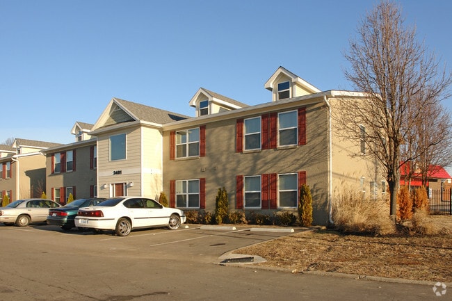
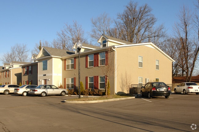
3400 Coventry Commons Dr
Louisville-Jefferson County, KY-IN
Cane Run Rd Coventry Arms Apts
101300250000
2.88 AC CANE RUN RD COVENTRY ARMS APTS
Specialpurpose
Jefferson
X
Kentucky
21111C0054F
2.88 AC
2025
St Dennis
2025
Louisville
012701
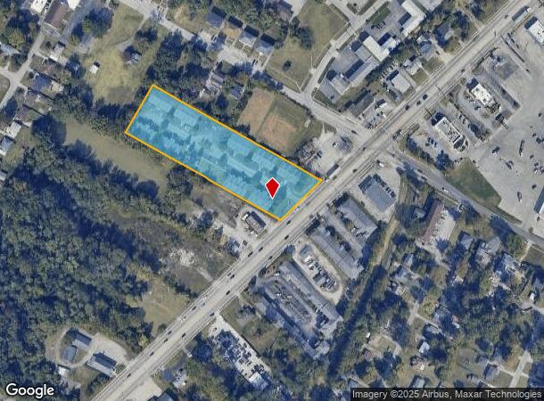
DEMOGRAPHICS near 3400 Coventry Commons Dr
1 Mile
3 Mile
5 Mile
2024 Total Population
9,464
58,243
179,036
2029 Population
9,362
57,644
178,055
Pop Growth 2024-2029
(1.08%)
(1.03%)
(0.55%)
Average Age
39
39
38
2024 Total Households
3,897
23,853
71,889
HH Growth 2024-2029
(1.08%)
(1.07%)
(0.58%)
Median Household Inc
$45,757
$44,125
$42,147
Avg Household Size
2.40
2.40
2.40
2024 Avg HH Vehicles
2.00
2.00
2.00
Median Home Value
$160,465
$154,807
$141,452
Median Year Built
1966
1964
1957
Nearby Places
Map Layers
Map Styles
 Street
 Aerial
- Restaurants
- Banks
- Shops
- Fitness
- Groceries
PUBLIC TRANSPORTATION
AIRPORT
Louisville Muhammad Ali International
DRIVE
WALK
Distance
Louisville Muhammad Ali International
15 min
8.3 mi
Freight Ports
Port of Toledo
DRIVE
WALK
Distance
Port of Toledo
365 min
312.4 mi
Nearby Properties
Address
Land Use
TOTAL SIZE
Lot Size
Zoning
Address
Land Use
TOTAL SIZE
Lot Size
Zoning
194,084 SF
24.87 AC
EZ1-ENTERP
Address
Land Use
TOTAL SIZE
Lot Size
Zoning
241,462 SF
25.28 AC
EZ1-ENTERP
Address
Land Use
TOTAL SIZE
Lot Size
Zoning
16.31 AC
OR1-OFFICE
Address
Land Use
TOTAL SIZE
Lot Size
Zoning
24.92 AC
EZ1-ENTERP
Address
Land Use
TOTAL SIZE
Lot Size
Zoning
26.79 AC
R4-RESIDEN
Address
Land Use
TOTAL SIZE
Lot Size
Zoning
427,337 SF
50.32 AC
EZ1-ENTERP
Address
Land Use
TOTAL SIZE
Lot Size
Zoning
Address
Land Use
TOTAL SIZE
Lot Size
Zoning
38.34 AC
Address
Land Use
TOTAL SIZE
Lot Size
Zoning
270 SF
121 AC
M3-INDUSTR
Address
Land Use
TOTAL SIZE
Lot Size
Zoning
164,677 SF
13.54 AC
EZ1-ENTERP
Address
Land Use
TOTAL SIZE
Lot Size
Zoning
325,600 SF
17.15 AC
EZ1-ENTERP
Address
Land Use
TOTAL SIZE
Lot Size
Zoning
139,200 SF
29.50 AC
EZ1-ENTERP
Address
Land Use
TOTAL SIZE
Lot Size
Zoning
29.54 AC
R5-RESIDEN
Address
Land Use
TOTAL SIZE
Lot Size
Zoning
19,032 SF
5.88 AC
C1-COMMERC
Address
Land Use
TOTAL SIZE
Lot Size
Zoning
4,250 SF
2.83 AC
OR1-OFFICE
Address
Land Use
TOTAL SIZE
Lot Size
Zoning
220,844 SF
29.19 AC
C2-COMMERC
Address
Land Use
TOTAL SIZE
Lot Size
Zoning
9.95 AC
Address
Land Use
TOTAL SIZE
Lot Size
Zoning
21.36 AC
Address
Land Use
TOTAL SIZE
Lot Size
Zoning
259,570 SF
20.38 AC
EZ1-ENTERP
Address
Land Use
TOTAL SIZE
Lot Size
Zoning
2,352 SF
2.42 AC
C2-COMMERC
Address
Land Use
TOTAL SIZE
Lot Size
Zoning
15,928 SF
13.67 AC
R4-RESIDEN
Address
Land Use
TOTAL SIZE
Lot Size
Zoning
Address
Land Use
TOTAL SIZE
Lot Size
Zoning
19,000 SF
12.86 AC
EZ1-ENTERP
Address
Land Use
TOTAL SIZE
Lot Size
Zoning
5,720 SF
93.67 AC
EZ1-ENTERP
Address
Land Use
TOTAL SIZE
Lot Size
Zoning
19,375 SF
10.11 AC
C1-COMMERC
Address
Land Use
TOTAL SIZE
Lot Size
Zoning
121,509 SF
4.48 AC
Address
Land Use
TOTAL SIZE
Lot Size
Zoning
20,258 SF
60.94 AC
M3-INDUSTR
Address
Land Use
TOTAL SIZE
Lot Size
Zoning
91,913 SF
2.46 AC
C2-COMMERC
Address
Land Use
TOTAL SIZE
Lot Size
Zoning
170,619 SF
6.35 AC
R7-RESIDEN
Address
Land Use
TOTAL SIZE
Lot Size
Zoning
6,132 SF
10.17 AC
R7-RESIDEN
The World's #1 Commercial Real Estate Marketplace
Connect with us
© 2025 CoStar Group
The information above has been obtained from sources believed reliable. While we do not doubt its accuracy we have not verified it and make no guarantee, warranty or representation about it. It is your responsibility to independently confirm its accuracy and completeness. Any projections, opinions, assumptions, or estimates used are for example only and do not represent the current or future performance of the property. The value of this transaction to you depends on tax and other factors which should be evaluated by your tax, financial, and legal advisors. You and your advisors should conduct a careful, independent investigation of the property to determine to your satisfaction the suitability of the property for your needs.