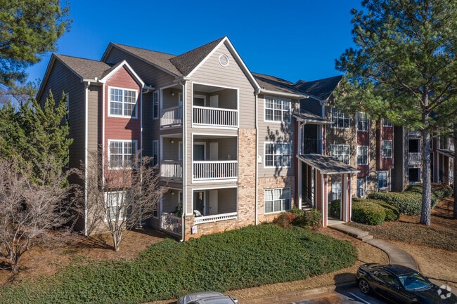
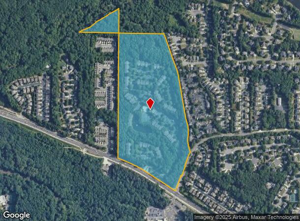
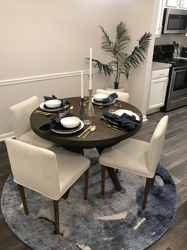
Property Record
3400 Kimball Bridge Rd, Alpharetta, GA 30022

NEARBY LISTINGS FOR SALE OR LEASE
Property Detail
3400 Kimball Bridge Rd
Apartment
Fulton
AE
Georgia
13121C0067F
37.86 AC
2024
Hampton Hall
2025
Atlanta
011443
Atlanta-Sandy Springs-Roswell, GA
2,480,205 SF
12-3130-0905-279-8
DEMOGRAPHICS near 3400 Kimball Bridge Rd
1 Mile
3 Mile
5 Mile
2024 Total Population
8,409
69,910
201,439
2029 Population
8,563
71,271
207,109
Pop Growth 2024-2029
+ 1.83%
+ 1.95%
+ 2.81%
Average Age
39
40
39
2024 Total Households
2,971
26,134
74,793
HH Growth 2024-2029
+ 1.92%
+ 2.19%
+ 2.95%
Median Household Inc
$173,818
$131,502
$124,526
Avg Household Size
2.70
2.60
2.60
2024 Avg HH Vehicles
2.00
2.00
2.00
Median Home Value
$621,941
$512,413
$474,724
Median Year Built
1996
1993
1993
Nearby Places
Map Layers
Map Styles
 Street
 Aerial
- Restaurants
- Banks
- Shops
- Fitness
- Groceries
PUBLIC TRANSPORTATION
AIRPORT
Hartsfield - Jackson Atlanta International
DRIVE
WALK
Distance
Hartsfield - Jackson Atlanta International
51 min
35.5 mi
Freight Ports
Georgia Ports - Savannah
DRIVE
WALK
Distance
Georgia Ports - Savannah
314 min
274.8 mi
Nearby Properties
Address
Land Use
TOTAL SIZE
Lot Size
Zoning
Address
Land Use
TOTAL SIZE
Lot Size
Zoning
1,080,765 SF
36.65 AC
MIX
Address
Land Use
TOTAL SIZE
Lot Size
Zoning
14,832,179 SF
50.89 AC
OI
Address
Land Use
TOTAL SIZE
Lot Size
Zoning
699,024 SF
6.79 AC
MIX
Address
Land Use
TOTAL SIZE
Lot Size
Zoning
4,705,880 SF
8.55 AC
OI
Address
Land Use
TOTAL SIZE
Lot Size
Zoning
415,701 SF
6.75 AC
OI
Address
Land Use
TOTAL SIZE
Lot Size
Zoning
330,549 SF
68.46 AC
CUP
Address
Land Use
TOTAL SIZE
Lot Size
Zoning
434,804 SF
4.96 AC
Address
Land Use
TOTAL SIZE
Lot Size
Zoning
3,617,271 SF
29 AC
CUP
Address
Land Use
TOTAL SIZE
Lot Size
Zoning
604,953 SF
3.30 AC
MIX
Address
Land Use
TOTAL SIZE
Lot Size
Zoning
241,349 SF
35 AC
OI
Address
Land Use
TOTAL SIZE
Lot Size
Zoning
1,159,560 SF
7.12 AC
CUP
Address
Land Use
TOTAL SIZE
Lot Size
Zoning
1,297,776 SF
34.75 AC
CUP
Address
Land Use
TOTAL SIZE
Lot Size
Zoning
303,485 SF
1.44 AC
C2
Address
Land Use
TOTAL SIZE
Lot Size
Zoning
666,599 SF
24.20 AC
PSC
Address
Land Use
TOTAL SIZE
Lot Size
Zoning
237,995 SF
23 AC
TRC
Address
Land Use
TOTAL SIZE
Lot Size
Zoning
247,639 SF
0.68 AC
MIX
Address
Land Use
TOTAL SIZE
Lot Size
Zoning
761,850 SF
4.77 AC
OI
Address
Land Use
TOTAL SIZE
Lot Size
Zoning
2,045,850 SF
21.23 AC
CUP
Address
Land Use
TOTAL SIZE
Lot Size
Zoning
308,494 SF
2.64 AC
OI
Address
Land Use
TOTAL SIZE
Lot Size
Zoning
1,854,951 SF
33.30 AC
CUP
Address
Land Use
TOTAL SIZE
Lot Size
Zoning
367,876 SF
41.40 AC
PSC
Address
Land Use
TOTAL SIZE
Lot Size
Zoning
2,101,414 SF
11 AC
CUP
Address
Land Use
TOTAL SIZE
Lot Size
Zoning
588,244 SF
11.80 AC
R4
Address
Land Use
TOTAL SIZE
Lot Size
Zoning
253,296 SF
1.34 AC
MIX
Address
Land Use
TOTAL SIZE
Lot Size
Zoning
1,351,350 SF
19.20 AC
OICON
Address
Land Use
TOTAL SIZE
Lot Size
Zoning
396,000 SF
43.42 AC
C1
Address
Land Use
TOTAL SIZE
Lot Size
Zoning
216,794 SF
6.66 AC
OI
Address
Land Use
TOTAL SIZE
Lot Size
Zoning
286,394 SF
39.10 AC
R1
Address
Land Use
TOTAL SIZE
Lot Size
Zoning
1,747,896 SF
36.51 AC
C1C
The World's #1 Commercial Real Estate Marketplace
Connect with us
© 2026 CoStar Group
The information above has been obtained from sources believed reliable. While we do not doubt its accuracy we have not verified it and make no guarantee, warranty or representation about it. It is your responsibility to independently confirm its accuracy and completeness. Any projections, opinions, assumptions, or estimates used are for example only and do not represent the current or future performance of the property. The value of this transaction to you depends on tax and other factors which should be evaluated by your tax, financial, and legal advisors. You and your advisors should conduct a careful, independent investigation of the property to determine to your satisfaction the suitability of the property for your needs.