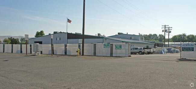
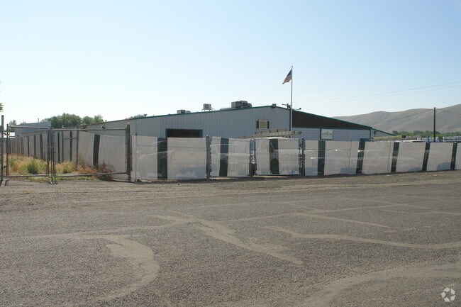
Property Record
3400 Tacoma St, Union Gap, WA 98903

NEARBY LISTINGS FOR SALE OR LEASE
Property Detail
3400 Tacoma St
Yakima, WA
Sp 82-161
191205-34454
SP 82-161: LOT 1 EX N 40 FT OF W 115 FT
Lightindustrial
Yakima
X
Washington
53077C1061F
1
2025
2.03 AC
2025
Union Gap
001400
Yakima
28,197 SF
DEMOGRAPHICS near 3400 Tacoma St
1 Mile
3 Mile
5 Mile
2024 Total Population
3,071
22,921
85,585
2029 Population
3,061
22,941
85,777
Pop Growth 2024-2029
(0.33%)
+ 0.09%
+ 0.22%
Average Age
35
34
35
2024 Total Households
1,012
7,440
29,249
HH Growth 2024-2029
(0.49%)
0.00%
+ 0.17%
Median Household Inc
$55,425
$46,505
$52,440
Avg Household Size
3.00
3.00
2.80
2024 Avg HH Vehicles
2.00
2.00
2.00
Median Home Value
$195,258
$163,393
$222,500
Median Year Built
1969
1970
1968
Nearby Places
Map Layers
Map Styles
 Street
 Aerial
- Restaurants
- Banks
- Shops
- Fitness
- Groceries
PUBLIC TRANSPORTATION
AIRPORT
Yakima Air Trml/McAllister Field
DRIVE
WALK
Distance
Yakima Air Trml/McAllister Field
10 min
4.2 mi
Nearby Properties
Address
Land Use
TOTAL SIZE
Lot Size
Zoning
Address
Land Use
TOTAL SIZE
Lot Size
Zoning
208,322 SF
3.69 AC
PUB
Address
Land Use
TOTAL SIZE
Lot Size
Zoning
106,878 SF
3.46 AC
RD
Address
Land Use
TOTAL SIZE
Lot Size
Zoning
82,436 SF
11 AC
RD
Address
Land Use
TOTAL SIZE
Lot Size
Zoning
345,698 SF
3.52 AC
C1
Address
Land Use
TOTAL SIZE
Lot Size
Zoning
100,992 SF
9.15 AC
RD
Address
Land Use
TOTAL SIZE
Lot Size
Zoning
91,856 SF
9.17 AC
RD
Address
Land Use
TOTAL SIZE
Lot Size
Zoning
64,171 SF
48.08 AC
PUB
Address
Land Use
TOTAL SIZE
Lot Size
Zoning
135,634 SF
9.84 AC
C1
Address
Land Use
TOTAL SIZE
Lot Size
Zoning
325,959 SF
11.95 AC
M2
Address
Land Use
TOTAL SIZE
Lot Size
Zoning
80,374 SF
8.99 AC
C1
Address
Land Use
TOTAL SIZE
Lot Size
Zoning
114,406 SF
15.50 AC
PUB
Address
Land Use
TOTAL SIZE
Lot Size
Zoning
151,831 SF
21.08 AC
M1
Address
Land Use
TOTAL SIZE
Lot Size
Zoning
43,687 SF
3.33 AC
C1
Address
Land Use
TOTAL SIZE
Lot Size
Zoning
195,753 SF
11.66 AC
M1
Address
Land Use
TOTAL SIZE
Lot Size
Zoning
82,422 SF
4.58 AC
C1
Address
Land Use
TOTAL SIZE
Lot Size
Zoning
38,498 SF
7 AC
C1
Address
Land Use
TOTAL SIZE
Lot Size
Zoning
69.87 AC
SR
Address
Land Use
TOTAL SIZE
Lot Size
Zoning
123,690 SF
12.02 AC
M1
Address
Land Use
TOTAL SIZE
Lot Size
Zoning
204,600 SF
12.54 AC
B2
Address
Land Use
TOTAL SIZE
Lot Size
Zoning
9,121 SF
0.22 AC
C1
Address
Land Use
TOTAL SIZE
Lot Size
Zoning
34,271 SF
5.87 AC
B2
Address
Land Use
TOTAL SIZE
Lot Size
Zoning
138,550 SF
10.20 AC
M1
Address
Land Use
TOTAL SIZE
Lot Size
Zoning
110,526 SF
9.70 AC
C1
Address
Land Use
TOTAL SIZE
Lot Size
Zoning
264,269 SF
10.49 AC
B2
Address
Land Use
TOTAL SIZE
Lot Size
Zoning
125,789 SF
7.15 AC
C1
Address
Land Use
TOTAL SIZE
Lot Size
Zoning
231,397 SF
4.76 AC
M1
Address
Land Use
TOTAL SIZE
Lot Size
Zoning
117,973 SF
12.70 AC
C1
Address
Land Use
TOTAL SIZE
Lot Size
Zoning
67,192 SF
9.70 AC
B2
Address
Land Use
TOTAL SIZE
Lot Size
Zoning
55,300 SF
5.78 AC
M1
Address
Land Use
TOTAL SIZE
Lot Size
Zoning
68,647 SF
7.10 AC
R2
The World's #1 Commercial Real Estate Marketplace
Connect with us
© 2026 CoStar Group
The information above has been obtained from sources believed reliable. While we do not doubt its accuracy we have not verified it and make no guarantee, warranty or representation about it. It is your responsibility to independently confirm its accuracy and completeness. Any projections, opinions, assumptions, or estimates used are for example only and do not represent the current or future performance of the property. The value of this transaction to you depends on tax and other factors which should be evaluated by your tax, financial, and legal advisors. You and your advisors should conduct a careful, independent investigation of the property to determine to your satisfaction the suitability of the property for your needs.