Property Record
3401 Guion Rd, Indianapolis, IN 46222


NEARBY LISTINGS FOR SALE OR LEASE
-
-
View all Indianapolis listings for sale on LoopNet.com
Property Detail
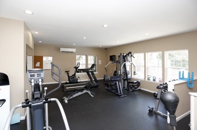
3401 Guion Rd
Indianapolis
Na
Indianapolis-Carmel-Anderson, IN
PT SE1/4 NE1/4 S20 T16 R3 BEG SE COR., W 1162.5,NW 388.1, N 559.3, E 1336.5, S 893.6 TO BEG.26.985AC
49-06-20-116-001.000-901
Marion
Apartment
Indiana
2023
3
2024
26.99 AC
340600
Eagledale
4,944 SF
DEMOGRAPHICS near 3401 Guion Rd
1 Mile
3 Mile
5 Mile
2024 Total Population
11,490
93,069
275,542
2029 Population
11,354
92,492
274,385
Pop Growth 2024-2029
(1.18%)
(0.62%)
(0.42%)
Average Age
34
35
36
2024 Total Households
4,120
35,829
114,240
HH Growth 2024-2029
(1.38%)
(0.62%)
(0.37%)
Median Household Inc
$52,081
$51,037
$55,309
Avg Household Size
2.50
2.50
2.30
2024 Avg HH Vehicles
2.00
2.00
2.00
Median Home Value
$170,157
$145,149
$179,361
Median Year Built
1967
1965
1968
Nearby Places
Map Layers
Map Styles
 Street
 Aerial
- Restaurants
- Banks
- Shops
- Fitness
- Groceries
PUBLIC TRANSPORTATION
COMMUTER RAIL
Indianapolis (Cardinal - Amtrak)
DRIVE
WALK
Distance
Indianapolis (Cardinal - Amtrak)
12 min
6.2 mi
AIRPORT
Indianapolis International
DRIVE
WALK
Distance
Indianapolis International
28 min
14.8 mi
Freight Ports
Port of Toledo
DRIVE
WALK
Distance
Port of Toledo
270 min
225.4 mi
Nearby Properties
Address
Land Use
TOTAL SIZE
Lot Size
Zoning
Address
Land Use
TOTAL SIZE
Lot Size
Zoning
80,249 SF
71.96 AC
ZO01
Address
Land Use
TOTAL SIZE
Lot Size
Zoning
5,820 SF
32.03 AC
ZO01
Address
Land Use
TOTAL SIZE
Lot Size
Zoning
967,690 SF
59.63 AC
ZO01
Address
Land Use
TOTAL SIZE
Lot Size
Zoning
415,877 SF
55.83 AC
ZO01
Address
Land Use
TOTAL SIZE
Lot Size
Zoning
296,086 SF
6.19 AC
ZO01
Address
Land Use
TOTAL SIZE
Lot Size
Zoning
1,889,477 SF
89.82 AC
ZO01
Address
Land Use
TOTAL SIZE
Lot Size
Zoning
108,872 SF
30 AC
Address
Land Use
TOTAL SIZE
Lot Size
Zoning
3,546 SF
25.09 AC
ZO01
Address
Land Use
TOTAL SIZE
Lot Size
Zoning
18,154 SF
9.40 AC
ZO01
Address
Land Use
TOTAL SIZE
Lot Size
Zoning
3,878 SF
17.76 AC
Address
Land Use
TOTAL SIZE
Lot Size
Zoning
2,288 SF
6 AC
ZO01
Address
Land Use
TOTAL SIZE
Lot Size
Zoning
438,643 SF
43.63 AC
ZO01
Address
Land Use
TOTAL SIZE
Lot Size
Zoning
70,717 SF
7.40 AC
ZO01
Address
Land Use
TOTAL SIZE
Lot Size
Zoning
23,195 SF
31.18 AC
Address
Land Use
TOTAL SIZE
Lot Size
Zoning
19,930 SF
3.92 AC
ZO01
Address
Land Use
TOTAL SIZE
Lot Size
Zoning
42,611 SF
151.50 AC
ZO01
Address
Land Use
TOTAL SIZE
Lot Size
Zoning
30,545 SF
3.41 AC
ZO01
Address
Land Use
TOTAL SIZE
Lot Size
Zoning
2,703 SF
17.50 AC
ZO01
Address
Land Use
TOTAL SIZE
Lot Size
Zoning
73,528 SF
80 AC
ZO01
Address
Land Use
TOTAL SIZE
Lot Size
Zoning
2,000 SF
57.60 AC
ZO01
Address
Land Use
TOTAL SIZE
Lot Size
Zoning
1,700 SF
40.37 AC
ZO01
Address
Land Use
TOTAL SIZE
Lot Size
Zoning
1.39 AC
ZO01
Address
Land Use
TOTAL SIZE
Lot Size
Zoning
20,746 SF
28.38 AC
ZO01
Address
Land Use
TOTAL SIZE
Lot Size
Zoning
380,355 SF
26.75 AC
ZO01
Address
Land Use
TOTAL SIZE
Lot Size
Zoning
9,094 SF
6.22 AC
ZO01
Address
Land Use
TOTAL SIZE
Lot Size
Zoning
8,496 SF
20 AC
ZO01
Address
Land Use
TOTAL SIZE
Lot Size
Zoning
8,998 SF
3.56 AC
ZO01
Address
Land Use
TOTAL SIZE
Lot Size
Zoning
28,878 SF
4.66 AC
ZO01
Address
Land Use
TOTAL SIZE
Lot Size
Zoning
76,022 SF
57.30 AC
ZO01
The World's #1 Commercial Real Estate Marketplace
Connect with us
© 2026 CoStar Group
The information above has been obtained from sources believed reliable. While we do not doubt its accuracy we have not verified it and make no guarantee, warranty or representation about it. It is your responsibility to independently confirm its accuracy and completeness. Any projections, opinions, assumptions, or estimates used are for example only and do not represent the current or future performance of the property. The value of this transaction to you depends on tax and other factors which should be evaluated by your tax, financial, and legal advisors. You and your advisors should conduct a careful, independent investigation of the property to determine to your satisfaction the suitability of the property for your needs.