Property Record
3401 Masons Mill Rd, Huntingdon Valley, PA 19006


NEARBY LISTINGS FOR SALE OR LEASE
Property Detail
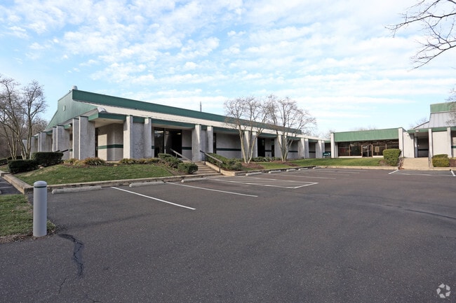
3401 Masons Mill Rd
Philadelphia-Camden-Wilmington, PA-NJ-DE-MD
Mason Mill-Sec I
03-00-00489-003
BLDGS 1 2 3 4 5 6
Officebuilding
Montgomery
AE
Pennsylvania
42091C0312G
24
2024
14.17 AC
2025
Horsham/Willow Grove
200200
Philadelphia
84,000 SF
DEMOGRAPHICS near 3401 Masons Mill Rd
1 Mile
3 Mile
5 Mile
2024 Total Population
4,246
85,048
239,616
2029 Population
4,361
86,598
239,865
Pop Growth 2024-2029
+ 2.71%
+ 1.82%
+ 0.10%
Average Age
42
43
43
2024 Total Households
1,440
34,073
91,638
HH Growth 2024-2029
+ 2.71%
+ 1.97%
+ 0.13%
Median Household Inc
$107,176
$88,160
$93,162
Avg Household Size
2.80
2.40
2.50
2024 Avg HH Vehicles
2.00
2.00
2.00
Median Home Value
$454,963
$349,901
$349,448
Median Year Built
1975
1965
1965
Nearby Places
Map Layers
Map Styles
 Street
 Aerial
- Restaurants
- Banks
- Shops
- Fitness
- Groceries
PUBLIC TRANSPORTATION
COMMUTER RAIL
Hatboro (R2 - Southeastern Pennsylvania Transportation Authority Regional Rail (SEPTA Regional Rail))
DRIVE
WALK
Distance
Hatboro (R2 - Southeastern Pennsylvania Transportation Authority Regional Rail (SEPTA Regional Rail))
5 min
2.3 mi
Willow Grove (R2 - Southeastern Pennsylvania Transportation Authority Regional Rail (SEPTA Regional Rail))
DRIVE
WALK
Distance
Willow Grove (R2 - Southeastern Pennsylvania Transportation Authority Regional Rail (SEPTA Regional Rail))
7 min
3.2 mi
AIRPORT
Trenton Mercer
DRIVE
WALK
Distance
Trenton Mercer
36 min
20.7 mi
Philadelphia International
DRIVE
WALK
Distance
Philadelphia International
49 min
29.1 mi
Freight Ports
Port of Philadelphia
DRIVE
WALK
Distance
Port of Philadelphia
27 min
14.8 mi
Nearby Properties
Address
Land Use
TOTAL SIZE
Lot Size
Zoning
Address
Land Use
TOTAL SIZE
Lot Size
Zoning
794,476 SF
30.14 AC
PB
Address
Land Use
TOTAL SIZE
Lot Size
Zoning
17,563 SF
1.60 AC
C-O-2.5
Address
Land Use
TOTAL SIZE
Lot Size
Zoning
377,044 SF
58.73 AC
INST
Address
Land Use
TOTAL SIZE
Lot Size
Zoning
571,213 SF
67.31 AC
M
Address
Land Use
TOTAL SIZE
Lot Size
Zoning
498,072 SF
5.39 AC
TC1
Address
Land Use
TOTAL SIZE
Lot Size
Zoning
343,852 SF
8.42 AC
I
Address
Land Use
TOTAL SIZE
Lot Size
Zoning
282,292 SF
74.30 AC
IN
Address
Land Use
TOTAL SIZE
Lot Size
Zoning
251,655 SF
48.95 AC
SC
Address
Land Use
TOTAL SIZE
Lot Size
Zoning
167,743 SF
20.70 AC
T
Address
Land Use
TOTAL SIZE
Lot Size
Zoning
251,935 SF
13.03 AC
TC1
Address
Land Use
TOTAL SIZE
Lot Size
Zoning
257,010 SF
34.12 AC
INST
Address
Land Use
TOTAL SIZE
Lot Size
Zoning
84,400 SF
4.70 AC
I
Address
Land Use
TOTAL SIZE
Lot Size
Zoning
236,808 SF
17.66 AC
PB
Address
Land Use
TOTAL SIZE
Lot Size
Zoning
309,264 SF
9.93 AC
I
Address
Land Use
TOTAL SIZE
Lot Size
Zoning
256,679 SF
14 AC
MI
Address
Land Use
TOTAL SIZE
Lot Size
Zoning
420,736 SF
29.47 AC
LI
Address
Land Use
TOTAL SIZE
Lot Size
Zoning
344,636 SF
25.02 AC
R7
Address
Land Use
TOTAL SIZE
Lot Size
Zoning
110,198 SF
12.18 AC
R2
Address
Land Use
TOTAL SIZE
Lot Size
Zoning
273,531 SF
11.11 AC
INST
Address
Land Use
TOTAL SIZE
Lot Size
Zoning
123,538 SF
12.32 AC
CC
Address
Land Use
TOTAL SIZE
Lot Size
Zoning
24,000 SF
6.12 AC
C2
Address
Land Use
TOTAL SIZE
Lot Size
Zoning
189,765 SF
57.28 AC
HL
Address
Land Use
TOTAL SIZE
Lot Size
Zoning
107,905 SF
9 AC
PB
Address
Land Use
TOTAL SIZE
Lot Size
Zoning
127,251 SF
17.55 AC
L
Address
Land Use
TOTAL SIZE
Lot Size
Zoning
186,511 SF
14 AC
T
Address
Land Use
TOTAL SIZE
Lot Size
Zoning
205,254 SF
4.71 AC
HR
Address
Land Use
TOTAL SIZE
Lot Size
Zoning
205,254 SF
4.71 AC
HR
Address
Land Use
TOTAL SIZE
Lot Size
Zoning
120,549 SF
10 AC
C2
Address
Land Use
TOTAL SIZE
Lot Size
Zoning
66,364 SF
9.61 AC
T
Address
Land Use
TOTAL SIZE
Lot Size
Zoning
91,814 SF
38.63 AC
RC
The World's #1 Commercial Real Estate Marketplace
Connect with us
© 2026 CoStar Group
The information above has been obtained from sources believed reliable. While we do not doubt its accuracy we have not verified it and make no guarantee, warranty or representation about it. It is your responsibility to independently confirm its accuracy and completeness. Any projections, opinions, assumptions, or estimates used are for example only and do not represent the current or future performance of the property. The value of this transaction to you depends on tax and other factors which should be evaluated by your tax, financial, and legal advisors. You and your advisors should conduct a careful, independent investigation of the property to determine to your satisfaction the suitability of the property for your needs.