Property Record
34015 Excor Rd Sw, Albany, OR 97321
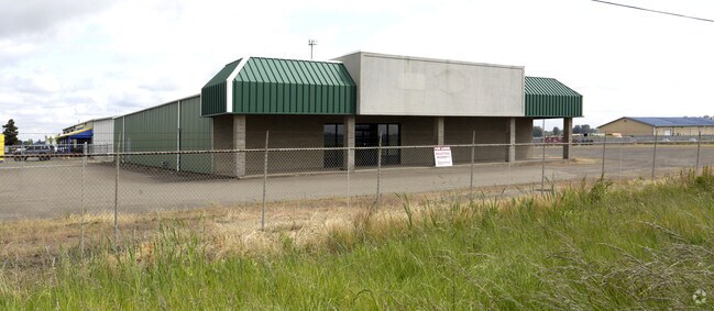


Property Detail
34015 Excor Rd Sw
0154472
11S04W33D0
Municipalproperty
LINN
UD-II
Oregon
B and X Area of moderate flood hazard, usually the area between the limits of the 100-year and 500-year floods.
1.64 AC
2025
Linn County
2025
Portland
030700
Albany, OR
22,800 SF
NEARBY LISTINGS FOR SALE OR LEASE
DEMOGRAPHICS near 34015 Excor Rd Sw
1 mile
3 mile
5 mile
2025 Total Population
169
2,481
47,919
2030 Population
167
2,492
49,782
Pop Growth 2025-2030
(1.18%)
+ 0.44%
+ 3.89%
Average Age
50
48
37
2025 Total Households
80
1,077
19,492
HH Growth 2025-2030
(1.25%)
+ 0.37%
+ 4.28%
Median Household Inc
$74,999
$89,437
$57,967
Avg Household Size
2.10
2.20
2.20
2025 Avg HH Vehicles
2.00
2.00
2.00
Median Home Value
$640,625
$572,917
$428,824
Median Year Built
1969
1971
1978
Nearby Places
Map Layers
Map Styles
 Street
 Aerial
Transit
 Traffic
 Biking
Places
Listings with unknown addresses are not visible on the map
- Restaurants
- Banks
- Shops
- Fitness
- Groceries
PUBLIC TRANSPORTATION
COMMUTER RAIL
Albany Amtrak Station (Amtrak Cascades - Amtrak, Coast Starlight - Amtrak)
Drive
Walk
Distance
Albany Amtrak Station (Amtrak Cascades - Amtrak, Coast Starlight - Amtrak)
12 min
6.8 mi
Freight Ports
Port of Portland
Drive
Walk
Distance
Port of Portland
102 min
81.9 mi
SALE & LEASE HISTORY
LISTING DATE
SALE/LEASE

Sep 25, 2016
For Lease
Nearby Properties
Address
Land Use
TOTAL SIZE
Lot Size
Zoning
Address
Land Use
TOTAL SIZE
Lot Size
Zoning
104.75 AC
LI
Address
Land Use
TOTAL SIZE
Lot Size
Zoning
58,316 SF
8.72 AC
UD-I
Address
Land Use
TOTAL SIZE
Lot Size
Zoning
13,600 SF
11.89 AC
LI
Address
Land Use
TOTAL SIZE
Lot Size
Zoning
105 SF
33.79 AC
EFU
Address
Land Use
TOTAL SIZE
Lot Size
Zoning
7.61 AC
IP
Address
Land Use
TOTAL SIZE
Lot Size
Zoning
10,920 SF
9.12 AC
LI
Address
Land Use
TOTAL SIZE
Lot Size
Zoning
40,800 SF
8 AC
RR-5
Address
Land Use
TOTAL SIZE
Lot Size
Zoning
19,950 SF
5.60 AC
HC/I
Address
Land Use
TOTAL SIZE
Lot Size
Zoning
7 AC
HI
Address
Land Use
TOTAL SIZE
Lot Size
Zoning
1,440 SF
3.32 AC
LI
Address
Land Use
TOTAL SIZE
Lot Size
Zoning
35,235 SF
4.41 AC
LI
Address
Land Use
TOTAL SIZE
Lot Size
Zoning
22,133 SF
9.23 AC
LI
Address
Land Use
TOTAL SIZE
Lot Size
Zoning
5.05 AC
UD-II
Address
Land Use
TOTAL SIZE
Lot Size
Zoning
13,920 SF
2 AC
LI
Address
Land Use
TOTAL SIZE
Lot Size
Zoning
4.28 AC
UD-II
Address
Land Use
TOTAL SIZE
Lot Size
Zoning
24,000 SF
1.99 AC
LI
Address
Land Use
TOTAL SIZE
Lot Size
Zoning
22,884 SF
3.16 AC
LI
Address
Land Use
TOTAL SIZE
Lot Size
Zoning
29,880 SF
5.88 AC
UD-II
Address
Land Use
TOTAL SIZE
Lot Size
Zoning
6,000 SF
1.39 AC
HC/I
Address
Land Use
TOTAL SIZE
Lot Size
Zoning
10,368 SF
4.37 AC
HC/I
Address
Land Use
TOTAL SIZE
Lot Size
Zoning
25,000 SF
1.88 AC
UD-I
Address
Land Use
TOTAL SIZE
Lot Size
Zoning
3.10 AC
UD-II
Address
Land Use
TOTAL SIZE
Lot Size
Zoning
1.85 AC
UD-II
Address
Land Use
TOTAL SIZE
Lot Size
Zoning
14,067 SF
7.39 AC
EFU
Address
Land Use
TOTAL SIZE
Lot Size
Zoning
15,000 SF
2.66 AC
UD-II
Address
Land Use
TOTAL SIZE
Lot Size
Zoning
8,665 SF
5.39 AC
UD-II
Address
Land Use
TOTAL SIZE
Lot Size
Zoning
27,620 SF
2.51 AC
UD-II
Address
Land Use
TOTAL SIZE
Lot Size
Zoning
8,100 SF
3.15 AC
HC/I
Address
Land Use
TOTAL SIZE
Lot Size
Zoning
13,952 SF
1.32 AC
UD-II
Address
Land Use
TOTAL SIZE
Lot Size
Zoning
15,968 SF
57.08 AC
EFU
The World's #1 Commercial Real Estate Marketplace
Connect with us
© 2026 CoStar Group
The information above has been obtained from sources believed reliable. While we do not doubt its accuracy we have not verified it and make no guarantee, warranty or representation about it. It is your responsibility to independently confirm its accuracy and completeness. Any projections, opinions, assumptions, or estimates used are for example only and do not represent the current or future performance of the property. The value of this transaction to you depends on tax and other factors which should be evaluated by your tax, financial, and legal advisors. You and your advisors should conduct a careful, independent investigation of the property to determine to your satisfaction the suitability of the property for your needs.