Property Record
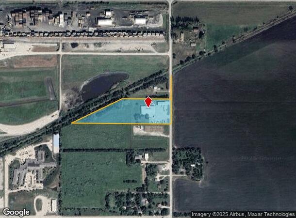
3405 N Yager Rd, Fremont, NE 68025
NEARBY LISTINGS FOR SALE OR LEASE
-
-
View all Fremont listings for lease on LoopNet.com
Property Detail
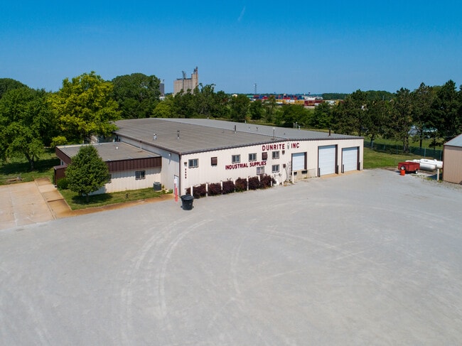
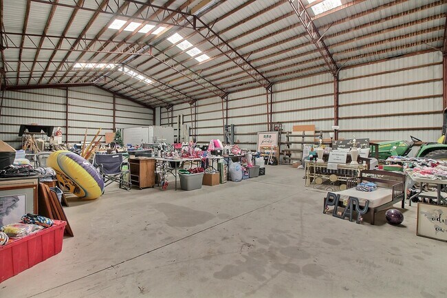
3405 N Yager Rd
270101703
TL 35 6.44A 11 17 8; MAP NUMBER: 2391-11-1-00000-000-0007
Warehouse
Dodge
X
Nebraska
31177C0250D
6.44 AC
2024
Nebraska Area
2024
Other Market Areas
963800
Fremont, NE
17,700 SF
DEMOGRAPHICS near 3405 N Yager Rd
1 Mile
3 Mile
5 Mile
2024 Total Population
2,752
27,774
29,863
2029 Population
2,832
27,557
29,713
Pop Growth 2024-2029
+ 2.91%
(0.78%)
(0.50%)
Average Age
44
40
40
2024 Total Households
1,242
11,098
11,884
HH Growth 2024-2029
+ 3.46%
(0.76%)
(0.49%)
Median Household Inc
$41,521
$59,702
$60,961
Avg Household Size
2.10
2.40
2.40
2024 Avg HH Vehicles
1.00
2.00
2.00
Median Home Value
$156,331
$168,477
$171,261
Median Year Built
1988
1966
1967
Nearby Places
Map Layers
Map Styles
 Street
 Aerial
- Restaurants
- Banks
- Shops
- Fitness
- Groceries
SALE & LEASE HISTORY
LISTING DATE
SALE/LEASE

Oct 07, 2021
For Lease
Jul 28, 2021
For Sale
Nearby Properties
Address
Land Use
TOTAL SIZE
Lot Size
Zoning
Address
Land Use
TOTAL SIZE
Lot Size
Zoning
7,385 SF
20.27 AC
INDUSTRIAL
Address
Land Use
TOTAL SIZE
Lot Size
Zoning
28,281 SF
14.60 AC
COMMERCIAL
Address
Land Use
TOTAL SIZE
Lot Size
Zoning
7,504 SF
25.27 AC
INDUSTRIAL
Address
Land Use
TOTAL SIZE
Lot Size
Zoning
162,301 SF
18.06 AC
COMMERCIAL
Address
Land Use
TOTAL SIZE
Lot Size
Zoning
200,088 SF
23.04 AC
COMMERCIAL
Address
Land Use
TOTAL SIZE
Lot Size
Zoning
36,135 SF
8.89 AC
COMMERCIAL
Address
Land Use
TOTAL SIZE
Lot Size
Zoning
52,993 SF
4 AC
COMMERCIAL
Address
Land Use
TOTAL SIZE
Lot Size
Zoning
4,120 SF
9.44 AC
MULTI-FAMI
Address
Land Use
TOTAL SIZE
Lot Size
Zoning
67,947 SF
10.67 AC
INDUSTRIAL
Address
Land Use
TOTAL SIZE
Lot Size
Zoning
33,392 SF
5.57 AC
SINGLE-FAM
Address
Land Use
TOTAL SIZE
Lot Size
Zoning
59,307 SF
1.99 AC
COMMERCIAL
Address
Land Use
TOTAL SIZE
Lot Size
Zoning
99,964 SF
7.47 AC
INDUSTRIAL
Address
Land Use
TOTAL SIZE
Lot Size
Zoning
3,000 SF
4.37 AC
INDUSTRIAL
Address
Land Use
TOTAL SIZE
Lot Size
Zoning
60,000 SF
11.02 AC
INDUSTRIAL
Address
Land Use
TOTAL SIZE
Lot Size
Zoning
65,589 SF
5.76 AC
COMMERCIAL
Address
Land Use
TOTAL SIZE
Lot Size
Zoning
21,384 SF
15 AC
INDUSTRIAL
Address
Land Use
TOTAL SIZE
Lot Size
Zoning
4,952 SF
4.64 AC
MULTI-FAMI
Address
Land Use
TOTAL SIZE
Lot Size
Zoning
18,346 SF
2.94 AC
COMMERCIAL
Address
Land Use
TOTAL SIZE
Lot Size
Zoning
53,688 SF
2.27 AC
MULTI-FAMI
Address
Land Use
TOTAL SIZE
Lot Size
Zoning
45,228 SF
2.01 AC
COMMERCIAL
Address
Land Use
TOTAL SIZE
Lot Size
Zoning
3,360 SF
4.99 AC
INDUSTRIAL
Address
Land Use
TOTAL SIZE
Lot Size
Zoning
43,560 SF
1.75 AC
COMMERCIAL
Address
Land Use
TOTAL SIZE
Lot Size
Zoning
59,225 SF
5.41 AC
COMMERCIAL
Address
Land Use
TOTAL SIZE
Lot Size
Zoning
9,870 SF
5.13 AC
COMMERCIAL
Address
Land Use
TOTAL SIZE
Lot Size
Zoning
28,088 SF
10 AC
INDUSTRIAL
Address
Land Use
TOTAL SIZE
Lot Size
Zoning
16,360 SF
1.67 AC
COMMERCIAL
Address
Land Use
TOTAL SIZE
Lot Size
Zoning
8,368 SF
3.25 AC
SINGLE-FAM
Address
Land Use
TOTAL SIZE
Lot Size
Zoning
11,810 SF
13.42 AC
COMMERCIAL
Address
Land Use
TOTAL SIZE
Lot Size
Zoning
44,736 SF
2.45 AC
COMMERCIAL
The World's #1 Commercial Real Estate Marketplace
Connect with us
© 2025 CoStar Group
The information above has been obtained from sources believed reliable. While we do not doubt its accuracy we have not verified it and make no guarantee, warranty or representation about it. It is your responsibility to independently confirm its accuracy and completeness. Any projections, opinions, assumptions, or estimates used are for example only and do not represent the current or future performance of the property. The value of this transaction to you depends on tax and other factors which should be evaluated by your tax, financial, and legal advisors. You and your advisors should conduct a careful, independent investigation of the property to determine to your satisfaction the suitability of the property for your needs.