Property Record
3405 Us Highway 9, Valatie, NY 12184
NEARBY LISTINGS FOR SALE OR LEASE
-
-
View all Valatie listings for sale on LoopNet.com
Property Detail
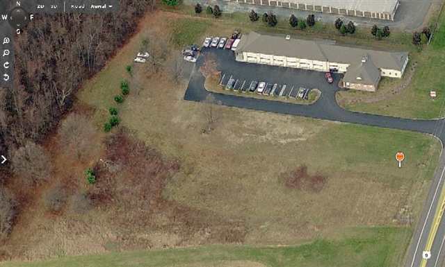
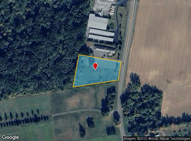
3405 Us Highway 9
Hudson, NY
Columbia
104489-022-000-0001-077-100-0000
New York
Commercialacreage
77.100
2025
2.03 AC
2024
Columbia County
000402
Albany/Schenectady/Troy
DEMOGRAPHICS near 3405 Us Highway 9
1 Mile
3 Mile
5 Mile
2024 Total Population
998
5,381
11,990
2029 Population
985
5,271
11,714
Pop Growth 2024-2029
(1.30%)
(2.04%)
(2.30%)
Average Age
44
45
45
2024 Total Households
416
2,198
4,930
HH Growth 2024-2029
(1.44%)
(2.18%)
(2.45%)
Median Household Inc
$64,000
$86,988
$87,687
Avg Household Size
2.30
2.30
2.30
2024 Avg HH Vehicles
2.00
2.00
2.00
Median Home Value
$295,535
$282,289
$270,385
Median Year Built
1976
1972
1969
Nearby Places
Map Layers
Map Styles
 Street
 Aerial
- Restaurants
- Banks
- Shops
- Fitness
- Groceries
PUBLIC TRANSPORTATION
AIRPORT
Albany International
DRIVE
WALK
Distance
Albany International
38 min
25.8 mi
Freight Ports
Albany, NY Port
DRIVE
WALK
Distance
Albany, NY Port
25 min
18.2 mi
SALE & LEASE HISTORY
LISTING DATE
SALE/LEASE

Sep 24, 2016
For Sale
Nearby Properties
Address
Land Use
TOTAL SIZE
Lot Size
Zoning
Address
Land Use
TOTAL SIZE
Lot Size
Zoning
97,278 SF
47.70 AC
07 - MIXED
Address
Land Use
TOTAL SIZE
Lot Size
Zoning
110,043 SF
120.60 AC
07 - MIXED
Address
Land Use
TOTAL SIZE
Lot Size
Zoning
62,192 SF
19.16 AC
05 - COMME
Address
Land Use
TOTAL SIZE
Lot Size
Zoning
80,893 SF
4.89 AC
07 - MIXED
Address
Land Use
TOTAL SIZE
Lot Size
Zoning
72,355 SF
15.71 AC
05 - COMME
Address
Land Use
TOTAL SIZE
Lot Size
Zoning
59,049 SF
233 AC
07 - MIXED
Address
Land Use
TOTAL SIZE
Lot Size
Zoning
20,297 SF
6.60 AC
07 - MIXED
Address
Land Use
TOTAL SIZE
Lot Size
Zoning
13,225 SF
2.62 AC
05 - COMME
Address
Land Use
TOTAL SIZE
Lot Size
Zoning
4,436 SF
16 AC
08 - GOVER
Address
Land Use
TOTAL SIZE
Lot Size
Zoning
6,362 SF
166.30 AC
05 - COMME
Address
Land Use
TOTAL SIZE
Lot Size
Zoning
3,000 SF
344.88 AC
07 - MIXED
Address
Land Use
TOTAL SIZE
Lot Size
Zoning
10,775 SF
3.50 AC
05 - COMME
Address
Land Use
TOTAL SIZE
Lot Size
Zoning
1,544 SF
4.60 AC
05 - COMME
Address
Land Use
TOTAL SIZE
Lot Size
Zoning
46,650 SF
1.40 AC
05 - COMME
Address
Land Use
TOTAL SIZE
Lot Size
Zoning
5,216 SF
39.30 AC
02 - SINGL
Address
Land Use
TOTAL SIZE
Lot Size
Zoning
2,730 SF
2 AC
05 - COMME
Address
Land Use
TOTAL SIZE
Lot Size
Zoning
11,838 SF
4.55 AC
07 - MIXED
Address
Land Use
TOTAL SIZE
Lot Size
Zoning
82,771 SF
10.50 AC
07 - MIXED
Address
Land Use
TOTAL SIZE
Lot Size
Zoning
33,172 SF
41 AC
05 - COMME
Address
Land Use
TOTAL SIZE
Lot Size
Zoning
84.40 AC
Address
Land Use
TOTAL SIZE
Lot Size
Zoning
18,831 SF
25 AC
PD-4
Address
Land Use
TOTAL SIZE
Lot Size
Zoning
1,810 SF
185.02 AC
04 - FARM
Address
Land Use
TOTAL SIZE
Lot Size
Zoning
8,080 SF
10.82 AC
05 - COMME
Address
Land Use
TOTAL SIZE
Lot Size
Zoning
3,872 SF
17.81 AC
HC
Address
Land Use
TOTAL SIZE
Lot Size
Zoning
226.82 AC
RL20
Address
Land Use
TOTAL SIZE
Lot Size
Zoning
14,400 SF
20 AC
05 - COMME
Address
Land Use
TOTAL SIZE
Lot Size
Zoning
3,258 SF
205.30 AC
02 - SINGL
Address
Land Use
TOTAL SIZE
Lot Size
Zoning
9,624 SF
21.08 AC
08 - GOVER
Address
Land Use
TOTAL SIZE
Lot Size
Zoning
13,440 SF
2.40 AC
05 - COMME
Address
Land Use
TOTAL SIZE
Lot Size
Zoning
1,200 SF
15.40 AC
07 - MIXED
The World's #1 Commercial Real Estate Marketplace
Connect with us
© 2025 CoStar Group
The information above has been obtained from sources believed reliable. While we do not doubt its accuracy we have not verified it and make no guarantee, warranty or representation about it. It is your responsibility to independently confirm its accuracy and completeness. Any projections, opinions, assumptions, or estimates used are for example only and do not represent the current or future performance of the property. The value of this transaction to you depends on tax and other factors which should be evaluated by your tax, financial, and legal advisors. You and your advisors should conduct a careful, independent investigation of the property to determine to your satisfaction the suitability of the property for your needs.