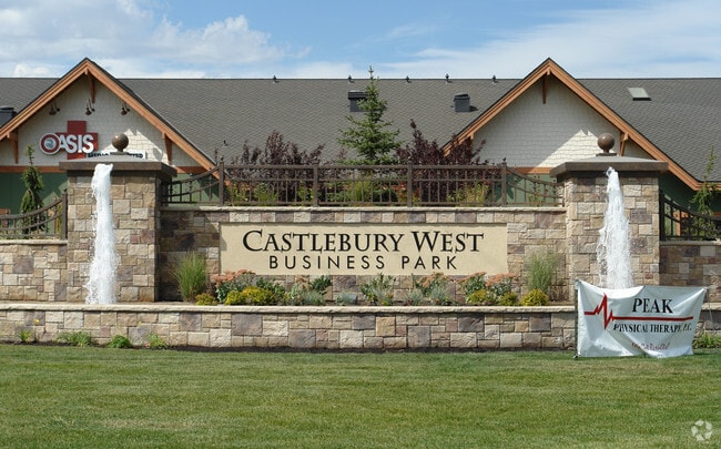
Property Record
3405 W Bavaria St, Eagle, ID 83616

Property Detail
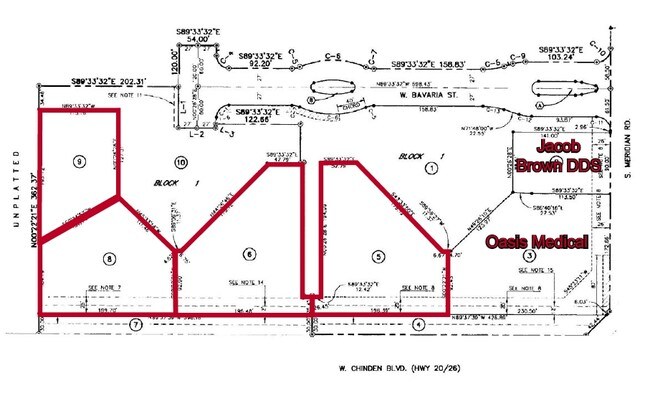
3405 W Bavaria St
R1801770100
LOT 03 BLK 01 DELTOID SUB NO 02
Commercialbuilding
Ada
MU-DA
Idaho
B and X Area of moderate flood hazard, usually the area between the limits of the 100-year and 500-year floods.
03
2024
0.29 AC
2025
Eagle
010357
Boise City/Nampa
3,582 SF
Boise City, ID
NEARBY LISTINGS FOR SALE OR LEASE
-
-
-
-
-
No Photo
-
-
View all Eagle listings for sale on LoopNet.com
DEMOGRAPHICS near 3405 W Bavaria St
1 mile
3 mile
5 mile
2024 Total Population
10,712
82,763
184,536
2029 Population
11,141
86,725
194,358
Pop Growth 2024-2029
+ 4.00%
+ 4.79%
+ 5.32%
Average Age
40
40
41
2024 Total Households
3,549
28,383
66,961
HH Growth 2024-2029
+ 4.37%
+ 5.22%
+ 5.77%
Median Household Inc
$134,702
$113,070
$97,808
Avg Household Size
2.90
2.90
2.70
2024 Avg HH Vehicles
3.00
2.00
2.00
Median Home Value
$731,388
$636,922
$569,306
Median Year Built
2010
2006
2003
Nearby Places
Map Layers
Map Styles
 Street
 Aerial
Transit
 Traffic
 Biking
Places
Listings with unknown addresses are not visible on the map
- Restaurants
- Banks
- Shops
- Fitness
- Groceries
PUBLIC TRANSPORTATION
AIRPORT
Boise Air Trml/Gowen Field
Drive
Walk
Distance
Boise Air Trml/Gowen Field
26 min
16.2 mi
Freight Ports
Port of Portland
Drive
Walk
Distance
Port of Portland
1 min
336.5 mi
Nearby Properties
Address
Land Use
TOTAL SIZE
Lot Size
Zoning
Address
Land Use
TOTAL SIZE
Lot Size
Zoning
342,567 SF
19.16 AC
MU-DA
Address
Land Use
TOTAL SIZE
Lot Size
Zoning
415,710 SF
14.78 AC
R-40
Address
Land Use
TOTAL SIZE
Lot Size
Zoning
17.46 AC
R-15
Address
Land Use
TOTAL SIZE
Lot Size
Zoning
301,800 SF
12.70 AC
R-3D
Address
Land Use
TOTAL SIZE
Lot Size
Zoning
190,106 SF
10.10 AC
R-4
Address
Land Use
TOTAL SIZE
Lot Size
Zoning
138,828 SF
4.22 AC
C-1D
Address
Land Use
TOTAL SIZE
Lot Size
Zoning
126,466 SF
5.29 AC
R-40
Address
Land Use
TOTAL SIZE
Lot Size
Zoning
108,505 SF
6.84 AC
C-G
Address
Land Use
TOTAL SIZE
Lot Size
Zoning
170,333 SF
14.65 AC
C-3-DA
Address
Land Use
TOTAL SIZE
Lot Size
Zoning
69,546 SF
4.26 AC
MU-DA
Address
Land Use
TOTAL SIZE
Lot Size
Zoning
65,034 SF
4.44 AC
MU-DA
Address
Land Use
TOTAL SIZE
Lot Size
Zoning
89,693 SF
2.43 AC
R-3D
Address
Land Use
TOTAL SIZE
Lot Size
Zoning
152,895 SF
14.29 AC
C-G
Address
Land Use
TOTAL SIZE
Lot Size
Zoning
164,251 SF
21.52 AC
C-G
Address
Land Use
TOTAL SIZE
Lot Size
Zoning
97,655 SF
7.74 AC
T-1D
Address
Land Use
TOTAL SIZE
Lot Size
Zoning
110,152 SF
6.02 AC
R-40
Address
Land Use
TOTAL SIZE
Lot Size
Zoning
28.08 AC
R-8
Address
Land Use
TOTAL SIZE
Lot Size
Zoning
59,778 SF
3.68 AC
C-3-DA
Address
Land Use
TOTAL SIZE
Lot Size
Zoning
125,400 SF
12.68 AC
C-4D
Address
Land Use
TOTAL SIZE
Lot Size
Zoning
220,153 SF
11.86 AC
I-L
Address
Land Use
TOTAL SIZE
Lot Size
Zoning
137,796 SF
13.07 AC
C-G
Address
Land Use
TOTAL SIZE
Lot Size
Zoning
68,707 SF
2.83 AC
C-3-DA
Address
Land Use
TOTAL SIZE
Lot Size
Zoning
81,617 SF
5.09 AC
TN-R
Address
Land Use
TOTAL SIZE
Lot Size
Zoning
80,913 SF
8 AC
C-C
Address
Land Use
TOTAL SIZE
Lot Size
Zoning
167,896 SF
13.41 AC
I-L
Address
Land Use
TOTAL SIZE
Lot Size
Zoning
75,520 SF
4.64 AC
R-15
Address
Land Use
TOTAL SIZE
Lot Size
Zoning
34,602 SF
2.61 AC
MU-DA
Address
Land Use
TOTAL SIZE
Lot Size
Zoning
179,824 SF
9.66 AC
I-L
Address
Land Use
TOTAL SIZE
Lot Size
Zoning
96,024 SF
8.32 AC
C-G
Address
Land Use
TOTAL SIZE
Lot Size
Zoning
16.42 AC
R-8
The World's #1 Commercial Real Estate Marketplace
Connect with us
© 2026 CoStar Group
The information above has been obtained from sources believed reliable. While we do not doubt its accuracy we have not verified it and make no guarantee, warranty or representation about it. It is your responsibility to independently confirm its accuracy and completeness. Any projections, opinions, assumptions, or estimates used are for example only and do not represent the current or future performance of the property. The value of this transaction to you depends on tax and other factors which should be evaluated by your tax, financial, and legal advisors. You and your advisors should conduct a careful, independent investigation of the property to determine to your satisfaction the suitability of the property for your needs.