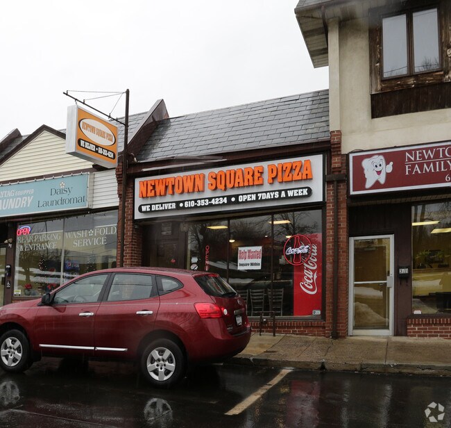
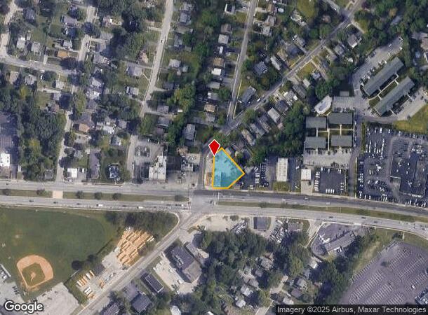
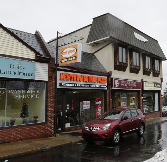
Property Record
3081 W Chester Pike, Newtown Square, PA 19073
NEARBY LISTINGS FOR SALE OR LEASE
Property Detail
3081 W Chester Pike
30-00-02790-00
2 STY BLDG STORE APT 53 X 206.66 IRR
Restaurantbuilding
Delaware
X
Pennsylvania
42045C0108F
0.33 AC
2024
Delaware County
2025
Philadelphia
409903
Philadelphia-Camden-Wilmington, PA-NJ-DE-MD
9,618 SF
DEMOGRAPHICS near 3081 W Chester Pike
1 Mile
3 Mile
5 Mile
2024 Total Population
12,660
55,052
207,155
2029 Population
12,769
54,935
206,869
Pop Growth 2024-2029
+ 0.86%
(0.21%)
(0.14%)
Average Age
45
44
41
2024 Total Households
5,256
20,983
76,252
HH Growth 2024-2029
+ 1.41%
0.00%
(0.12%)
Median Household Inc
$102,263
$128,248
$115,826
Avg Household Size
2.40
2.60
2.50
2024 Avg HH Vehicles
2.00
2.00
2.00
Median Home Value
$404,917
$477,424
$432,261
Median Year Built
1959
1963
1956
Nearby Places
Map Layers
Map Styles
 Street
 Aerial
- Restaurants
- Banks
- Shops
- Fitness
- Groceries
PUBLIC TRANSPORTATION
COMMUTER RAIL
Rosemont (R5 - Southeastern Pennsylvania Transportation Authority Regional Rail (SEPTA Regional Rail))
DRIVE
WALK
Distance
Rosemont (R5 - Southeastern Pennsylvania Transportation Authority Regional Rail (SEPTA Regional Rail))
14 min
6.2 mi
St. Davids (R5 - Southeastern Pennsylvania Transportation Authority Regional Rail (SEPTA Regional Rail))
DRIVE
WALK
Distance
St. Davids (R5 - Southeastern Pennsylvania Transportation Authority Regional Rail (SEPTA Regional Rail))
14 min
6.4 mi
AIRPORT
Philadelphia International
DRIVE
WALK
Distance
Philadelphia International
27 min
16.6 mi
Freight Ports
South Jersey Port
DRIVE
WALK
Distance
South Jersey Port
35 min
16.8 mi
Nearby Properties
Address
Land Use
TOTAL SIZE
Lot Size
Zoning
Address
Land Use
TOTAL SIZE
Lot Size
Zoning
227,940 SF
110.24 AC
Address
Land Use
TOTAL SIZE
Lot Size
Zoning
192,800 SF
129.66 AC
Address
Land Use
TOTAL SIZE
Lot Size
Zoning
259,200 SF
21.14 AC
Address
Land Use
TOTAL SIZE
Lot Size
Zoning
45,294 SF
83.20 AC
Address
Land Use
TOTAL SIZE
Lot Size
Zoning
59,126 SF
84.57 AC
Address
Land Use
TOTAL SIZE
Lot Size
Zoning
60,768 SF
16.17 AC
Address
Land Use
TOTAL SIZE
Lot Size
Zoning
26.47 AC
Address
Land Use
TOTAL SIZE
Lot Size
Zoning
73,059 SF
10.17 AC
Address
Land Use
TOTAL SIZE
Lot Size
Zoning
308,248 SF
52 AC
Address
Land Use
TOTAL SIZE
Lot Size
Zoning
90,784 SF
26.26 AC
Address
Land Use
TOTAL SIZE
Lot Size
Zoning
264,399 SF
122.05 AC
Address
Land Use
TOTAL SIZE
Lot Size
Zoning
23,868 SF
11.18 AC
Address
Land Use
TOTAL SIZE
Lot Size
Zoning
185,720 SF
0.50 AC
Address
Land Use
TOTAL SIZE
Lot Size
Zoning
238,024 SF
3.07 AC
Address
Land Use
TOTAL SIZE
Lot Size
Zoning
168,474 SF
1 AC
Address
Land Use
TOTAL SIZE
Lot Size
Zoning
30,204 SF
13.75 AC
Address
Land Use
TOTAL SIZE
Lot Size
Zoning
261,618 SF
30.57 AC
Address
Land Use
TOTAL SIZE
Lot Size
Zoning
93,068 SF
12.47 AC
Address
Land Use
TOTAL SIZE
Lot Size
Zoning
331,021 SF
35.19 AC
Address
Land Use
TOTAL SIZE
Lot Size
Zoning
26,999 SF
21 AC
Address
Land Use
TOTAL SIZE
Lot Size
Zoning
Address
Land Use
TOTAL SIZE
Lot Size
Zoning
38,220 SF
22.05 AC
Address
Land Use
TOTAL SIZE
Lot Size
Zoning
72,564 SF
24.44 AC
Address
Land Use
TOTAL SIZE
Lot Size
Zoning
126,812 SF
10.09 AC
Address
Land Use
TOTAL SIZE
Lot Size
Zoning
100,242 SF
5 AC
Address
Land Use
TOTAL SIZE
Lot Size
Zoning
90,368 SF
124 AC
Address
Land Use
TOTAL SIZE
Lot Size
Zoning
88,056 SF
10.98 AC
Address
Land Use
TOTAL SIZE
Lot Size
Zoning
55,439 SF
1.82 AC
Address
Land Use
TOTAL SIZE
Lot Size
Zoning
103,176 SF
16.38 AC
Address
Land Use
TOTAL SIZE
Lot Size
Zoning
132,579 SF
14.35 AC
The World's #1 Commercial Real Estate Marketplace
Connect with us
© 2025 CoStar Group
The information above has been obtained from sources believed reliable. While we do not doubt its accuracy we have not verified it and make no guarantee, warranty or representation about it. It is your responsibility to independently confirm its accuracy and completeness. Any projections, opinions, assumptions, or estimates used are for example only and do not represent the current or future performance of the property. The value of this transaction to you depends on tax and other factors which should be evaluated by your tax, financial, and legal advisors. You and your advisors should conduct a careful, independent investigation of the property to determine to your satisfaction the suitability of the property for your needs.