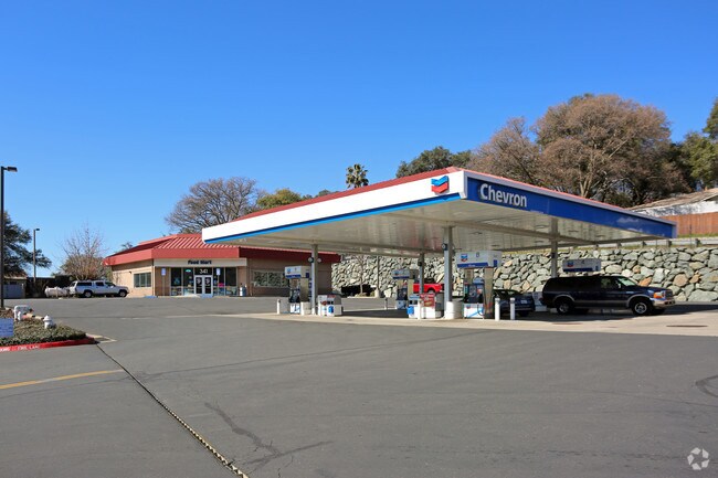
Property Record
341 Green Valley Rd, El Dorado Hills, CA 95762

NEARBY LISTINGS FOR SALE OR LEASE
-
-
View all El Dorado Hills listings for sale on LoopNet.com
Property Detail
341 Green Valley Rd
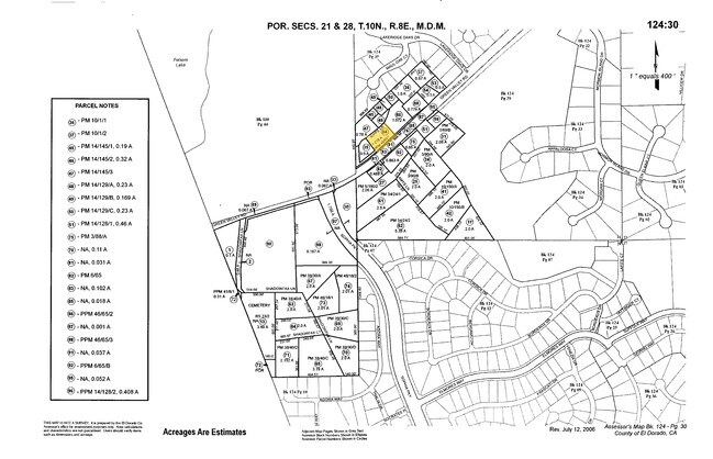
124-301-028-000
POR P1 P/M 46-65
Servicestation
El Dorado
X
California
06067C0128J
1.22 AC
2024
El Dorado
2025
Sacramento
030701
Sacramento-Roseville-Folsom, CA
3,330 SF
DEMOGRAPHICS near 341 Green Valley Rd
1 Mile
3 Mile
5 Mile
2024 Total Population
4,024
49,140
127,385
2029 Population
4,103
49,865
130,106
Pop Growth 2024-2029
+ 1.96%
+ 1.48%
+ 2.14%
Average Age
39
41
42
2024 Total Households
1,312
17,044
44,703
HH Growth 2024-2029
+ 1.91%
+ 1.47%
+ 2.19%
Median Household Inc
$171,875
$158,803
$140,444
Avg Household Size
3.00
2.80
2.70
2024 Avg HH Vehicles
2.00
2.00
2.00
Median Home Value
$800,847
$771,277
$753,918
Median Year Built
2004
1997
1997
Nearby Places
Map Layers
Map Styles
 Street
 Aerial
- Restaurants
- Banks
- Shops
- Fitness
- Groceries
PUBLIC TRANSPORTATION
AIRPORT
Sacramento International
DRIVE
WALK
Distance
Sacramento International
51 min
33.9 mi
Nearby Properties
Address
Land Use
TOTAL SIZE
Lot Size
Zoning
Address
Land Use
TOTAL SIZE
Lot Size
Zoning
424,801 SF
32.65 AC
R-M (PD)
Address
Land Use
TOTAL SIZE
Lot Size
Zoning
264,478 SF
13.46 AC
R-M (PD)
Address
Land Use
TOTAL SIZE
Lot Size
Zoning
293,505 SF
27.52 AC
R-M (PD)
Address
Land Use
TOTAL SIZE
Lot Size
Zoning
150,808 SF
14.91 AC
R2
Address
Land Use
TOTAL SIZE
Lot Size
Zoning
121,190 SF
6.65 AC
R-4 (PD)
Address
Land Use
TOTAL SIZE
Lot Size
Zoning
23.12 AC
R2
Address
Land Use
TOTAL SIZE
Lot Size
Zoning
8,064 SF
4.68 AC
R2
Address
Land Use
TOTAL SIZE
Lot Size
Zoning
65,961 SF
7.56 AC
SP-C-2 (SP
Address
Land Use
TOTAL SIZE
Lot Size
Zoning
90,530 SF
4.32 AC
BP (PD)
Address
Land Use
TOTAL SIZE
Lot Size
Zoning
10.11 AC
SP-RM-17 (
Address
Land Use
TOTAL SIZE
Lot Size
Zoning
84,054 SF
2.77 AC
C-1 (PD)
Address
Land Use
TOTAL SIZE
Lot Size
Zoning
55,580 SF
6.99 AC
CP
Address
Land Use
TOTAL SIZE
Lot Size
Zoning
65,151 SF
6.11 AC
R2
Address
Land Use
TOTAL SIZE
Lot Size
Zoning
31,666 SF
2.91 AC
SP-C (SP 9
Address
Land Use
TOTAL SIZE
Lot Size
Zoning
9,668 SF
6.86 AC
CP
Address
Land Use
TOTAL SIZE
Lot Size
Zoning
47,335 SF
3.91 AC
C-1 (PD)
Address
Land Use
TOTAL SIZE
Lot Size
Zoning
38,759 SF
6.85 AC
R1
Address
Land Use
TOTAL SIZE
Lot Size
Zoning
20,486 SF
7.03 AC
BP (PD)
Address
Land Use
TOTAL SIZE
Lot Size
Zoning
14,749 SF
88.49 AC
SP-GOLF (S
Address
Land Use
TOTAL SIZE
Lot Size
Zoning
52,604 SF
16.82 AC
OSC (PD) C
Address
Land Use
TOTAL SIZE
Lot Size
Zoning
20,240 SF
0.38 AC
BP (PD)
Address
Land Use
TOTAL SIZE
Lot Size
Zoning
52,362 SF
5.92 AC
CP
Address
Land Use
TOTAL SIZE
Lot Size
Zoning
95,026 SF
17.83 AC
C
Address
Land Use
TOTAL SIZE
Lot Size
Zoning
3,060 SF
0.96 AC
SP-C-2 (SP
Address
Land Use
TOTAL SIZE
Lot Size
Zoning
10,000 SF
0.72 AC
SP-C-2 (SP
Address
Land Use
TOTAL SIZE
Lot Size
Zoning
3,150 SF
2.11 AC
A
Address
Land Use
TOTAL SIZE
Lot Size
Zoning
15,027 SF
11.07 AC
R1A
Address
Land Use
TOTAL SIZE
Lot Size
Zoning
8,740 SF
0.77 AC
SP-C-2 (SP
Address
Land Use
TOTAL SIZE
Lot Size
Zoning
22,240 SF
2.51 AC
C
Address
Land Use
TOTAL SIZE
Lot Size
Zoning
8,700 SF
1.61 AC
SP-C-2 (SP
The World's #1 Commercial Real Estate Marketplace
Connect with us
© 2026 CoStar Group
The information above has been obtained from sources believed reliable. While we do not doubt its accuracy we have not verified it and make no guarantee, warranty or representation about it. It is your responsibility to independently confirm its accuracy and completeness. Any projections, opinions, assumptions, or estimates used are for example only and do not represent the current or future performance of the property. The value of this transaction to you depends on tax and other factors which should be evaluated by your tax, financial, and legal advisors. You and your advisors should conduct a careful, independent investigation of the property to determine to your satisfaction the suitability of the property for your needs.