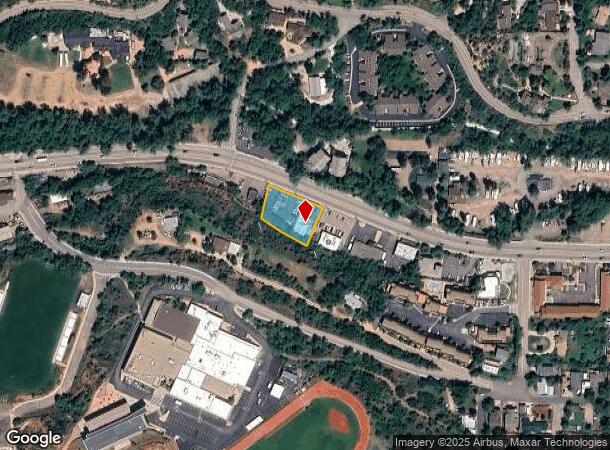
Property Record
341 Manitou Ave, Manitou Springs, CO 80829


NEARBY LISTINGS FOR SALE OR LEASE
Property Detail
341 Manitou Ave
Colorado Springs, CO
Manitou Springs
74043-00-003
PART OF LOT 8 BLK Q MANITOU SPGS LY N OF SLY R/W LN OF DENVER + RIO GRANDE W RR + ELY OF LN DRAWN S 1<30 W FROM A PT ON SLY LN OF MANITOU AVE, THAT IS 515 FT N 78<30 W FROM NE COR OF LOT 22 IN BLK Q IN RESUB OF BLKS R, S, T, U + PART OF Q, + W OF LN
Commercialnec
El Paso
AE
Colorado
08041C0707G
8
2024
0.38 AC
2025
Southwest
006702
Colorado Springs
3,019 SF
DEMOGRAPHICS near 341 Manitou Ave
1 Mile
3 Mile
5 Mile
2024 Total Population
4,450
23,824
76,727
2029 Population
4,646
24,943
80,254
Pop Growth 2024-2029
+ 4.40%
+ 4.70%
+ 4.60%
Average Age
46
46
43
2024 Total Households
2,201
11,457
35,350
HH Growth 2024-2029
+ 4.63%
+ 5.03%
+ 4.89%
Median Household Inc
$83,955
$71,469
$68,698
Avg Household Size
2.00
2.00
2.00
2024 Avg HH Vehicles
2.00
2.00
2.00
Median Home Value
$560,027
$465,869
$463,582
Median Year Built
1958
1973
1973
Nearby Places
Map Layers
Map Styles
 Street
 Aerial
- Restaurants
- Banks
- Shops
- Fitness
- Groceries
PUBLIC TRANSPORTATION
AIRPORT
City of Colorado Springs Municipal
DRIVE
WALK
Distance
City of Colorado Springs Municipal
28 min
15.4 mi
Nearby Properties
Address
Land Use
TOTAL SIZE
Lot Size
Zoning
Address
Land Use
TOTAL SIZE
Lot Size
Zoning
107,247 SF
56.98 AC
R-E PF
Address
Land Use
TOTAL SIZE
Lot Size
Zoning
2,422 SF
616.19 AC
PK MX-I PD
Address
Land Use
TOTAL SIZE
Lot Size
Zoning
75,349 SF
27.75 AC
EPC
Address
Land Use
TOTAL SIZE
Lot Size
Zoning
45,268 SF
8.37 AC
PDZ UV
Address
Land Use
TOTAL SIZE
Lot Size
Zoning
37,196 SF
3 AC
PDZ
Address
Land Use
TOTAL SIZE
Lot Size
Zoning
99,085 SF
6.85 AC
R-1 6
Address
Land Use
TOTAL SIZE
Lot Size
Zoning
34,126 SF
1.37 AC
Address
Land Use
TOTAL SIZE
Lot Size
Zoning
212,439 SF
12.67 AC
R-5 UV
Address
Land Use
TOTAL SIZE
Lot Size
Zoning
267,790 SF
15.13 AC
PDZ HS
Address
Land Use
TOTAL SIZE
Lot Size
Zoning
115,608 SF
9.45 AC
MX-M
Address
Land Use
TOTAL SIZE
Lot Size
Zoning
157,471 SF
0.02 AC
PUD,HS
Address
Land Use
TOTAL SIZE
Lot Size
Zoning
17,764 SF
1.63 AC
PDZ
Address
Land Use
TOTAL SIZE
Lot Size
Zoning
20,147 SF
38.98 AC
PK HS
Address
Land Use
TOTAL SIZE
Lot Size
Zoning
127.25 AC
PK HS
Address
Land Use
TOTAL SIZE
Lot Size
Zoning
31,314 SF
1.55 AC
MX-M/CR
Address
Land Use
TOTAL SIZE
Lot Size
Zoning
34,296 SF
0.85 AC
Address
Land Use
TOTAL SIZE
Lot Size
Zoning
3,058 SF
28.22 AC
HLDR
Address
Land Use
TOTAL SIZE
Lot Size
Zoning
6,658 SF
189.56 AC
R-E PK HS
Address
Land Use
TOTAL SIZE
Lot Size
Zoning
14,263 SF
0.98 AC
R-2 R-5
Address
Land Use
TOTAL SIZE
Lot Size
Zoning
80 AC
PK HS SS
Address
Land Use
TOTAL SIZE
Lot Size
Zoning
1,188 SF
27.20 AC
R-E
Address
Land Use
TOTAL SIZE
Lot Size
Zoning
464,447 SF
17.53 AC
PDZ
Address
Land Use
TOTAL SIZE
Lot Size
Zoning
33,548 SF
3.80 AC
R-E
Address
Land Use
TOTAL SIZE
Lot Size
Zoning
31,110 SF
9.38 AC
R-1 6
Address
Land Use
TOTAL SIZE
Lot Size
Zoning
4,062 SF
355.88 AC
PK HS
Address
Land Use
TOTAL SIZE
Lot Size
Zoning
33,673 SF
0.83 AC
MX-M
Address
Land Use
TOTAL SIZE
Lot Size
Zoning
15,964 SF
6.04 AC
R-2 HS CU
Address
Land Use
TOTAL SIZE
Lot Size
Zoning
26,813 SF
2.48 AC
R-2 CU
Address
Land Use
TOTAL SIZE
Lot Size
Zoning
36,471 SF
3.03 AC
MX-L
Address
Land Use
TOTAL SIZE
Lot Size
Zoning
24,433 SF
1.69 AC
R-1 6
The World's #1 Commercial Real Estate Marketplace
Connect with us
© 2025 CoStar Group
The information above has been obtained from sources believed reliable. While we do not doubt its accuracy we have not verified it and make no guarantee, warranty or representation about it. It is your responsibility to independently confirm its accuracy and completeness. Any projections, opinions, assumptions, or estimates used are for example only and do not represent the current or future performance of the property. The value of this transaction to you depends on tax and other factors which should be evaluated by your tax, financial, and legal advisors. You and your advisors should conduct a careful, independent investigation of the property to determine to your satisfaction the suitability of the property for your needs.