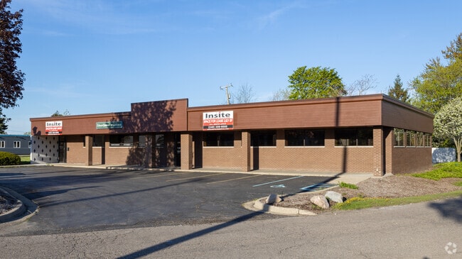
Property Record
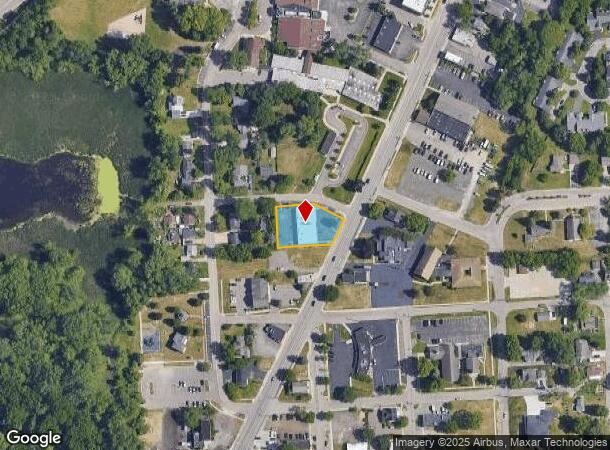
341 N Pontiac Trl, Walled Lake, MI 48390
NEARBY LISTINGS FOR SALE OR LEASE
Property Detail
341 N Pontiac Trl
Detroit-Warren-Dearborn, MI
O'flaherty's Lake View Sub
17-34-255-010
T2N, R8E, SEC 34 O'FLAHERTY'S LAKE VIEW SUB LOTS 6 & 7, ALSO OF 'SUPERVISOR'S PLAT NO 2' LOT 127 10-30-89 FR 004 & 009
Officebuilding
Oakland
X
Michigan
26125C0486F
127
2024
0.46 AC
2024
Central I-96 Corridor
134900
Detroit
5,059 SF
DEMOGRAPHICS near 341 N Pontiac Trl
1 Mile
3 Mile
5 Mile
2024 Total Population
8,155
62,014
139,714
2029 Population
8,111
61,323
138,180
Pop Growth 2024-2029
(0.54%)
(1.11%)
(1.10%)
Average Age
42
42
42
2024 Total Households
3,845
28,504
57,870
HH Growth 2024-2029
(0.52%)
(1.33%)
(1.18%)
Median Household Inc
$66,942
$73,918
$91,747
Avg Household Size
2.10
2.10
2.40
2024 Avg HH Vehicles
2.00
2.00
2.00
Median Home Value
$236,621
$295,055
$340,054
Median Year Built
1986
1990
1989
Nearby Places
Map Layers
Map Styles
 Street
 Aerial
- Restaurants
- Banks
- Shops
- Fitness
- Groceries
PUBLIC TRANSPORTATION
AIRPORT
Detroit Metro Wayne County
DRIVE
WALK
Distance
Detroit Metro Wayne County
43 min
31.8 mi
Windsor International
DRIVE
WALK
Distance
Windsor International
66 min
42.0 mi
Bishop International
DRIVE
WALK
Distance
Bishop International
68 min
49.6 mi
SALE & LEASE HISTORY
LISTING DATE
SALE/LEASE

Jun 10, 2019
For Lease
Jul 30, 2024
For Lease
Aug 17, 2021
For Lease
Apr 06, 2021
For Sale
Nearby Properties
Address
Land Use
TOTAL SIZE
Lot Size
Zoning
Address
Land Use
TOTAL SIZE
Lot Size
Zoning
162,600 SF
102.81 AC
RM-1
Address
Land Use
TOTAL SIZE
Lot Size
Zoning
873,288 SF
Address
Land Use
TOTAL SIZE
Lot Size
Zoning
486,998 SF
24.18 AC
R-C
Address
Land Use
TOTAL SIZE
Lot Size
Zoning
614,079 SF
57.44 AC
Address
Land Use
TOTAL SIZE
Lot Size
Zoning
72.63 AC
RM-1
Address
Land Use
TOTAL SIZE
Lot Size
Zoning
86.19 AC
RC2
Address
Land Use
TOTAL SIZE
Lot Size
Zoning
659,897 SF
53.96 AC
AI
Address
Land Use
TOTAL SIZE
Lot Size
Zoning
563,160 SF
47.06 AC
Address
Land Use
TOTAL SIZE
Lot Size
Zoning
152,130 SF
64.46 AC
R-C
Address
Land Use
TOTAL SIZE
Lot Size
Zoning
400,505 SF
26.50 AC
Address
Land Use
TOTAL SIZE
Lot Size
Zoning
9.72 AC
OS-1
Address
Land Use
TOTAL SIZE
Lot Size
Zoning
59.71 AC
RM-1
Address
Land Use
TOTAL SIZE
Lot Size
Zoning
17,277 SF
17.73 AC
R-A
Address
Land Use
TOTAL SIZE
Lot Size
Zoning
274,645 SF
39.27 AC
AI
Address
Land Use
TOTAL SIZE
Lot Size
Zoning
Address
Land Use
TOTAL SIZE
Lot Size
Zoning
367,354 SF
62.73 AC
AI
Address
Land Use
TOTAL SIZE
Lot Size
Zoning
188,643 SF
12.81 AC
IV
Address
Land Use
TOTAL SIZE
Lot Size
Zoning
269,975 SF
23.88 AC
AI
Address
Land Use
TOTAL SIZE
Lot Size
Zoning
63,152 SF
14 AC
R-C
Address
Land Use
TOTAL SIZE
Lot Size
Zoning
38.85 AC
RC2
Address
Land Use
TOTAL SIZE
Lot Size
Zoning
287,023 SF
22.20 AC
Address
Land Use
TOTAL SIZE
Lot Size
Zoning
249,084 SF
19.65 AC
AI
Address
Land Use
TOTAL SIZE
Lot Size
Zoning
115,400 SF
9.38 AC
BI
Address
Land Use
TOTAL SIZE
Lot Size
Zoning
19.26 AC
R-A
Address
Land Use
TOTAL SIZE
Lot Size
Zoning
2,073 SF
116.28 AC
MH
Address
Land Use
TOTAL SIZE
Lot Size
Zoning
7,646 SF
24.55 AC
RM1
Address
Land Use
TOTAL SIZE
Lot Size
Zoning
97,000 SF
18.75 AC
R-C
Address
Land Use
TOTAL SIZE
Lot Size
Zoning
222,664 SF
21.10 AC
BI
Address
Land Use
TOTAL SIZE
Lot Size
Zoning
Address
Land Use
TOTAL SIZE
Lot Size
Zoning
147,714 SF
13.54 AC
OST
The World's #1 Commercial Real Estate Marketplace
Connect with us
© 2025 CoStar Group
The information above has been obtained from sources believed reliable. While we do not doubt its accuracy we have not verified it and make no guarantee, warranty or representation about it. It is your responsibility to independently confirm its accuracy and completeness. Any projections, opinions, assumptions, or estimates used are for example only and do not represent the current or future performance of the property. The value of this transaction to you depends on tax and other factors which should be evaluated by your tax, financial, and legal advisors. You and your advisors should conduct a careful, independent investigation of the property to determine to your satisfaction the suitability of the property for your needs.